Near Rowlesburg in Preston County, West Virginia — The American South (Appalachia)
Battle of Rowlesburg: "The B&O Railroad Bridge"
Inscription.
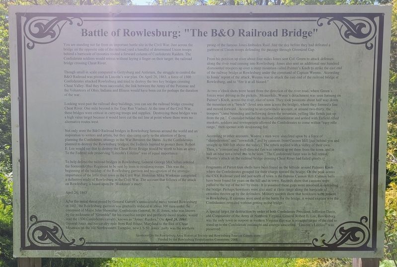
You are standing not far from an important battle site in the Civil War. Just across the bridge on the opposite side of the railroad yard a handful of determined Union troops behind a barricade of crossties routed a forward column of Confederate Raiders. The Confederate soldiers would retreat without laying a finger on their target: the railroad bridge crossing Cheat River.
Though small in scale compared to Gettysburg and Antietam, the struggle to control the B&O Railroad was pivotal in Lincoln's war plan. On April 26, 1863, a force of 1500 Confederates attacked Rowlesburg and tried to destroy the two key bridges crossing Cheat Valley. Had they been successful, the link between the Army of the Potomac and the Volunteers of Ohio, Indiana and Illinois would have been cut for perhaps the duration of the war.
Looking west past the railroad shop buildings, you can see the railroad bridge crossing Cheat River. One mile beyond is the Tray Run Viaduct. At the time of the Civil War, these bridges were critical in carrying troops and supplies. Destroying these bridges was a high value target because it would have cut the rail line at point where there were no alternative routes west.
Not only were the B&O Railroad bridges in Rowlesburg famous around the world and an inspiration to writers and artists, but they also came early to the attention of those planning the Confederate strategy in the War Between the States. As the Confederates planned to destroy the Rowlesburg bridges, the Federals hurried to protect them. Robert E. Lee would say that to destroy the Cheat River Bridge would be worth to him an army. To the Federal side preserving "Lincoln's Lifeline" was of equal importance.
To help defend the railroad bridges in Rowlesburg, General George McClellan ordered the Sixteenth Ohio Regiment to be sent by train to reinforce troops. This was the beginning of the buildup of the Rowlesburg garrison and recognition of the strategic importance of the little river town in the Civil War. Historian Mike Workman completed a definitive study of Rowlesburg in the Civil War. The account that follows of the attack on Rowlesburg is based upon Dr. Workman's study.
April 26, 1863
After the initial threat posed by General Garrett's unsuccessful move toward Rowlesburg in 1861, the Rowlesburg garrison was gradually reduced to about 300 men under the command of Major John Showalter. Confederate General, W. E. Jones, who was known by the nickname of "Grumble" for his irascible temper and profanity-laced tirades, would lead the 1500 Confederate cavalry, known as "Jones' Raiders." On April 26, 1863, General Jones and his cavalry rode from Red House, Maryland to
the foot of Cheat Mountain on the old Northwestern Turnpike, now US 50. Jones' party was the northern prong of the famous Jones-Imboden Raid. Just the day before they had defeated a garrison of Union troops defending the passage through Greenleaf Gap.
From his position up river about four miles Jones sent Col. Green to attack defenses along the river road coming into Rowlesburg. Jones also sent an additional one hundred dismounted troopers up over a steep mountain called Palmer's Knob to strike the east end of the railway bridge at Rowlesburg under the command of Captain Weems. According to Jones' report of the attack, Weems was to attack the east end of the railroad bridge at Rowlesburg, and to "fire it at all hazard."
At two o'clock shots were heard from the direction of the river road, where Green's forces were driving in the pickets. Meanwhile, Weem's detachment was seen forming on Palmer's Knob, across the river, east of town. They took positions about half way down the mountain on a "bench" (level area seen across the bridge), where they formed a line and moved forward. According to an eyewitness account, at around two-thirty, the troopers "came bounding and bellowing down the mountain, yelling like fiends just up from the pit." Concealed behind the railroad embankment and armed with Enfield rifled muskets, soldiers and townspeople allowed the Confederates to come within "easy rifle range," then opened with devastating fire.
According to other accounts, Weems's men were also fired upon by a force of "sharpshooters" and "townsfolk," and by cannons from Cannon Hill (just behind you and straight up 600 feet above the valley). The rebels replied with a volley of their own. Then, a "constant and well-directed fire was opened up on them from the town, and in half an hour not a rebel was to be seen." The Confederate force was in full retreat. Weems's attack on the railroad bridge crossing Cheat River had failed utterly.
Fragments of Parrot Gun shells have been found on the hillside around Palmers Knob where the Confederates grouped for their charge toward the bridge. On the peak across the CSX Railroad yard and just north of town is the famous Cannon Hill. Cannon balls have been found for years on the hill and in town. Records show that cannons were pulled to the top of the hill by oxen. It is assumed these guns were involved in defending the bridge. Perhaps howitzers were also used at close range along the barricade of crossties thrown up by the defenders. Military records show that howitzers were present in Rowlesburg. If cannons were used in the battle for the bridge, it would explain why the Confederates retreated without getting to the bridge.
A special target for destruction by order of both Confederate President, Jefferson Davis, and Commander of the Army of Northern Virginia, General Robert E. Lee, Rowlesburg was the only town or outpost in western Virginia that was a principal target of the raid to stand up to the Confederate onslaught and emerge unscathed. "Lincoln's Lifeline" was preserved.
Erected 2008 by Rowlesburg Area Historical Society, Rowlesburg Tourism Commission and the Rowlesburg Revitalization Committee.
Topics. This historical marker is listed in this topic list: War, US Civil. A significant historical date for this entry is April 26, 1863.
Location. 39° 21.29′ N, 79° 39.563′ W. Marker is near Rowlesburg, West Virginia, in Preston County. Marker is on Cannon Hill Road, 0.1 miles north of Maple Avenue (County Route 51), on the right when traveling north. Touch for map. Marker is in this post office area: Rowlesburg WV 26425, United States of America. Touch for directions.
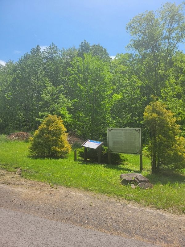
Other nearby markers. At least 8 other markers are within walking distance of this marker. Battle of Rowlesburg (here, next to this marker); Canon Hill (approx. 0.6 miles away); a different marker also named Battle of Rowlesburg (approx. 0.7 miles away); a different marker also named Battle of Rowlesburg (approx. 0.7 miles away); a different marker also named "Battle of Rowlesburg" (approx. 0.7 miles away); The 1841 Mountain Howitzer, thought to be the type used in Rowlesburg during the Civil War (approx. 0.7 miles away); Rowlesburg Area Honor Roll (approx. 0.7 miles away); Restoring the American Chestnut Tree (approx. 0.7 miles away). Touch for a list and map of all markers in Rowlesburg.
More about this marker. The marker condition is well worn.
Credits. This page was last revised on June 3, 2022. It was originally submitted on May 29, 2022, by Bradley Owen of Morgantown, West Virginia. This page has been viewed 171 times since then and 30 times this year. Photos: 1, 2. submitted on May 30, 2022, by Bradley Owen of Morgantown, West Virginia. • Bill Pfingsten was the editor who published this page.

