Near Fairplay in Washington County, Maryland — The American Northeast (Mid-Atlantic)
Jones’s Crossroads
Forts Facing Forts
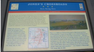
(Quote 1): “[T]heir line of works ... were by far the strongest I have seen yet; evidently laid out by engineers and built as if they meant to stand a month’s siege. The parapet was a good six feet wide on top, and the guns, which were very thick, were all placed so as to get a perfect cross fire.” —Col. Charles S. Wainwright, U.S. Army, July 14, 1863
(Quote 2): “ There is a difference between the people of Maryland and those of Pennsylvania. A man of some fifty or more stood looking at our men pull down the fences to start their breastworks. ... Having a fellow-feeling for the owner as a brother farmer, I spoke to the man and said it was hard on the owner of the land to destroy his crops and fences so. ‘Oh,’ says he, ‘you may destroy my whole farm if you will only whip the rebels.’ If the eastern Marylanders are the most bitter of the rebels, those west of Frederick are the truest Union people I have met with anywhere.” —Col. Charles S. Wainwright, U.S. Army, July 10, 1863.
Topics and series. This historical marker is listed in this topic list: War, US Civil. In addition, it is included in the Maryland Civil War Trails series list. A significant historical month for this entry is July 1920.
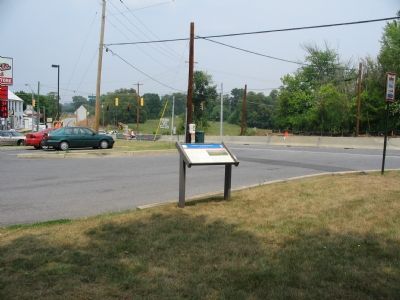
Location. 39° 33.192′ N, 77° 44.26′ W. Marker is near Fairplay, Maryland, in Washington County. Marker is at the intersection of Shepherdstown Pike (Maryland Route 65) and Lappans Road (Route 68), on the right when traveling south on Shepherdstown Pike. Located in the parking lot for a gas station in the Southwest corner of Jones’ Crossroads. Touch for map. Marker is at or near this postal address: 8650 Sharpsburg Pike, Boonsboro MD 21713, United States of America. Touch for directions.
Other nearby markers. At least 8 other markers are within 4 miles of this marker, measured as the crow flies. Jones’ Crossroads (about 300 feet away, measured in a direct line); St. Mark's Episcopal Church (approx. ¼ mile away); Devil's Backbone Dam Rehabilitation (approx. 1.8 miles away); Council of War (approx. 1.8 miles away); Booth’s Mill Bridge (approx. 1.8 miles away); Roxbury Mills Bridge (approx. 2 miles away); Rose's Mill Bridge (approx. 2.9 miles away); Claggett’s Millrace Bridge (approx. 3.2 miles away).
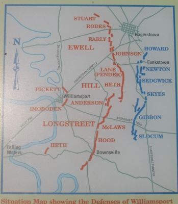
More about this marker. The marker features a painting depicting the fortifications with the caption, “Confederate fortifications near Williamsport.” The marker also displays a map showing the general location of the fortifications and battle lines.
Also see . . . Battle Summary: Williamsport, MD. (Submitted on August 5, 2007, by Craig Swain of Leesburg, Virginia.)
Additional commentary.
1. Earthworks
As far as this writer can determine none of the earthworks built during the war are still visible or accessible from public roads. Perhaps the farmers, such as the one mentioned by Col. Wainwright, were able to quickly repair the damage and return the land to a peaceful guise.
— Submitted August 5, 2007, by Craig Swain of Leesburg, Virginia.
Additional keywords. Gettysburg Campaign
Credits. This page was last revised on March 21, 2020. It was originally submitted on August 5, 2007, by Craig Swain of Leesburg, Virginia. This page has been viewed 2,204 times since then and 46 times this year. Photos: 1, 2, 3. submitted on August 5, 2007, by Craig Swain of Leesburg, Virginia. • J. J. Prats was the editor who published this page.


