Teotihuacán de Arista in Teotihuacán, Mexico State, Mexico — The Central Highlands (North America)
Palacio de Quetzalpapalotl
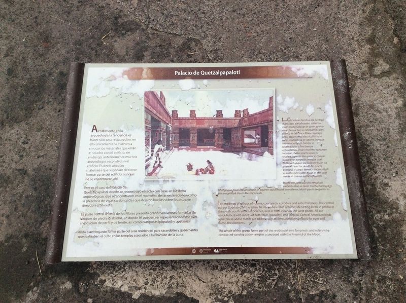
Actualmente en la arqueología la tendencia es hacer sólo una restauración, en ella únicamente se vuelven a colocar los materiales que están asociados con el edificio, sin embargo, anteriormente muchos arqueólogos reconstruían el edificio. Es decir, añadían materiales que suponían debieron formar parte del edificio, aunque no se encontraran ahí.
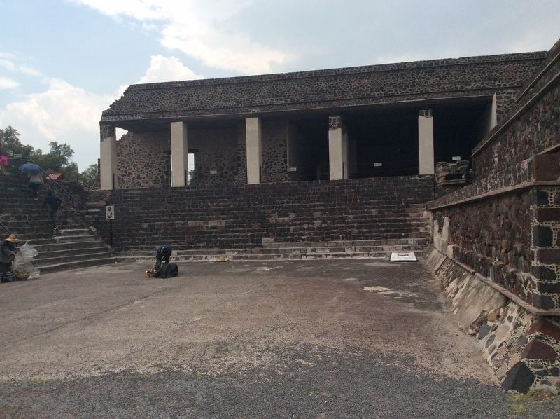
Este es el caso del Palacio de Quetzalpapalotl, donde se reconstruyó el techo con base en los datos arqueológicos que se encontraron en el momento de las excavaciones, como la presencia de vigas carbonizadas que dejaron huellas sobre los pisos, en dirección este-oeste.
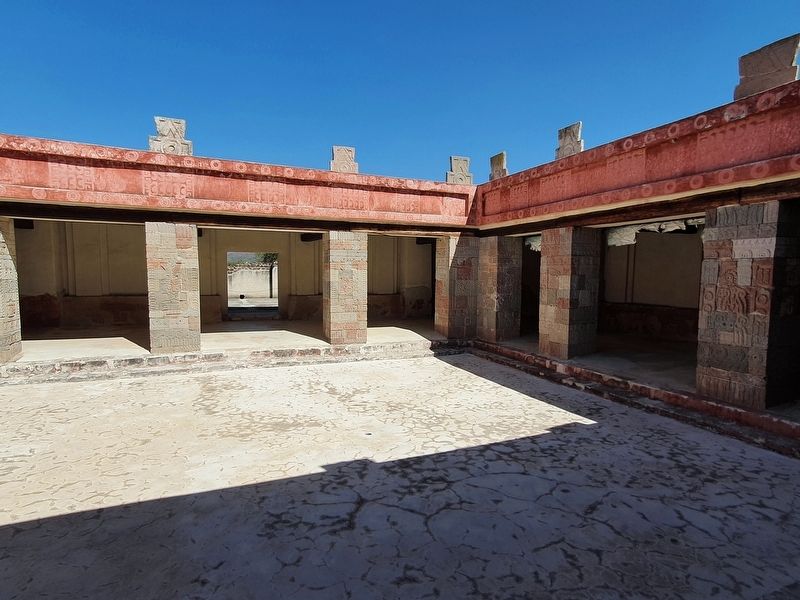
La parte central o Patio de los Pilares presenta grandes columnas formadas de bloques de piedra grabados, en donde se pueden ver representaciones de aves en-posición de perfil y de frente, así como mariposas (papalotl) y quetzales.
Todo este conjunto forma parte del área residencial para sacerdotes y gobernantes que realizaban el culto en los templos asociados a la Pirámide de la Luna.
Pie de dibujo: Reconstrucción hipotética. Jorge Acosta.
In mochi manechicohua ica occequi chantoton, tlalcahuayan, caltenco, ihuan mocehuiloyan in canin ayamo calacohuaya itec in caltepamitl. Ipan calteco in tlemitoca Pilares quipiya cequi tepamiti ica tlacuicuiliztin, in canin mixtlachiya in totome, ininque monánacaztiya ic compic in tecataquipan ic mictlampa, cohuatlampa ihuan mochic'iquizayan tonatiuh, ihuan mochi ixpan in tecalaquizpan in tlen yatoc ic compic icalaqdiyan tonatiuh; ininque cuali tlatlamachyòque ica papaloti-ihuan ica quetzalli. Inin tlacuicuiliztin mochi quipìpiya occequi tlemach tlacuicuiliztli in quenin ixtelolotin ihuan in then cuali mohte in quenin quiza in teconitli.
Mochi imin caltecpanchichihualiztli mocetilia itlan in canin mocháchantiaya in Teteopixque-ihuan-Tlanahuatique, in aquintin quichihuaya in teotlamachiliztli ipan in teopantin in tlen mocetilrayá itlan in Metztli Teocalli.
Palace of Quetzalpapalotl
It is made up of groups of rooms, courtyards, corridors and antechambers. The central part or Courtyard of the Pillars has large bas-relief columns depicting birds in profile in the north, south and east porches, and in front views in the west porch. All are embellished with motifs of butterflies (papalotl) and Tropical Central American birds (quetzales). These motifs are additionally accompanied by symbols for eyes and flame-like
elements.
The whole of this group forms part of the residential area for priests and rulers who conducted worship at the temples associated with the Pyramid of the Moon.
Caption:Possible rescontruction. Jorge Acosta.
Erected by Instituto Nacional de Antropología e Historia (INAH).
Topics. This historical marker is listed in these topic lists: Anthropology & Archaeology • Architecture • Native Americans.
Location. 19° 41.861′ N, 98° 50.718′ W. Marker is in Teotihuacán de Arista, Estado de Mexico (Mexico State), in Teotihuacán. Marker can be reached from Estado de Mexico Route 132 just east of Puerta 3 Ruta de Acceso, on the right when traveling north. Touch for map. Marker is in this post office area: Teotihuacán de Arista MEX 55829, Mexico. Touch for directions.
Other nearby markers. At least 8 other markers are within walking distance of this marker. The Quetzalpapálotl Architectural Complex (a few steps from this marker); The Temple of Agriculture (about 120 meters away, measured in a direct line); Miccoatli (about 120 meters away); Late Occupation of Teotihuacan and the Mexica Presence (about 150 meters away); The Pyramid of the Moon (about 180 meters away); The Puma Mural (about 240 meters away); The History of Teotihuacán
(approx. half a kilometer away); The Importance of the Pyramid of the Sun (approx. half a kilometer away). Touch for a list and map of all markers in Teotihuacán de Arista.
Credits. This page was last revised on May 31, 2022. It was originally submitted on May 31, 2022, by J. Makali Bruton of Accra, Ghana. This page has been viewed 178 times since then and 30 times this year. Photos: 1, 2, 3, 4. submitted on May 31, 2022, by J. Makali Bruton of Accra, Ghana.


