Teotihuacán de Arista in Teotihuacán, Mexico State, Mexico — The Central Highlands (North America)
Avenue of the Dead
Inscription.
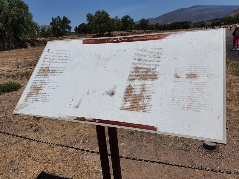
Es el eje principal de la ciudad de Teotihuacan y parte fundamental de su planeacion. Tiene una dirección sur-norte con una orientatcion de 15º 25’ hacia el este con respecto al norte astronómico. Al parecer, como toda la ciudad, está orientada al punto donde sale el sol en importantes fecha del año. Su límite norte se encuentra en la Plaza de la Luna y su extremo sur aún no ha sido explorado. Alcanza una longitud superior a los 4 kilómetros, aunque solo se pueden visitar 2 km.
Perpendicular a ella en el centro de la ciudad corre la Calzada este-oeste que divide a la ciudad en cuatro cuadrantes, dándole la cudad una perfecta simetría. A partir de ambas calzadas, el trazo urbano se realizó de manera que las calles y la orientación general de todos los edificios fueran paralelos y perpendiculares a las mismas.
Hacia ambos lados, existen edificios que corresponden a complejos de palacios y templos dedicados tanto a las actividades politico-administrativas y civico-religiosas, como a las áreas donde vivian los sacerdotes y otros individuos de las altas jerarquías sociales.
La Calzada de los Muertos fue llamada así por los mexicas, quienes vivieron en el Centro de México mucho tiempo después del abandono de Teotihuacan. Le dieron dicho nombre porque creían -erróneamente-, que las construcciones situadas a los lados eran tumbas.
ln minca Otli-in tien cachi trepanatlalia in Teotihuacan Arepeti inin tlachaliz quiplya is conuatlanpa mistlampa thuan moyectalia ipan 159 25c compic-in canin ca iquizayan in tonatiuh, itlam in uen itoca morte astronómico huan in canin tlami ic compic in mictlampa, ompa ca in Teotlalcahuayan Metztli ihuan in occefcan, ic compic cohuatlampa ayamo mixtlapohua. Ihuan ihueviliz mate quipiya ic 4 km. Ihuan itlan in yèhua, mochi motlalohua in Flueyi Otli in tien mixpantia ic iquizayan tonatiubic calaquiyan tonatiuh in then quixcohua in Altepet! pan nanauhpa dalli. thuan ipan ininque ome buehueyi òtli, mochi itlachaliz ihuan itlatecpaniliz in caltepantin moxexelohuâ, in quenin mocahua, cequ mocecetilia ihuan in occequi mixcuanánamiqui. in mochtin in caltepanchichihualiztin in tlen quiyehualohuâ in òome itlanacaztia in Milica Otli, inique catcâ in tlatocauh caltepantin-ihuan teocaltin, ininque monenequia ipampa in occequi tequipanoliztli in tlen itoca político-administrativo ihuan in tlen iteca civico-religioso, mochi in tlen quipiaya in Teotihuacan Tlanahuatil. Ihuan mochi in cacanin mochachahuiaya, in ompa mochantiayâ in huehueyi tlatlaca, ihuan maté ompa can catcâ in tereopixque.
Thuan ipan in yolotlalli in tlen tzalan onca itec in Tonatiuh Teocali ihuan in San Juan apamitl, ompa onca ce caltepantli tanechicoliztli in tlen motocayotia Complejo Calle de los Muertos (caltepamitl in minca oth). Mochi inin caltepanchichihualiztli quiyehualoa ce yeyehualtic tepamitl, in tlen mochi ihueyaliz quipiya 350 mihuan tlayehuatohuaic compiciquizayan in tonatiuh-ihuanic icalaquian in tonatiuh, ihuan quipiya 380 m. ic compic mictlampa cohuatlampa. huan inin mocecetilia ica miyac temamatlatl intlen yèyexpa quitetequi ipan in Mihca Òtli. Inin tlanechicoliztli yexpá mocecetiliâ ininque caltepantin in tlen motocayotiâ in Tlanenepanol Caltecpantin, ihuan in Tlalcahuayan Tlanechicolli in teln onca ic compa Icalaquiyan Tonatiuh, ihuan in Talcahuayan in tlen onca ic compic lquizayan Tonatiuh ihuan mochi in tlen itoca Grupo Viking.
Avenue of the Dead
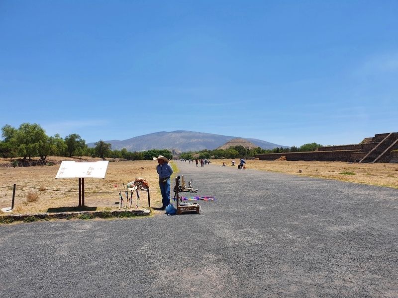
This is the main axis of the city of Teotihuacan and a fundamental part of its planning. It has a south-north direction, though off-center from astronomical north by 15° 25' to the east. Its northern limit is found at the Plaza of the Moon while its southernmost end has not been explored. It reaches a length of more than 4 kilometers, although only 2 km can be visited. Perpendicular to it in the center of the city runs the East-West Causeway that divides the city into four quadrants, giving the city a perfect symmetry. The groups of buildings that line both sides of the Avenue of the Dead belong to palace and temple complexes designed specifically for the Teotihuacan state's different political-administrative and civic-religious activities as well as to dwelling areas for the society's top-level hierarchy, consisting mainly of priests.
In the core area lying between the Pyramid of the Sun and the San Juan River, there is a group called the Avenue of the Dead Complex. It is comprised of pyramidal bases with temples atop them, courtyards, streets, stepped platforms and residential sections around central plazas. This walled-off complex measures 1,167 feet from east to west and 1,267 feet from north to south and is divided in three sections by transverse stairways overlooking the Avenue of the Dead. Forming part of these complexes are the groups known as the Superimposed Buildings, the West Plaza Complex and the Viking Complex.
Erected by Instituto de Antropología e Historia (INAH).
Topics. This historical marker is listed in these topic lists: Anthropology & Archaeology • Roads & Vehicles.
Location. 19° 40.975′ N, 98° 50.934′ W. Marker is in Teotihuacán de Arista, Estado de Mexico (Mexico State), in Teotihuacán. Marker is on Calzada de los Muertos just east of 1 (Route 132), on the left when traveling north. Touch for map. Marker is in this post office area: Teotihuacán de Arista MEX 55829, Mexico. Touch for directions.
Other nearby markers. At least 8 other markers are within walking distance of this marker. La Ciudadela (about 90 meters away, measured in a direct line); Monolithic Sculpture of a Water-related Deity (about 90 meters away); The Southern Building of Teotihuacan (about 210 meters away); Southern Building (about 210 meters away); Embedded Platform (about 210 meters away); Temple of the Plumed Serpent (approx. 0.3 kilometers away); Northwest San Juan River Complex (approx. 0.4 kilometers away); Plaza C of the Avenue of the Dead Complex (approx. half a kilometer away). Touch for a list and map of all markers in Teotihuacán de Arista.
Credits. This page was last revised on June 3, 2022. It was originally submitted on June 1, 2022, by J. Makali Bruton of Accra, Ghana. This page has been viewed 67 times since then and 14 times this year. Photos: 1, 2. submitted on June 1, 2022, by J. Makali Bruton of Accra, Ghana. 3. submitted on June 3, 2022, by J. Makali Bruton of Accra, Ghana.


