South Kansas City in Jackson County, Missouri — The American Midwest (Upper Plains)
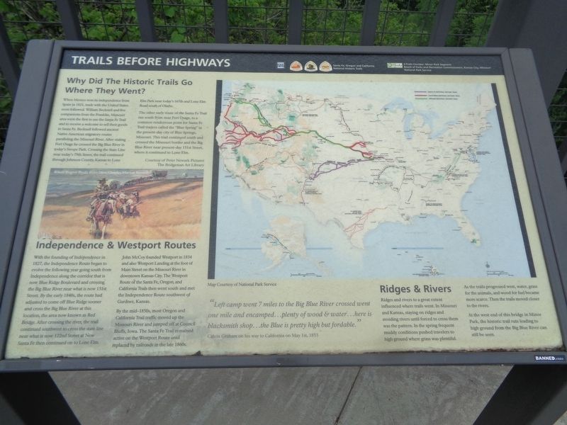
Trails Before Highways
Santa Fe, Oregon and California National Historic Trails
Why Did The Historic Trails Go Where They Went?
When Mexico won its independence from Spain in 1821, trade with the United States soon followed. William Becknell and five companions from the Franklin, Missouri area were the first to use the Santa Fe Trail and to receive a welcome to sell their goods in Santa Fe. Becknell followed ancient Native American migratory routes paralleling the Missouri River. After visiting Fort Osage he crossed the Big Blue River in today's Swope Park. Crossing the State Line near today's 79th Street, the trail continued through Johnson County, Kansas to Lone Elm Park near today's 167th and Lone Elm Road south of Olathe.
The other early route of the Santa Fe Trail ran south from near Fort Osage, to a common rendezvous point for Santa Fe Trail traders called the "Blue Spring" in the present-day city of Blue Springs, Missouri. This trail continued south and cross the Missouri border and the Big Blue River near present-day 151st Street, where it continued to Lone Elm.
Independence & Westport Routes
With the founding of Independence in 1827, the Independence Route began to evolve the following year going south from Independence along the corridor that is now Blue Ridge Boulevard and crossing the Big Blue River near what is now 151st Street. By the early 1840s, the route had adjusted to come off Blue Ridge sooner and cross the Big Blue River at this location, the area now known as Red Bridge. After crossing the river, the trail continued southwest to cross the state line near what is now 122nd Street at New Santa Fe then continued on to Lone Elm, John McCoy founded Westport in 1834 and also Westport Landing at the foot of Main Street on the Missouri River in downtown Kansas City. The Westport Route of the Santa Fe, Oregon and California Trails then went south and met the Independence Route southwest of Gardner, Kansas.
By the mid-1850s, most Oregon and California Trail traffic moved up the Missouri River and jumped off at Council Bluffs, Iowa. The Santa Fe Trail remained active on the Westport Route until replaced by railroads in the late 1860s.
Ridges & Rivers
Ridges and rivers to a great extent influenced where trails went. In Missouri and Kansas, staying on ridges and avoiding rivers until forced to cross them was the pattern. In the spring frequent muddy conditions pushed travelers to high ground where grass was plentiful. As the trails progressed west, water, grass for the animals, and wood for fuel became more scarce. Then the trails moved closer to the rivers.
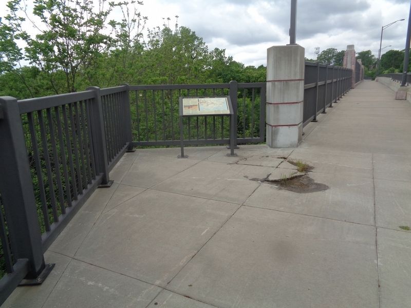
At the west end of this bridge in Minor Park, the historic trail ruts leading to high ground from the Big Blue River can still be seen.
(side quote:)
"Left camp went 7 miles to the Big Blue River crossed went one mile and encamped…plenty of wood & water…here is blacksmith shop…the Blue is pretty high but fordable."
Calvin Graham on his way to California on May 1st, 1853
Erected by National Park Service and KC Parks.
Topics and series. This historical marker is listed in these topic lists: Roads & Vehicles • Waterways & Vessels. In addition, it is included in the California Trail, the Oregon Trail, and the Santa Fe Trail series lists. A significant historical date for this entry is May 1, 1853.
Location. 38° 55.528′ N, 94° 34.362′ W. Marker is in Kansas City, Missouri, in Jackson County. It is in South Kansas City. Marker is on East Red Bridge Road east of East 110th Street, on the right when traveling east. Touch for map. Marker is at or near this postal address: 1590 E Red Bridge Rd, Kansas City MO 64131, United States of America. Touch for directions.
Other nearby markers. At least 8 other markers are within walking distance of this marker. Hiram Young (within shouting distance of this marker); Kit Carson (within shouting distance of this marker); Alexander Majors (within shouting distance of this marker); River Crossings and Red Bridges (within shouting distance of this marker); Jim Bridger (within shouting distance of this marker); James Beckwourth (about 300 feet away, measured in a direct line); Amache Prowers (about 300 feet away); People and the Trails (about 500 feet away). Touch for a list and map of all markers in Kansas City.
Credits. This page was last revised on February 10, 2023. It was originally submitted on June 6, 2022, by Jason Voigt of Glen Carbon, Illinois. This page has been viewed 124 times since then and 24 times this year. Photos: 1, 2. submitted on June 6, 2022, by Jason Voigt of Glen Carbon, Illinois.

