Centro Histórico in Ciudad de México, Mexico — The Valley of Mexico (The Central Highlands)
Plaza Manuel Gamio
Photographed by J. Makali Bruton, May 22, 2022
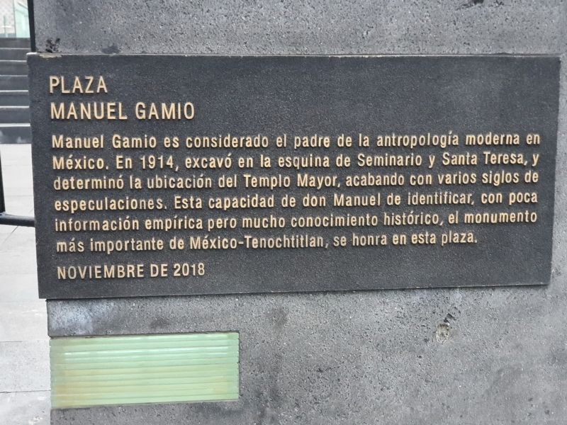
1. Plaza Manuel Gamio Marker

Manuel Gamio es considerado el padre de la antropología moderna en México. En 1914, excavó en la esquina de Seminario y Santa Teresa, y determinó la ubicación del Templo Mayor, acabando con varios siglos de especulaciones. Esta capacidad de don Manuel de identificar, con poca información empírica pero mucho conocimiento histórico, el monumento más importante de México-Tenochtitlan, se honra en esta plaza.
Noviembre de 2018
Plaza Manuel Gamio
Manuel Gamio is considered the father of modern anthropology in Mexico. In 1914, he excavated at the corner of Seminario and Santa Teresa, and determined the location of the Templo Mayor, ending several centuries of speculation. This ability of Don Manuel to identify, with little empirical information but a lot of historical knowledge, the most important monument of Mexico-Tenochtitlan, is honored in this square.
November 2018
Erected 2018.
Topics. This historical marker is listed in this topic list: Anthropology & Archaeology. A significant historical month for this entry is November 2018.
Location. 19° 26.047′ N, 99° 7.932′ W. Marker
this page online

Regionally, this marker is in Central Mexico and specifically in Mexico City Metropolitan Area. Globally, it is in North America, specifically in Mesoamerica, on the Ring of Fire, and in the Western Hemisphere. Historically, it finds itself in what was once New Spain, a Spanish colony, and the Aztec Empire.
Other nearby markers. At least 8 other markers are within walking distance of this marker: Dr. Antonio Marquez G. (within shouting distance of this marker); The Basin of Mexico (within shouting distance of this marker); Plaza in Front of the Templo Mayor (within shouting distance of this marker); The Mexica People (within shouting distance of this marker); The City of Tenochtitlan (within shouting distance of this marker); The Templo Mayor and its Seven Construction Stages (within shouting distance of this marker); The Royal and Pontifical University of Mexico (within
Photographed by J. Makali Bruton, May 22, 2022
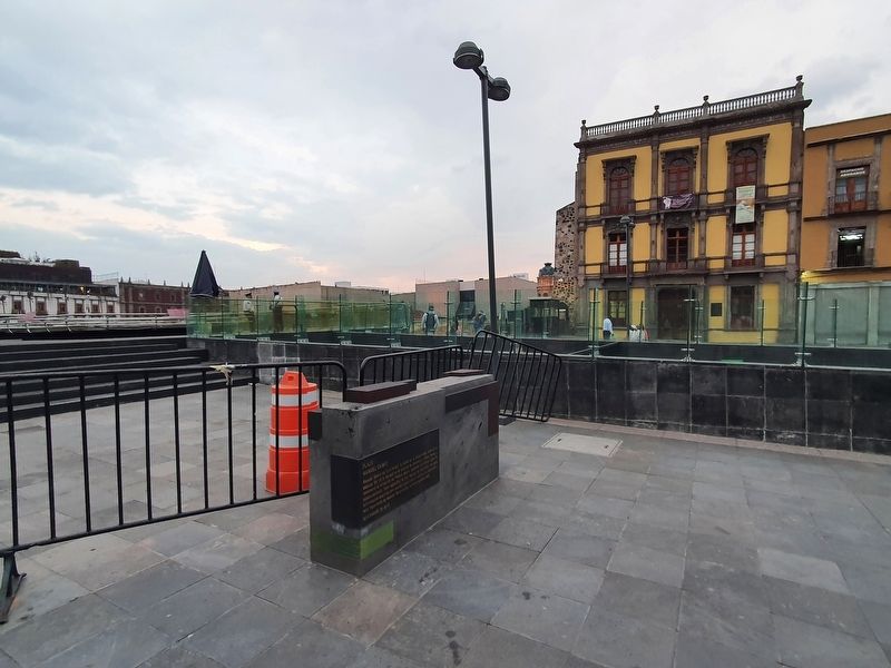
2. Plaza Manuel Gamio Marker
This view of the marker and plaza towards the northeast is looking towards the ruins of the Templo Mayor.
Credits. This page was last revised on June 6, 2022. It was originally submitted on June 6, 2022, by J. Makali Bruton of Washington, District of Columbia. This page has been viewed 266 times since then and 24 times this year. Photos: 1, 2. submitted on June 6, 2022, by J. Makali Bruton of Washington, District of Columbia.
