Myrtle Beach in Horry County, South Carolina — The American South (South Atlantic)
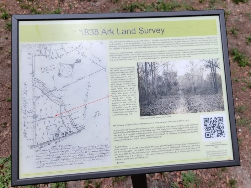
1838 Ark Land Survey
Elisha Tillman died in 1824. His son, John M. Tillman (1798-1865), inherited the Ark plantation and lived there until his death. In 1860, some of the farm products at the Ark were cattle, swine, wool, Indian corn, sweet potatoes, rye, peas, beans and mollasses. One hundred ninety acres were used for the production of upland rice. Most likely, Tillman was also involved in the Naval Stores Industry and derived an income from that, as a large part of his land was forest and suited to that industry. A survey from 1838 shows that the plantation contained a total of 3,197 acres.
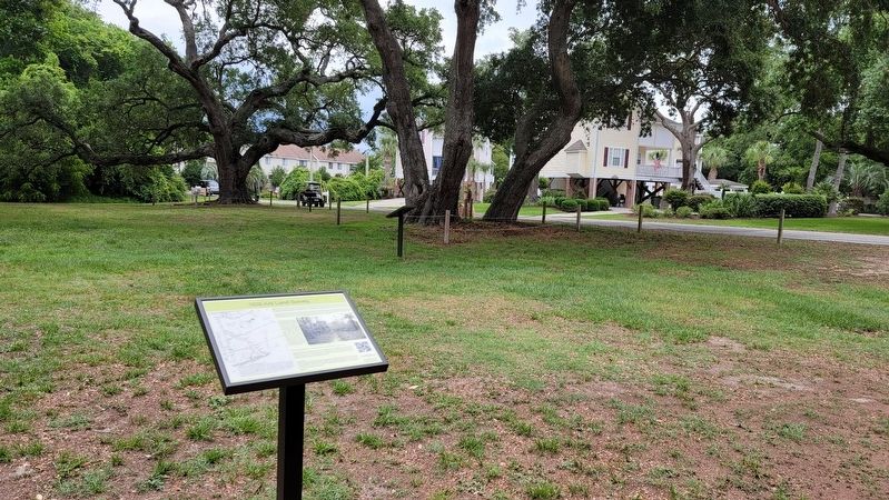
There are no longer any extant buildings from the colonial and antebellum eras in the Surfside Beach area. The land that was once called a "large indigo plantation" in the 1770's is now a thriving residential community and vacation resort. However, old Live Oak trees still stand on the site of the old Ark Plantation home site. The site of the main house has been left untouched and is now a park, owned by the Town of Surfside Beach. That site has taken on a new life as the town's Ark Heritage Park, dedicated to the area's rich local history.
The photograph on the right is of a nearby segment of the old Broad Road, taken in the 1930s near Ocean Lakes, located a little north-east of here. On the land survey on the left, you can see where the Broad Road went through the Ark proper ty. That section of the road would have been approximately where US Hwy 17 is today. Also shown on the survey are three structures located just behind the inner-most sand ridge. The structure on the far left represents the Ark House, which was at what is now the corner of East Willow Drive and Third Avenue South, now preserved as the Ark Heritage Park.
The following paragraph is from: The Hammocks of Horry, by James Henry Rice, Jr. May 9, 1926 "A generation ago [around 1900] miles and miles of hardwood forest extended from a point just below Myrtle Beach until they broke away at the Ark, now Floral Beach. It was a noble body of woods and would have given joy to the heart of a conservationist. The prevailing growth was oak and hickory, with black walnuts dotted about, and, now and then, tulip trees or "poplars," ash and maple. Underneath the tall trees, dogwood, wax myrtle, cassinas [sic] and hollies flourished." "South Carolina, At the request of Mr. John M. Tillman I have resurveyed a tract of land and from an actual survey made the 4th & 5th of October 1838, find the same to contain one thousand five hundred and seventy acres which lines are shaded red. The lines shaded blue contains sixteen hundred and twenty seven acres taken up for said tract is situated on Waccamaw Neck and has such shape forms Mr. Tillman [total of 3,197 acres]. and marks as the above plat represents."
Photo courtesy of the Nelson Jackson Family
Erected 2021 by Surfside Beach Historical Society.
Topics. This historical marker is listed in this topic list: Agriculture. A significant historical date for this entry is May 9, 1926.
Location. 33° 36.317′ N, 78° 58.582′ W. Marker is in Myrtle Beach, South Carolina, in Horry County. Marker is at the intersection of 3rd Avenue South and South Willow Drive, on the right when traveling south on 3rd Avenue South. Touch for map. Marker is in this post office area: Myrtle Beach SC 29575, United States of America. Touch for directions.
Other nearby markers. At least 8 other markers are within 4 miles of this marker, measured as the crow flies. The Ark Sand Ridge (a few steps from this marker); Ark Plantation (a few steps from this marker); Ark Agriculture (within shouting distance of this marker); The Ark House and Shady Side Inn (within shouting distance of this marker); Ark Cemetery (approx. 0.2 miles away); Surfside Beach Veterans Monument (approx. 0.2 miles away); Jack Walker (approx. 3.6 miles away); St. James Rosenwald School (approx. 3.9 miles away). Touch for a list and map of all markers in Myrtle Beach.
Also see . . . Surfside Beach History. Village website entry (Submitted on July 25, 2022, by Larry Gertner of New York, New York.)
Credits. This page was last revised on July 25, 2022. It was originally submitted on June 7, 2022, by Michael Herrick of Southbury, Connecticut. This page has been viewed 110 times since then and 19 times this year. Photos: 1, 2. submitted on June 7, 2022, by Michael Herrick of Southbury, Connecticut.

