Johnston Terrace in Austin in Travis County, Texas — The American South (West South Central)
The Original Townsite of Montopolis
Photographed by Richard Denney, January 27, 2024
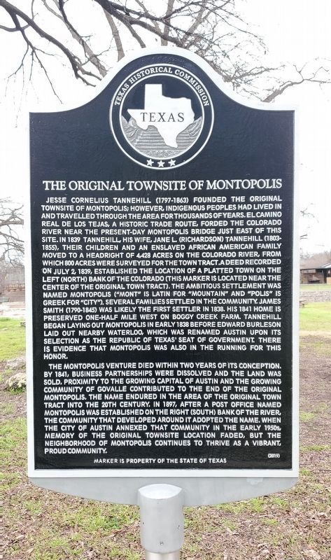
1. The Original Townsite of Montopolis
The Montopolis venture died within two years of its conception. By 1841, business partnerships were dissolved and the land was sold. Proximity to the growing Capital of Austin and the growing community of Govalle contributed to the end of the original Montopolis. The name endured in the area of the original town tract into the 20th century. In 1897, after a post office named Montopolis was established on the right (south) bank of the river, the community that developed around it adopted the name. When the city of Austin annexed that
this page online
Erected 2019 by Texas Historical Commission. (Marker Number 22517.)
Topics. This historical marker is listed in these topic lists: African Americans • Indigenous Peoples and Communities • Settlements & Settlers • War, Texas Independence. A significant historical date for this entry is July 2, 1839.
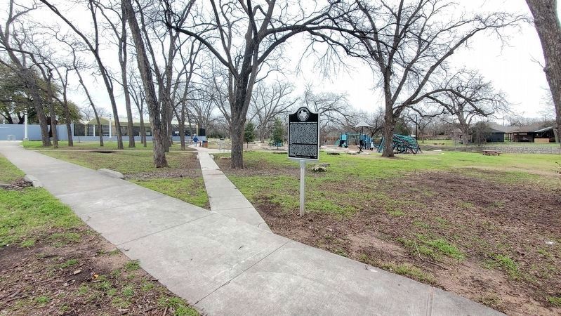
Location. 30° 15.563′ N, 97° 41.503′ W. Marker is in Austin, Texas, in Travis County. It is in Johnston Terrace. It can be reached from Bolm Road 0.1 miles east of Shady Lane. The marker is located in Govalle Neighborhood Park, just southwest of the swimming pool. Touch for map. Marker is at or near this postal address: 5200 Bolm Road, Austin TX 78721, United States of America. Touch for directions.

Regionally, this marker is in Central Texas. It is also in the American South. Globally, it is in North America, a Gulf of Mexico state, the Western Hemisphere, the Western World, and the Anglosphere. Historically, it finds itself in what was once New Spain, the
Photographed by Richard Denney, January 27, 2024
2. The Original Townsite of Montopolis
Other nearby markers. At least 8 other markers are within 2 miles of this marker, measured as the crow flies: Parque Zaragoza (approx. 1.2 miles away); L.C. Anderson High School and Integration of Austin’s Public Schools (approx. 1.2 miles away); Evergreen Cemetery (approx. 1.4 miles away); Bethany Cemetery (approx. 1½ miles away); Downs Field (approx. 1½ miles away); Rosewood Park (approx. 1.6 miles away); Henry G. Madison Cabin (approx. 1.6 miles away); Richard Overton (approx. 1.6 miles away). Touch for a list and map of all markers in Austin.
Also see . . .
1. Montopolis: The Old and New, Travis County Historical Commission. Travis County has had two locations named Montopolis that differ in their formation and location, causing confusion when the history of the two are conflated. This article sorts out the two Montopolis, the old and the new, as well as their common thread. (Submitted on June 18, 2022, by Richard Denney of Austin, Texas.)
2. Montopolis, Handbook of Texas. (Submitted on January 27, 2024, by Richard Denney of Austin, Texas.)
Credits. This page was last revised on January 31, 2024. It was originally submitted on April 26, 2022, by Richard Denney of Austin, Texas. This page has been viewed 2,756 times since then and 140 times this year. Last updated on January 30, 2024, by Richard Denney of Austin, Texas. Photos: 1, 2. submitted on January 27, 2024, by Richard Denney of Austin, Texas. • James Hulse was the editor who published this page.
