Strasburg in Shenandoah County, Virginia — The American South (Mid-Atlantic)
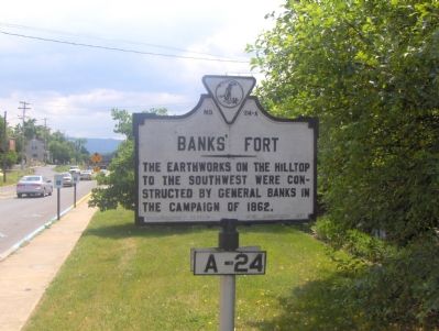
Banks’ Fort
Photographed by Roger Dean Meyer, June 3, 2006
1. Banks' Fort
The earthworks on the hilltop to the southwest were constructed by General Banks in the campaign of 1862.
Erected 1927 by Conservation & Development Commission. (Marker Number A-24.)
Topics and series. This historical marker is listed in this topic list: War, US Civil. In addition, it is included in the Virginia Department of Historic Resources (DHR) series list. A significant historical year for this entry is 1862.
Location. 38° 59.537′ N, 78° 21.431′ W. Marker is in Strasburg, Virginia, in Shenandoah County. It is on N. Massanutten Street (Route 11) 0.1 miles south of Thompson Street, on the right when traveling south. Touch for map. Marker is in this post office area: Strasburg VA 22657, United States of America. Touch for directions.

Regionally, this marker is in Virginia’s Shenandoah Valley. It is also in the American South, specifically in the Upper South, and in the Mid-Atlantic. Globally, it is in North America, the Western Hemisphere, the Western World, and the Anglosphere. Historically, it finds itself in what was once the territory of the Mississippian Culture, one of the original Thirteen
this page online
Other nearby markers. At least 8 other markers are within walking distance of this marker: Frontier Fort (approx. 0.2 miles away); a different marker also named Frontier Fort (approx. 0.2 miles away); American Legion (approx. 0.2 miles away); Historic Strasburg (approx. ¼ mile away); Stonewall's Surprise (approx. ¼ mile away); a different marker also named Historic Strasburg (approx. ¼ mile away); This Fertile Land (approx. 0.3 miles away); a different marker also named Historic Strasburg (approx. 0.3 miles away). Touch for a list and map of all markers in Strasburg.
Other markers no longer nearby. Historic Strasburg (was approx. ¼ mile away but has been replaced with another marker now near it); a different marker also named Historic Strasburg (was approx. 0.3 miles away but has been replaced with another marker now near it).
Additional keywords. General Nathaniel P. Banks
Photographed by Craig Swain, September 29, 2007
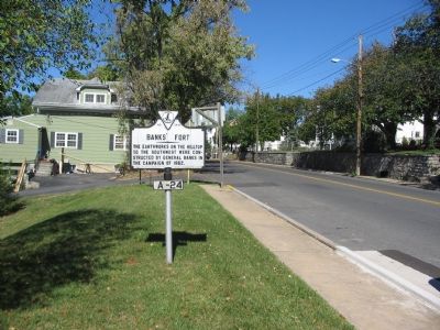
2. Banks’ Fort Marker
Photographed by Craig Swain, September 29, 2007
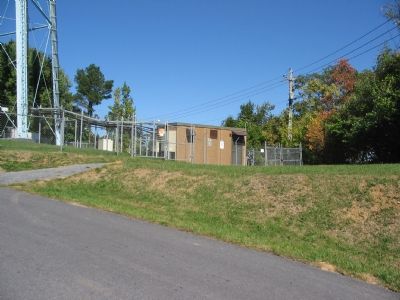
3. Site of Banks' Fort
Portions of Banks' Fort are now covered by the city water tower.
via Shenandoah Valley's Civil War, unknown
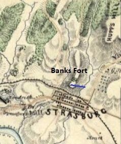
4. Banks’ Fort or Folly
Shenandoah Valley's Civil War blog entry
Click for more information.
Click for more information.
Credits. This page was last revised on April 2, 2026. It was originally submitted on November 2, 2006, by Roger Dean Meyer of Yankton, South Dakota. This page has been viewed 2,469 times since then and 33 times this year. Last updated on June 12, 2022, by Bradley Owen of Morgantown, West Virginia. Photos: 1. submitted on November 2, 2006, by Roger Dean Meyer of Yankton, South Dakota. 2, 3. submitted on November 10, 2007, by Craig Swain of Leesburg, Virginia. 4. submitted on July 28, 2022, by Larry Gertner of New York, New York. • Bernard Fisher was the editor who published this page.
