Brambleton in Loudoun County, Virginia — The American South (Mid-Atlantic)
Lyon Family Cemetery and Pvt. Richard Moran
History of the Northern Virginia Regional Parks
Photographed by Craig Swain, June 14, 2009
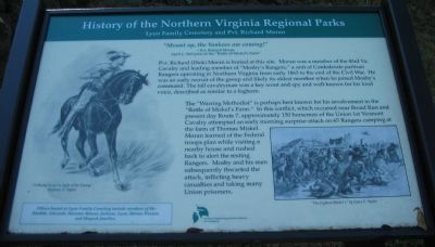
1. Lyon Family Cemetery and Pvt. Richard Moran Marker
-Pvt. Richard Moran
April 1, 1863 prior to the "Battle of Miskel's Farm"
Pvt. Richard (Dick) Moran is buried at this site. Moran was a member of the 43rd Va. Cavalry and leading member of "Mosby's Rangers," a unit of Confederate partisan Rangers operating in Northern Virginia from early 1863 to the end of the Civil War. He was an early recruit of the group and likely its oldest member when he joined Mosby's command. The tall cavalryman was a key scout and spy and well-known for his loud voice, described as similar to a foghorn.
The "Warring Methodist" is perhaps best known for his involvement in the "Battle of Miskel's Farm." In this conflict, which occurred near Broad Run and present day Route 7, approximately 150 horsemen of the Union 1st Vermont Cavalry attempted an early morning surprise-attack on 65 Rangers camping at the farm of Thomas Miskel. Moran learned of the Federal troops plan while visiting a nearby house and rushed back to alert the resting Rangers. Mosby and his men subsequently thwarted the attack, inflicting heavy casualties and taking many Union prisoners.
Others buried
this page online
Erected by Northern Virginia Regional Park Authority.
Topics and series. This historical marker is listed in this topic list: War, US Civil. In addition, it is included in the NOVA Parks series list. A significant historical month for this entry is April 1938.
Location. 38° 59.702′ N, 77° 31.975′ W. Marker is in Brambleton, Virginia, in Loudoun County. It is on Northstar Boulevard, on the right when traveling south. Located on the Brambleton Regional Park Golf Course. Although the cemetery and marker may be seen from Northstar Boulevard, access is only through the course cart path. Touch for map. Marker is in this post office area: Ashburn VA 20148, United States of America. Touch for directions.

Regionally, this marker is in the Washington Metropolitan Area and in Northern Virginia. It is also in the American South, specifically in the Upper South, and in the Mid-Atlantic. Globally, it is in North America, the Western Hemisphere, the Western World, and the Anglosphere. Historically, it finds itself
Photographed by Craig Swain, June 14, 2009
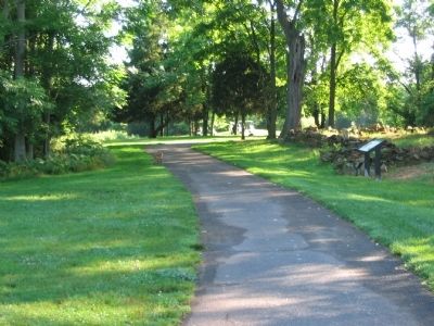
2. Marker on the Cart Path
A fox, to the left of the path, approaches the cemetery. The marker stands at the rock wall around the cemetery.
Other nearby markers. At least 8 other markers are within 5 miles of this marker, measured as the crow flies: Ashburn Station (approx. 4.2 miles away); Ashburn School (approx. 4.4 miles away); Tracks Into History (approx. 4½ miles away); Washington & Old Dominion Railroad Regional Park (approx. 4½ miles away); This is W&OD Trail: Smith Switch! (approx. 4½ miles away); Norman's Station (approx. 4.6 miles away); This is Gilbert's Corner! (approx. 4.6 miles away); Neighbor Against Neighbor (approx. 4.6 miles away).
More about this marker. On the left is a drawing of A Mosby Scout in Sight of the Enemy by James E. Taylor. On the lower right is another illustration by Taylor, titled The Fight at Miskel's.
Related markers. Click here for a list of markers that are related to this marker. Ranger Dick Moran and the Battle of Miskel's Farm.
Also see . . . Skirmish at Miskel Farm. Wikipedia article. (Submitted on June 16, 2009, by Craig Swain of Leesburg, Virginia.)
Photographed by Craig Swain, June 14, 2009
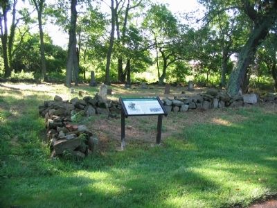
3. Marker at the Entrance to the Cemetery
Photographed by Craig Swain, June 14, 2009
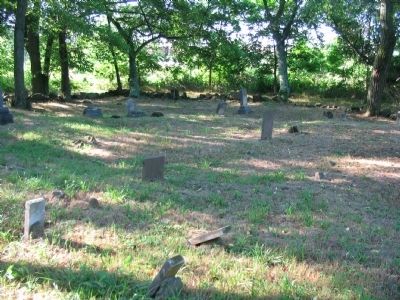
4. Lyon Family Cemetery
Photographed by Craig Swain, June 16, 2009
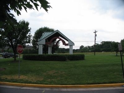
5. Site of the Green Home
The site of the Green family home stood near the entrance to Denizen Plaza, along the Leesburg Turnpike, modern Virginia Highway 7. The house was situated close to the spot where the gazebo now stands. On March 31, 1863, Ranger Dick Moran spent time with the Green family. On hearing the approach of Federal Cavalry, knowing the patrol was searching for Mosby's command, Moran rushed to the Miskel Farm. See related markers for more information about the fighting there.
Credits. This page was last revised on June 16, 2016. It was originally submitted on June 16, 2009, by Craig Swain of Leesburg, Virginia. This page has been viewed 4,518 times since then and 80 times this year. Photos: 1, 2, 3, 4, 5. submitted on June 16, 2009, by Craig Swain of Leesburg, Virginia.
