
North Fork in Aquebogue in Suffolk County, New York — The American Northeast (Mid-Atlantic)
Battles of Penny’s and Luce’s Landing
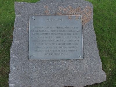
1814 - 1926
Photographed by Keith Menotti, June 14, 2009
1. Battles of Pennys and Luce Landing Marker
At Penny’s Landing Farmers and Militia prevented the capture of Sloop Nancy by British Man of War Sylph. At Luce’s Landing Revenue Cutter Nathan Hale was captured by British Frigate after a valiant defense for three days by its crew and the assembled farmers. Ye who tread in their footsteps remember their valor.
Erected 1926 by Yennicott Chapter, Daughters of the Revolution.
Topics. This historical marker is listed in these topic lists: Patriots & Patriotism • War of 1812 • Waterways & Vessels.
Location. 40° 58.189′ N, 72° 37.133′ W. Marker is in Aquebogue, New York, in Suffolk County. It is in North Fork. It is at the intersection of Church Lane and Sound Avenue, on the left when traveling north on Church Lane. Touch for map. Marker is at or near this postal address: 489 Sound Shore Rd, Aquebogue NY 11931, United States of America. Touch for directions.

Regionally, this marker is in the New York City Metropolitan Area and on Long Island. It is also in the American Northeast, in the Mid-Atlantic, and on the Eastern Seaboard. Globally, it is in the
this page online
Other nearby markers. At least 8 other markers are within 2 miles of this marker, measured as the crow flies: Old Orchard (approx. 1.7 miles away); Pigthle (approx. 1.7 miles away); Hallock Homestead (approx. 1.8 miles away); Horse Block (approx. 1.8 miles away); Front Porch (approx. 1.8 miles away); Shoemaker's Shop (approx. 1.8 miles away); a different marker also named Hallock Homestead (approx. 1.8 miles away); Homestead Kitchen End (approx. 1.8 miles away).
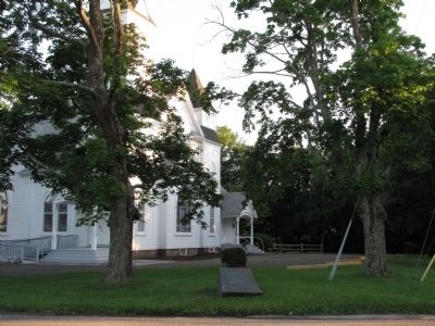
More about this marker. Originally Placed on a traffic island at the terminus of Church Lane, it was recently relocated to its current location on the corner.
Photographed by Larry Gertner, May 9, 2021
2. "A Local Battle in the War of 1812"
Hallockville Museum Farm website entry
(Submitted by Keith Menotti of Aquebogue, New York; June 14, 2009)
Click for more information.
(Submitted by Keith Menotti of Aquebogue, New York; June 14, 2009)
Click for more information.
Photographed by Keith Menotti, June 13, 2009
3. Battles of Pennys and Luce Landing Marker
Photographed by Keith Menotti, June 13, 2009
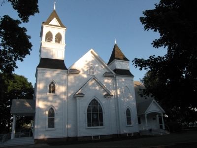
4. Community Baptist Church
Credits. This page was last revised on February 14, 2024. It was originally submitted on June 14, 2009, by Keith Menotti of Aquebogue, New York. This page has been viewed 3,204 times since then and 55 times this year. Last updated on June 16, 2009, by Keith Menotti of Aquebogue, New York. Photos: 1. submitted on June 14, 2009, by Keith Menotti of Aquebogue, New York. 2. submitted on May 9, 2021, by Larry Gertner of New York, New York. 3, 4. submitted on June 14, 2009, by Keith Menotti of Aquebogue, New York. • Syd Whittle was the editor who published this page.
