Olathe in Johnson County, Kansas — The American Midwest (Upper Plains)
Santa Fe Trail
Photographed by Thomas Onions, June 14, 2009
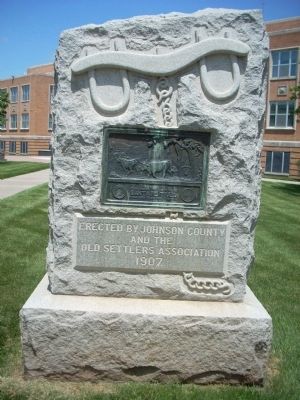
1. Santa Fe Trail Marker
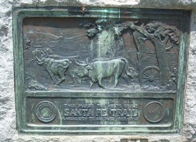
Closeup of Santa Fe Trail Marker
Erected 1907 by Johnson County and the Old Settler's Association.
Topics and series. This historical marker is listed in this topic list: Roads & Vehicles. In addition, it is included in the Santa Fe Trail series list. A significant historical year for this entry is 1822.
Location. 38° 52.933′ N, 94° 49.183′ W. Marker is in Olathe, Kansas, in Johnson County. It is on North Santa Fe Street. This marker is in the plaza between the Courthouse and the County Offices. Touch for map. Marker is at or near this postal address: 100 North Santa Fe Street, Olathe KS 66061, United States of America. Touch for directions.

Regionally, this marker is in Eastern Kansas and specifically in Greater Kansas City. It is also in the American Midwest, in the Corn Belt, on the prairies, on the Southern Plains, and on the Santa Fe Trail Corridor. Globally, it is in North America, the Western Hemisphere, the Western World, and the Anglosphere. Historically, it finds itself in what was once the Louisiana Purchase.
Other nearby markers. At least
this page online
More about this marker. There are similar companion markers in Gardner and Baldwin City, Ks.
Also see . . .
1. Santa Fe National Historic Trail. This website is sponsored by the National Park Service. (Submitted on June 19, 2009, by Thomas Onions of Olathe, Kansas.)
2. "With Each Turn of the Wheel". KMNE – Channel 5 production. This video is almost an hour long, so allow time. (Submitted on July 11, 2009.)
Additional keywords. Santa Fe Trail
Photographed by Thomas Onions, June 14, 2009
2. Santa Fe Trail Marker
Closeup of plaque
Photographed by Thomas Onions, June 14, 2009
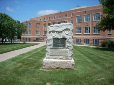
3. Santa Fe Trail Marker
Area shot of Marker with Johnson County Courthouse in the background.
Credits. This page was last revised on January 7, 2022. It was originally submitted on June 19, 2009, by Thomas Onions of Olathe, Kansas. This page has been viewed 1,689 times since then and 57 times this year. Photos: 1, 2, 3. submitted on June 19, 2009, by Thomas Onions of Olathe, Kansas. • Craig Swain was the editor who published this page.
