Indian Head in Indian Head No. 156, Saskatchewan — The Prairie Region (North America)
Bell Farm
A Saskatchewan Historic Site
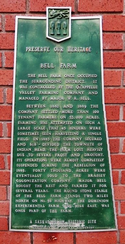
— Preserve Our Heritage —
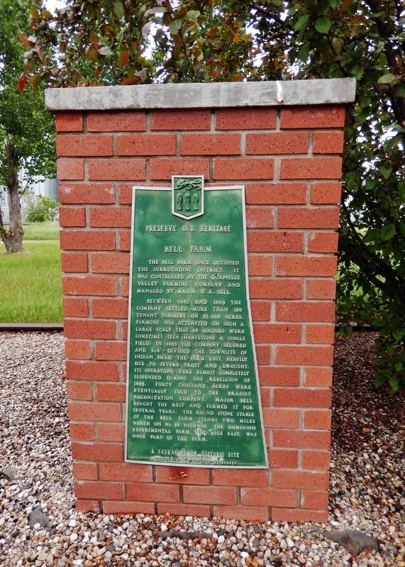
The Bell Farm once occupied the surrounding district. It was controlled by the Qu’appelle Valley Farming Company and managed by Major W. R. Bell.
Between 1882 and 1889 the company settled more than 100 tenant farmers on 53,000 acres. Farming was attempted on such a large scale that 45 binders were sometimes seen harvesting a single field. In 1883 the company secured and sub-divided the townsite of Indian Head. The farm lost heavily due to severe frost and drought. Its operations were almost completely suspended during the Rebellion of 1885. Forty thousand acres were eventually sold to the Brassey Colonization Company. Major Bell bought the rest and farmed it for several years. The round stone stable of the Bell Farm stands two miles north on No. 56 Highway. The Dominion Experimental Farm, one mile east, was once part of the farm.
Erected by Saskatchewan Department of Natural Resources.
Topics. This historical marker is listed in these topic lists: Agriculture • Industry & Commerce • Settlements & Settlers • Wars, Non-US. A significant historical year for this entry is 1882.
Location. 50° 31.75′ N, 103° 39.924′ W. Marker is in Indian Head, Saskatchewan, in Indian Head No. 156. Marker is at the intersection of North Railway Avenue and Main Street, on the left when traveling west on North Railway Avenue. Touch for map. Marker is in this post office area: Indian Head SK S0G 2K0, Canada. Touch for directions.
Other nearby markers. At least 1 other marker is within 3 kilometers of this marker, measured as the crow flies. The Bell Barn: A Unique Symbol of Our Agricultural History (approx. 2.8 kilometers away).
Related markers. Click here for a list of markers that are related to this marker.
Also see . . .
1. Bell Farm.
Bell Farm is a heritage farm built in 1882 by Major Bell on ten miles square or 60,000 acres at Indian Head. The first settlers moved into the district in 1882, a few months ahead of the Canadian Pacific Railway. The farming operations were so huge and out of the ordinary that, on many occasions, the passenger trains would stop and let the passengers watch the harvesting operation becoming the area's first tourist attraction. In 1886 the Bell Farm owned 45 reapers, and binders, 78 ploughs, 6 mowers, 40 seeders, 80 sets of harrows and seven steam threshing outfits to plant and harvest 5,000 acres of Red Fyfe wheat, oats and potatoes crop.(Submitted on June 27, 2022, by Cosmos Mariner of Cape Canaveral, Florida.)
2. William Robert Bell.
By June 1883 some 70 buildings had been erected, including several impressive stone structures; the company also bought the Indian Head town-site to provide support services, in particular a hotel and elevator. In early 1885 the company constructed a massive grist mill. The outbreak of the North-West rebellion, however, dealt the farm a blow from which it never recovered. Men and horses were recruited to transport military supplies, and as a consequence only 1,000 acres were cultivated that summer. By 1886 the farm was in serious difficulty and was refinanced as the Bell Farm Company Limited. In order to reduce its debt load, the new company sold the Indian Head town-site, as well as 675 acres to the federal government. In April 1889 the Supreme Court of the North-West Territories ordered that the farm be broken up and sold. Bell acquired almost 13,000 acres for his own use and attempted to carry on the original concept but on a smaller scale. This operation also foundered and Bell evidently left the area shortly after the death of his wife in October 1895; the farm was seized by creditors the following year.(Submitted on June 27, 2022, by Cosmos Mariner of Cape Canaveral, Florida.)
3. North-West Rebellion.
The North-West Rebellion of 1885 was a rebellion by the Métis people under Louis Riel and an associated uprising by First Nations Cree and Assiniboine of the District of Saskatchewan against the Canadian government.
(Submitted on June 27, 2022, by Cosmos Mariner of Cape Canaveral, Florida.)
Credits. This page was last revised on June 27, 2022. It was originally submitted on June 26, 2022, by Cosmos Mariner of Cape Canaveral, Florida. This page has been viewed 157 times since then and 31 times this year. Photos: 1, 2, 3. submitted on June 26, 2022, by Cosmos Mariner of Cape Canaveral, Florida.


