Near Monroe in Monroe County, Michigan — The American Midwest (Great Lakes)
Wm. C. Sterling State Park
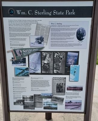
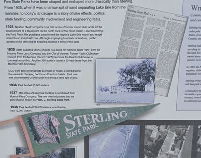
The January 1940 issue of Michigan Conservation proclaimed "the park area is man-made." Few State Parks have been shaped and reshaped more drastically than Sterling. From 1935, when it was a narrow spit of sand separating Lake Erie from the marshes, to today's landscape is a story of lake effects, politics, state funding, community involvement and engineering feats.
1928 Newton Steel Company buys 350 acres of former marsh club lands for the development of a steel plant on the north bank of the River Raisin. Later becoming the Ford Plant, this purchase transformed the region's Lake Erie marsh and resort area into an industrial zone. Although employing hundreds of workers, public access to the lake and its beaches became a thing of the past.
1935 State acquires title to original 134 acres for "Monroe State Park" from the Monroe Piers Land Company and the City of Monroe. Former Yacht Clubhouse (moved from the Monroe Piers in 1927) becomes the Beach Clubhouse, a concession pavilion. Another 395 acres is under a 30-year lease from the Monroe Piers Company.
CCC work project constructs five miles of roads, a campground, five movable changing booths and four box toilets. Park use was concentrated on the south end along a sand spit of land.
1936 Park hosted 80,000 visitors.
1937 150 acres of Lake Erie frontage is purchased from Monroe Piers Company. The new deed stipulates that the park shall be known as "Wm. C. Sterling State Park."
1938 Park hosted 226,870 visitors; one Sunday had 12,000 visitors.
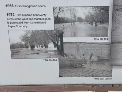
1952 Lake Erie high water and storms take out hundreds of yards of beach. Most of the beach, trees and buildings were lost. The Beach Clubhouse collapsed. Park is inaccessible.
1953 Local citizens pitch in to clean up beach debris; closed almost 2 years.
1954 New park plan is proposed.
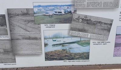
1957 Park almost totally flooded.
1960 State Park Motor Vehicle Permits begin to pay for State Park Improvement Bond; annual sticker is $2.
1961 Lake Erie is posted as "Unsafe for Swimming."
1964 Five thousand attend Winter Perchtown Derby. New Beach concession building is built.
1965 Boat ramp is constructed.
1966 First campground opens.
1972 Two hundred and twenty acres of the west end marsh lagoon is purchased from Consolidated Paper Company.
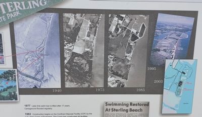
1977 Lake Erie swim ban is lifted after 17 years. Campground flooded regularly.
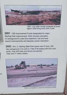
1982 Construction begins on the Confined Disposal Facility (CDF) by the U.S. Army Corps of Engineers. The Corps has constructed 44 facilities on the Great Lakes for the purpose of disposing contaminated sediments from dredging projects. As navigation channels are dredged, many bottom sediments contain high levels of contaminants. The chemical-laden soil is deposited in the CDF site, where water percolates through the soil, leaving the contaminants behind. The north end of Sterling State Park was selected for the 89-acre site. It can hold more than 2.3 million cubic yards of contaminant. Millions of cubic yards of soil from its construction are used to fill large areas of the south end of the park for future expanded parking lots.
1985 CDF facility is dedicated.
1988 Sandy Creek channel dredging opens channel up for boaters. Marsh Nature Trail is opened along the marsh lagoon dike.
2001 CMI Improvement Funds designated for major Sterling Park Improvement. Work includes relocation of campground to Lake Erie waterfront, trail and boat launch improvements and lakeplain prairie restoration.
2003 Wm. C. Sterling State Park opens new 47-acre, 288 site campground. It is built on 7 feet of till totaling 400,000 cubic yards. Over 200 trees and shrubs are planted.
Total cost: 17 million dollars.
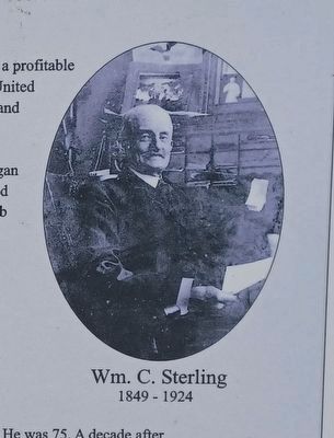
Wm. C. Sterling
Commodore Wm. C. Sterling was a pioneer in the early days of tourism, recreation and conservation - all things valued in state parks today.
Sterling State Park is named for William Clark Sterling. Born in 1849, Wm. C. Sterling founded a profitable cedar pole business at the Monroe city docks in 1880. This company, the first of its kind in the United States, processed, stacked and shipped cedar telegraph and telephone poles throughout the U.S. and Canada, and to many foreign countries.
Sterling had a lifelong interest in Lake Erie and the Monroe marshes. A passionate hunter, he began traveling to Lansing in 1878 to buy up the marsh land parcels. Being the only bidder, he acquired land for as little as 30-50 cents an acre. At one time, he and the exclusive Monroe Marsh Club owned more than five miles of waterfront and over 5,000 acres of marshland. The club was a pioneer in creating rules, regulations and seasons for duck hunting in Michigan.
In 1886, the Monroe Yacht Club was organized, with Wm. C. Sterling as commodore. Its sailing regattas, clubhouse on the Monroe Piers, weekly dances and its annual Muskrat Dinner each December were famous throughout the region for over 30 years.
Sterling
owned passenger ships for commuting tourists, constructed jetties to protect the beach and designed rakes for keeping the channel clear of floating vegetation.
Commodore Sterling was killed in a car accident involving a streetcar on Monroe Street in 1924. He was 75. A decade after his death, a group of Monroe city leaders, including Wm. C. Sterling, Jr., proposed that 115 acres of land north of the River Raisin channel, owned by the Monroe Piers Land Company, be deeded to the state of Michigan for the creation of a state park. In 1937, an additional sale of land to the state stipulated the park be named in honor of Wm. C. Sterling.
Erected by Michigan Department of Natural Resources.
Topics. This historical marker is listed in this topic list: Parks & Recreational Areas. A significant historical month for this entry is January 1940.
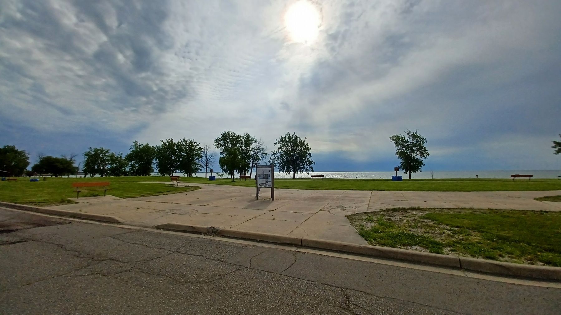
Location. 41° 54.614′ N, 83° 20.069′ W. Marker is near Monroe, Michigan, in Monroe County. Marker is on North Lakeshore Drive south of State Park Road, on the left when traveling south. Marker is in Sterling State Park and can be seen from the beach parking lot. Touch for map. Marker is at or near this postal address: 2800 State Park Road, Monroe MI 48162, United States of America. Touch for directions.
Other nearby markers. At least 8 other markers are within 2 miles of this marker, measured as the crow flies. Monroe (here, next to this marker); Monroe Piers (here, next to this marker); Famous Waterfront
(about 400 feet away, measured in a direct line); Sandy Creek Settlement (approx. 0.6 miles away); Capt. Norman W. Heck Jr (approx. 2 miles away); Monroe County Vietnam Veterans Memorial Tree (approx. 2 miles away); POW-MIA Chained Eagle (approx. 2 miles away); M29 81mm Mortar (approx. 2 miles away). Touch for a list and map of all markers in Monroe.
Credits. This page was last revised on July 1, 2022. It was originally submitted on July 1, 2022, by Joel Seewald of Madison Heights, Michigan. This page has been viewed 202 times since then and 63 times this year. Photos: 1, 2, 3, 4, 5, 6, 7, 8. submitted on July 1, 2022, by Joel Seewald of Madison Heights, Michigan.
