
Gainesville in Prince William County, Virginia — The American South (Mid-Atlantic)
Bull Run Battlefields
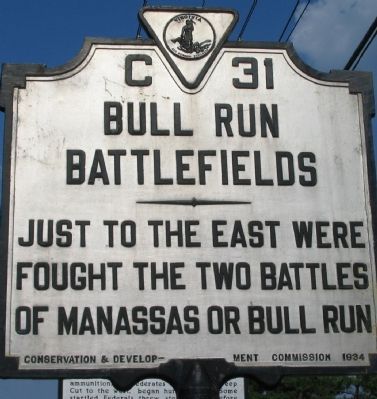
Photographed by Craig Swain, August 1, 2007
1. Bull Run Battlefields Marker
Erected 1934 by Conservation & Development Commission. (Marker Number C-31.)
Topics and series. This historical marker is listed in this topic list: War, US Civil. In addition, it is included in the Virginia Department of Historic Resources (DHR) series list.
Location. 38° 47.412′ N, 77° 38.051′ W. Marker is in Gainesville, Virginia, in Prince William County. It is on Lee Highway (U.S. 29), on the right when traveling east. Touch for map. Marker is in this post office area: Gainesville VA 20155, United States of America. Touch for directions.

Regionally, this marker is in the Washington Metropolitan Area, in Northern Virginia, and in the Piedmont. It is also in the American South, specifically in the Upper South, in the Mid-Atlantic, and on the Eastern Seaboard. Globally, it is in the North Atlantic Region, North America, the Western Hemisphere, the Western World, and the Anglosphere. Historically, it finds itself in what was once the territory of the Mississippian Culture, one of
this page online
Other nearby markers. At least 8 other markers are within 2 miles of this marker, measured as the crow flies: Campaign of Second Manassas (here, next to this marker); Rock Fight (here, next to this marker); Second Battle of Manassas (here, next to this marker); The Macrae School (approx. 0.8 miles away); Home of Thomas B. Gaines (approx. 1.2 miles away); The Shirley Cemetery (approx. 1.4 miles away); In This Area Are Buried (approx. 1.4 miles away); St. Paul's, Episcopal (approx. 1.4 miles away). Touch for a list and map of all markers in Gainesville.
More about this marker. This marker was originally erected on U.S. 29, less than half a mile to the east of the SR 55 intersection. It was moved here during the reconstruction of the US-29 – I-66 interchange. It and its counterpart, No. C-19 near the city of Fairfax, flank the battlefields of Bull Run. —Ed.
Also see . . . History of the Bull Run - Manassas Battlefields. (Submitted on August 7, 2007, by Craig Swain of Leesburg, Virginia.)
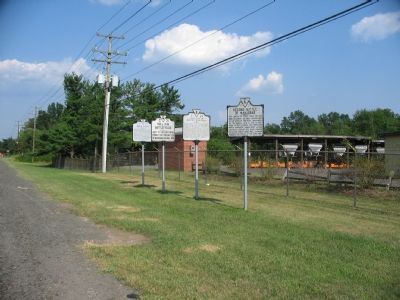
Photographed by Craig Swain, August 1, 2007
2. Four State Markers Along Lee Highway
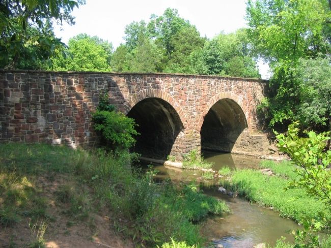
Photographed by Craig Swain, August 1, 2007
3. The Stone Bridge
The famous Stone Bridge was reconstructed after the war, but is a significant land mark used during both battles.
Credits. This page was last revised on June 25, 2017. It was originally submitted on August 6, 2007, by Craig Swain of Leesburg, Virginia. This page has been viewed 1,992 times since then and 39 times this year. Photos: 1, 2, 3. submitted on August 6, 2007, by Craig Swain of Leesburg, Virginia. • J. J. Prats was the editor who published this page.
