Ashland in Bayfield County, Wisconsin — The American Midwest (Great Lakes)
Lands Along the Lake
Inscription.
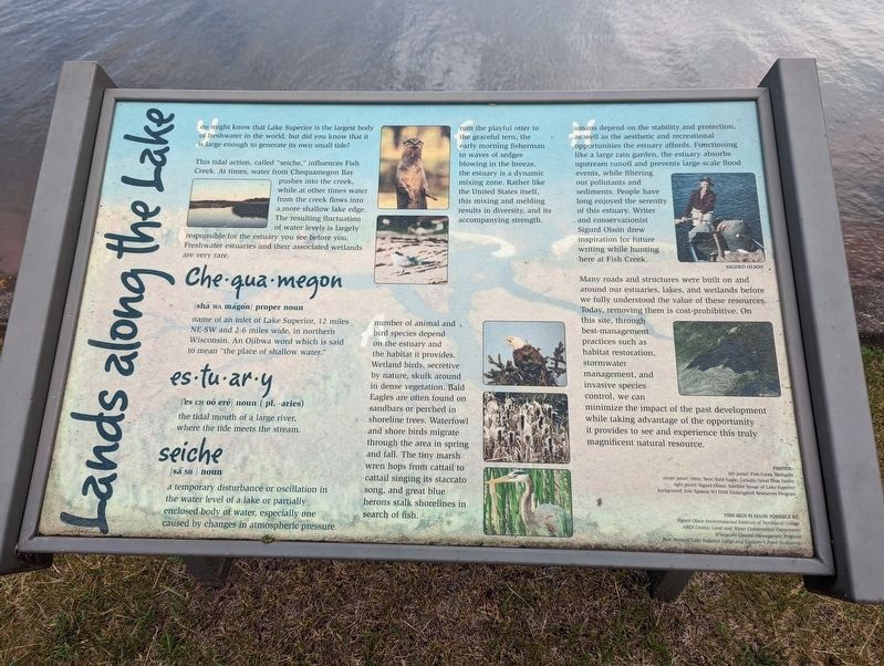
You might know that Lake Superior is the largest body of freshwater in the world, but did you know that it is large enough to generate its own small tide?
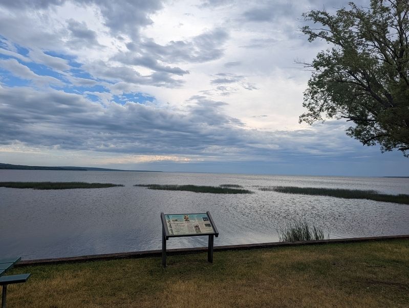
This tidal action, called "seiche,” influences Fish Creek. At times, water from Chequamegon Bay pushes into the creek, while at other times water from the creek flows into a more shallow lake edge. The resulting fluctuation of water levels is largely responsible for the estuary you see before you. Freshwater estuaries and their associated wetlands are very rare.
Che-qua-megon
|shä WA mägŏn| proper noun
name of an inlet of Lake Superior, 12 miles NE-SW and 2-6 miles wide, in northern Wisconsin. An Ojibwa word which is said to mean "the place of shallow water.”
es-tu-ar-y
|'es CH oō erē| noun (pl. -aries)
the tidal mouth of a large river, where the tide meets the stream.
seiche
|sā SH|noun a temporary disturbance or oscillation in the water level of a lake or partially enclosed body of water, especially one caused by changes in atmospheric pressure.
From the playful otter to the graceful tern, the early morning fisherman to waves of sedges blowing in the breeze, the estuary is a dynamic mixing zone. Rather like the United States itself, this mixing and melding results in diversity, and its accompanying strength.
A number of animal and bird species depend on the estuary and the habitat it provides. Wetland birds, secretive by nature, skulk around in dense vegetation. Bald Eagles are often found on sandbars or perched in shoreline trees. Waterfowl and shore birds migrate through the area in spring and fall. The tiny marsh wren hops from cattail to cattail singing its staccato song, and great blue herons stalk shorelines in search of fish.
Humans depend on the stability and protection, as well as the aesthetic and recreational opportunities the estuary affords. Functioning like a large rain garden, the estuary absorbs upstream runoff and prevents large-scale flood events, while filtering out pollutants and sediments. People have long enjoyed the serenity of this estuary. Writer and conservationist Sigurd Olson drew inspiration for future writing while hunting here at Fish Creek.
Many roads and structures were built on and around our estuaries, lakes, and wetlands before we fully understood the value of these resources. Today, removing them is cost-prohibitive. On this site, through best-management practices such as habitat restoration, stormwater management, and invasive species control, we can minimize the impact of the past development while taking advantage of the opportunity it provides to see and experience this truly magnificent natural resource.
Erected by Sigurd Olson Environmental Institute of Northland College, ABDI County Land and Water Conservation Department, Wisconsin Coastal Management Program, Best Western Lake Superior Lodge and Explorer's Point Restaurant.
Topics. This historical marker is listed in these topic lists: Environment • Waterways & Vessels.
Location. 46° 35.246′ N, 90° 56.198′ W. Marker is in Ashland, Wisconsin, in Bayfield County. Marker can be reached from U.S. 2, one mile west of Turner Road. Located on the grounds of the Quality Inn Ashland-Superior. Touch for map. Marker is at or near this postal address: 30600 US Highway 2, Ashland WI 54806, United States of America. Touch for directions.
Other nearby markers. At least 8 other markers are within 6 miles of this marker, measured as the crow flies. Voices in the Mist (within shouting distance of this marker); Radisson-Groseilliers Fort (approx. 0.9 miles away); Security Savings Bank (approx. 2½ miles away); Doctor Edwin Ellis (approx. 3 miles away); Northland College (approx. 3.1 miles away); Schooner Lucerne (approx. 3½ miles away); Fleet Admiral William D. Leahy (approx. 3.6 miles away); The Sprague Well (approx. 5.7 miles away). Touch for a list and map of all markers in Ashland.
Credits. This page was last revised on July 5, 2022. It was originally submitted on July 5, 2022, by Mike Wintermantel of Pittsburgh, Pennsylvania. This page has been viewed 107 times since then and 24 times this year. Photos: 1, 2. submitted on July 5, 2022, by Mike Wintermantel of Pittsburgh, Pennsylvania.

