Fort Stockton in Pecos County, Texas — The American South (West South Central)
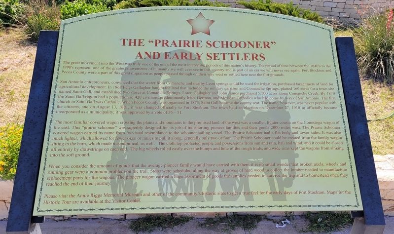
The "Prairie Schooner" and Early Settlers
San Antonio entrepreneurs, convinced that the water from Comanche and nearby Leon springs could be used for irrigation, purchased large tracts of land for agricultural development. In 1868 Peter Gallagher bought the land that included the military garrison and Comanche Springs, platted 160 acres for a town site named Saint Gall, and established two stores at Comanche Springs. Later, Gallagher and John James purchased 5,500 acres along Comanche Creek. By 1870 the Saint Gall region had a population of 420 civilians, predominantly Irish, German, and Mexican Catholics who had come by way of San Antonio. The first church in Saint Gall was Catholic. When Pecos County was organized in 1875, Saint Gall became the county seat. The name, however, was never popular with the citizens, and on August 13, 1881, it was changed officially to Fort Stockton. The town held an election on December 27, 1910 to officially become incorporated as a municipality; it was approved by a vote of 56-51.
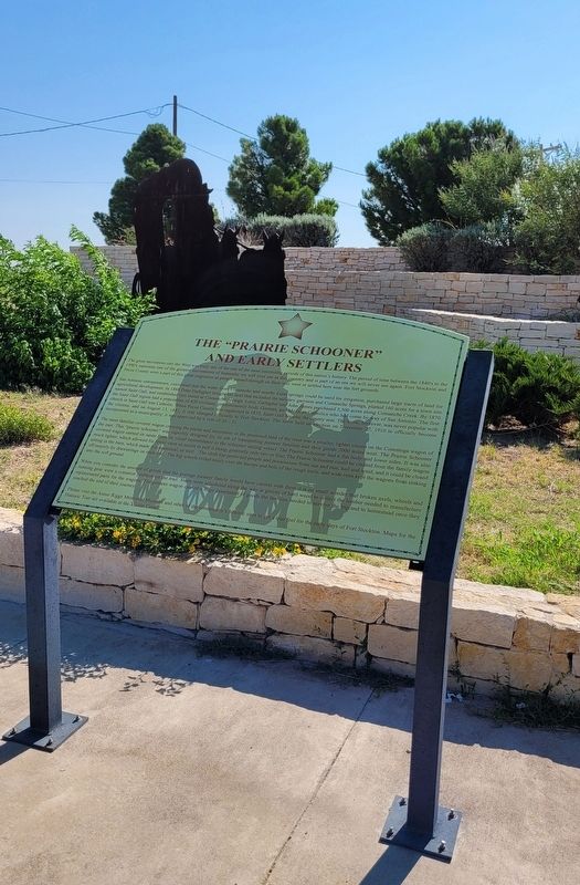
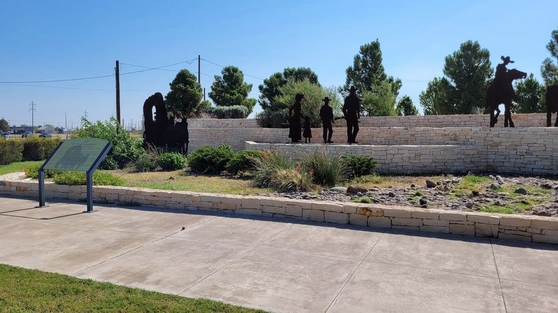
The most familiar covered wagon crossing the plains and mountains to the promised land of the west was a smaller, lighter cousin on the Conestoga wagon of the east. This "prairie schooner" was superbly designed for its job of transporting pioneer families and their goods 2000 miles west. The Prairie Schooner covered wagon earned its name from its visual resemblance to the schooner sailing vessel. The Prairie Schooner had a flat body and lower sides. It was also much lighter, which allowed for fewer oxen or mules to pull it along, generally only two or four. The Prairie Schooner could be created from the family wagon sitting in the barn, which made it economical, as well. The cloth top protected people and possessions from sun and rain, hail and wind, and it could be closed off entirely by drawstrings on each end. The big wheels rolled easily over the bumps and hole of the rough trails, and wide rims kept the wagons from sinking into the soft ground.
When you consider the amount of goods that the average pioneer family would have carried with them it is no small wonder that broken axels, wheels and running gear were a common problem on the trail. Stops were scheduled along the way at groves of hard wood to collect the lumber needed to manufacture replacement parts for the wagons. The pioneer wagon carried a huge assortment of goods the families needed to survive the trip and to homestead once they reached the end of their journey.
Please visit the Annie Riggs Memorial Museum and other of the community's historic sites to get a true feel for the early days of Fort Stockton. Maps for the Historic Tour are available at the Visitor Center.
Erected by Fort Stockton Convention & Visitors Bureau.
Topics. This historical marker is listed in these topic lists: Roads & Vehicles • Settlements & Settlers. A significant historical date for this entry is August 13, 1881.
Location. 30° 53.625′ N, 102° 52.699′ W. Marker is in Fort Stockton, Texas, in Pecos County. Marker can be reached from the intersection of Railroad Avenue and East 11th Street. The marker is located at the southwest section of the Fort Stockton Visitor Center acrossthe train tracks. Touch for map. Marker is at or near this postal address: 1000 Railroad Avenue, Fort Stockton TX 79735, United States of America. Touch for directions.
Other nearby markers. At least 8 other markers are within walking distance of this marker. Oil and Gas Industry in Pecos County (within shouting distance of this marker); Visitor Center (within shouting distance of this marker); Comanche Springs (about 300 feet away, measured in a direct line); The 9th Cavalry, Fort Stockton and Edward Hatch (about 300 feet away); Pecos County Fort Stockton Renewable Energy Park (about 300 feet away); The Great Comanche War Trail (about 400 feet away); Downtown Fort Stockton (about 500 feet away); Old Fort Cemetery (about 700 feet away). Touch for a list and map of all markers in Fort Stockton.
Also see . . . Covered wagon. Wikipedia (Submitted on July 6, 2022, by James Hulse of Medina, Texas.)
Credits. This page was last revised on July 6, 2022. It was originally submitted on July 5, 2022, by James Hulse of Medina, Texas. This page has been viewed 103 times since then and 20 times this year. Photos: 1, 2, 3. submitted on July 6, 2022, by James Hulse of Medina, Texas.


