Horse Cave in Hart County, Kentucky — The American South (East South Central)
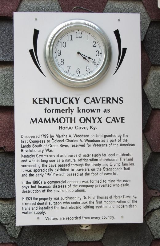
Kentucky Caverns
formerly known as Mammoth Onyx Cave
— Horse Cave Ky —
Kentucky Caverns served as a source of water supply for local residents and was in long use as a natural refrigeration storehouse. The land surrounding the cave passed through the Lively and Crump families. It was sporadically exhibited to travelers on the Stagecoach Trail and the early "Pike" which passed at the foot of cave hill.
In the 1890s a commercial concern was formed to mine the cave onyx but financial distress of the company prevented wholesale destruction of the cave's decorations.
In 1921 the properly was purchased by Dr. H.B. Thomas of Horse Cave Ky. a retired dental surgeon who undertook the first modernization of the trails and installed the first electric lighting system and modern deep water supply.
Visitors are recorded from every country.
Topics. This historical marker is listed in this topic list: Natural Features. A significant historical year for this entry is 1799.
Location. 37° 12.316′ N, 85° 55.94′ W. Marker is in Horse Cave, Kentucky, in Hart County. Marker can be reached from Kentucky Route 335 north of Kentucky Route 218. Located on the grounds of the Kentucky Down Under Adventure Zoo which offer cave tours. Touch for map. Marker is at or near this postal address: 3627 KY-335, Horse Cave KY 42749, United States of America. Touch for directions.
Other nearby markers. At least 8 other markers are within 5 miles of this marker, measured as the crow flies. Unknown Confederate Soldier Monument (approx. 0.8 miles away); Lt. Charles Moran - USAF (approx. 2.2 miles away); Texas Memorial (approx. 3˝ miles away); The Texas Rangers (approx. 3˝ miles away); Rowlett's Station (approx. 3.7 miles away); Battle of Rowletts Station (approx. 3.9 miles away); a different marker also named Battle of Rowletts Station (approx. 4 miles away); Battle of Munfordville (approx. 4.1 miles away). Touch for a list and map of all markers in Horse Cave.
Credits. This page was last revised on July 8, 2022. It was originally submitted on July 5, 2022, by Jason Armstrong of Talihina, Oklahoma. This page has been viewed 206 times since then and 57 times this year. Photo 1. submitted on July 5, 2022, by Jason Armstrong of Talihina, Oklahoma. • Mark Hilton was the editor who published this page.
Editor’s want-list for this marker. A wide shot of the marker and its surroundings. • Can you help?
