Near Junction in Kimble County, Texas — The American South (West South Central)
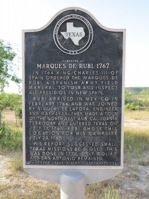
Campsite of Marques de Rubi, 1767
In 1764 King Charles III of Spain ordered the Marques de Rubi, a Spanish army field marshal, to tour and inspect all presidios in New Spain.
Rubi arrived in Mexico in February 1766, and was joined by Nicolas de Lafora, engineer and mapmaker. They made a tour of the Northwest and California territory and entered Texas on July 17, 1767. Rubi chose this location for his campsite July 23, 1767.
His report suggested small Texas missions be closed. This was done in 1772. Only Goliad and San Antonio remained.
Erected 1967 by State Historical Survey Committee. (Marker Number 1188.)
Topics. This historical marker is listed in these topic lists: Exploration • Hispanic Americans • Settlements & Settlers. A significant historical date for this entry is July 23, 1767.
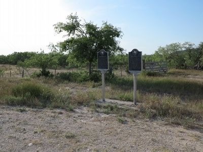
Location. 30° 31.274′ N, 99° 49.39′ W. Marker is near Junction, Texas, in Kimble County. Marker is on Ranch to Market Road 1674, 1.2 miles west of County Route 271, on the right when traveling west. Touch for map. Marker is in this post office area: Junction TX 76849, United States of America. Touch for directions.
Other nearby markers. At least 8 other markers are within 4 miles of this marker, measured as the crow flies. Old Bear Creek Texas Ranger Camp (here, next to this marker); Pioneer - North Llano Cemetery (approx. 3 miles away); Speer (approx. 3 miles away); First Court in Kimble County (approx. 3.2 miles away); The Killing of Sam Speer (approx. 3.2 miles away); Marvin E. and Retta Ann Blackburn House (approx. 3˝ miles away); Brambletye (approx. 3˝ miles away); Junction School Campus (approx. 3.6 miles away). Touch for a list and map of all markers in Junction.
Credits. This page was last revised on July 14, 2022. It was originally submitted on November 21, 2015, by Richard Denney of Austin, Texas. This page has been viewed 529 times since then and 35 times this year. Last updated on July 11, 2022, by Joe Lotz of Denton, Texas. Photos: 1, 2, 3. submitted on November 21, 2015, by Richard Denney of Austin, Texas. • J. Makali Bruton was the editor who published this page.


