Jonah in Williamson County, Texas — The American South (West South Central)
Community of Jonah

Photographed by Chris Talley, November 28, 2025
1. Community of Jonah Marker
Restored by Chris and Nicole
On 1820s land grant to Nashville colony. Settled 1851 by wagon train from Arkansas, and called Water Valley. In 1884, repeated ill-luck in selecting an acceptable name for Post Office led to renaming the town Jonah. This was site of famed Grist Mill, 1865–1912.
Erected 1970 by State Historical Survey Committee. (Marker Number 15548.)
Topics. This historical marker is listed in these topic lists: Communications • Industry & Commerce • Roads & Vehicles • Settlements & Settlers. A significant historical year for this entry is 1851.
Location. 30° 38.351′ N, 97° 32.451′ W. Marker is in Jonah, Texas, in Williamson County. It is on State Highway 29. Touch for map. Marker is in this post office area: Weir TX 78674, United States of America. Touch for directions.

Regionally, this marker is in Central Texas and in the Austin Metropolitan Area. It is also in the American South. Globally, it is in North America, a Gulf of Mexico state, the Western Hemisphere, the Western World, and the Anglosphere. Historically, it finds itself in what was once New Spain, the Republic of Texas, one of the Confederate States of America, and the Antebellum South.
Other nearby markers. At least 8 other markers are within 4 miles of this marker, measured as the crow flies: Jonah Cemetery (approx. 1.4 miles away); Mankins Crossing (approx. 2½ miles away); Weir Community Cemetery (approx. 3 miles away); The Double File Trail (Georgetown) (approx. 3.1 miles away); Texan Santa Fe Expedition (approx. 3.1 miles away); Site of Neusser (Naizerville) (approx. 3.2 miles away); Monodale Community (approx. 3½ miles away); City of Weir (approx. 3.7 miles away).
Also see . . . Restoring Texas Historical Marker 15548 "Community of Jonah". (Submitted on December 15, 2025, by Chris Talley of Bryan, Texas.)
this page online
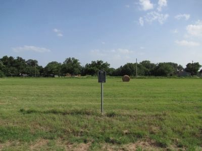
Photographed by QuesterMark, June 29, 2014
2. Community of Jonah Marker vicinity
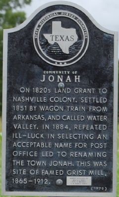
Photographed by Keith Peterson, July 5, 2007
3. Community of Jonah Marker
Credits. This page was last revised on January 25, 2026. It was originally submitted on October 1, 2007, by Keith Peterson of Cedar Park, Texas. This page has been viewed 2,450 times since then and 165 times this year. Last updated on July 11, 2022, by Joe Lotz of Flower Mound, Texas. Photos: 1. submitted on December 15, 2025, by Chris Talley of Bryan, Texas. 2. submitted on January 15, 2015, by QuesterMark of Fort Worth, Texas. 3. submitted on October 1, 2007, by Keith Peterson of Cedar Park, Texas. • Bill Pfingsten was the editor who published this page.
