Overland Park in Johnson County, Kansas — The American Midwest (Upper Plains)
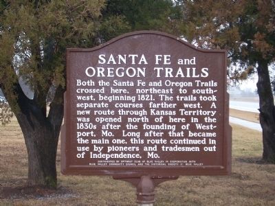
Santa Fe and Oregon Trails
Inscription.
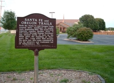
Both the Santa Fe and Oregon Trails crossed here, northeast to southwest, beginning 1821. The trails took separate courses farther west. A route through Kansas Territory was opened north of here in the 1830's after the founding of Westport, Mo. Long after that became the main one, this route continued in use by pioneers and tradesmen out of Independence, Mo.
Erected by Blue Valley Optimists, Blue Valley Community Council and Blue Valley Historical Society.
Topics and series. This historical marker is listed in these topic lists: Notable Places • Roads & Vehicles • Settlements & Settlers. In addition, it is included in the Oregon Trail, and the Santa Fe Trail series lists. A significant historical year for this entry is 1821.
Location. 38° 51.257′ N, 94° 41.316′ W. Marker is in Overland Park, Kansas, in Johnson County. Marker is on 151st Street, on the right when traveling east. The marker is west of the Blue Valley Baptist Church Parking lot very near a stand of trees. Touch for map. Marker is at or near this postal address: 8925 W 151st St, Overland Park KS 66221, United States of America. Touch for directions.
Other nearby markers. At least 8 other markers are within 7 miles of this marker, measured as the crow flies. Stanley Rural High School (approx. 1.1 miles away); Korean War Veterans Memorial (approx. 4.1 miles away); Santa Fe Trail (approx. 5.7 miles away in Missouri); New Santa Fe (approx. 5.7 miles away in Missouri); Trail Remnants (approx. 5.8 miles away in Missouri); Oregon and California National Historical Trails / Santa Fe National Historic Trail (approx. 5.8 miles away in Missouri); a different marker also named New Santa Fe (approx. 5.8 miles away in Missouri); Quantrill's Raids and the Military Road (approx. 6.2 miles away). Touch for a list and map of all markers in Overland Park.
More about this marker. 151st Street is a divided street with a median and one must be travelling east to be able to enter the parking lot.
Also see . . .
1. National Park Service – The Sante Fe National Historic Trail. Take a journey between western Missouri and Santa Fe on the Santa Fe National Historic Trail. (Submitted on June 26, 2009.)
2. Legends of America. History, Information, Maps, etc., of the Sante Fe Trail. (Submitted on June 26, 2009.)
3. Map of the Oregon Trail. (Submitted on June 26, 2009.)
4. Mileposts Along the Oregon Trail. (Submitted on June 26, 2009.)
Additional keywords.
Santa Fe Trail Oregon Trail
Credits. This page was last revised on April 26, 2019. It was originally submitted on June 23, 2009, by Thomas Onions of Olathe, Kansas. This page has been viewed 3,998 times since then and 78 times this year. Photos: 1, 2. submitted on June 23, 2009, by Thomas Onions of Olathe, Kansas. • Syd Whittle was the editor who published this page.

