Goldstream in Fairbanks North Star Borough, Alaska — Northwest (North America)
Pipeline History
Photographed by Mike Stroud, July 1, 1995
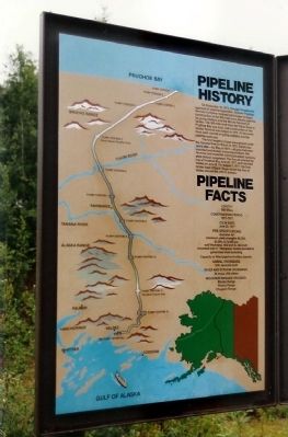
1. Pipeline History Marker
On November 16, 1973, through Presidential approval of pipeline legislation, Alyeska Pipeline Service Company received permission to begin construction of the 800-mile trans Alaska pipeline, its pump stations and the Marine Terminal at Valdez. The 360-mile road from the Yukon River to Prudhoe Bay was built, and construction of the Valdez Terminal was begun in 1974.At the same time, work started on pump stations and the pipeline work pad.
The lengths of pipe were placed under the Tonsina River in March of 1975. Barely two years later-by March of 1977- all pipe had been installed; and pump stations, the Terminal and essential communications systems were almost completed. The first oil entered the line at Prudhoe Bay June 20, 1977 and reached Valdez on July 28. On August 1, 1977, the first tanker load of North Slope oil left the Port of Valdez aboard the ARCO Juneau.
Pipeline Facts
Length : 800 miles
Construction Period :
1974-1977
Pipe Specifications:
diameter 48"
minimum yeild strengths 60,000,
65,000,& 70,000 psi
wall thickness .462 inch & .582 inch
insulated with 4" fiberglass, factory-bonded to
galvanized steel jacketing
Capacity of filled pipeline 9 million barrels
Animal Crossings:
554, specially built
River and Stream Crossing:
34 major, 800 others
Mountain Ranges Crossed:
Brooks Range
Alaska Range
Chugach Range
Topics. This historical marker is listed in these topic lists: Industry & Commerce • Natural Resources • Waterways & Vessels. A significant historical month for this entry is March 1975.
Location. 64° 55.763′ N, 147° 37.773′ W. Marker is in Goldstream, Alaska, in Fairbanks North Star Borough. It can be reached from Steese Highway (at milepost 8.4), on the right when traveling north. between Fairbanks and Fox. Touch for map. Marker is at or near this postal address:
this page online

Regionally, this marker is in the Alaska Railroad Corridor, in the Athabascan Region, and in Interior Alaska. It is also on the American Pacific Coast. Globally, it is in North America, on the Pacific Rim, in the Western Hemisphere, in the Western World, and in the Anglosphere. Historically, it finds itself in what was once the Russian Empire.
Other nearby markers. At least 8 other markers are within 7 miles of this marker, measured as the crow flies: Pipeline Facts (within shouting distance of this marker); James A. Maple (within shouting distance of this marker); Gold Dredge No. 8 (approx. 0.9 miles away); The F.E. [Fairbanks Exploration] Company (approx. 6 miles away); We Flew in the Same Sky (approx. 6.4 miles away); Women in Wartime (approx. 6.4 miles away); Home Front to Front Lines (approx. 6.4 miles away); The Artist (approx. 6.4 miles away). Touch for a list and map of all markers in Goldstream.
Also see . . .
1. Pictures of the Trans-Alaska Oil Pipeline also called the Alyeska Pipeline. Here you find a selection of
Photographed by Mike Stroud, July 1, 1995
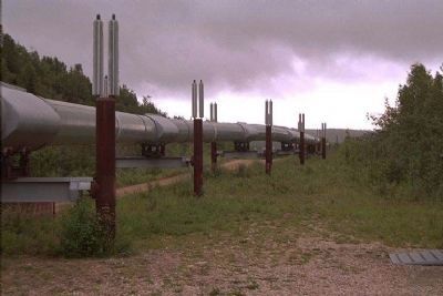
2. Trans Alaska Pipeline
2. The Trans-Alaska Pipeline. (Submitted on June 24, 2009, by Mike Stroud of Bluffton, South Carolina.)
Photographed by Mike Stroud, 1995
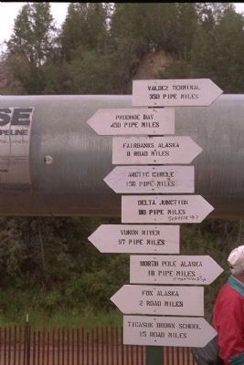
3. Pipeline with signpost
Photographed by Mike Stroud, 1995
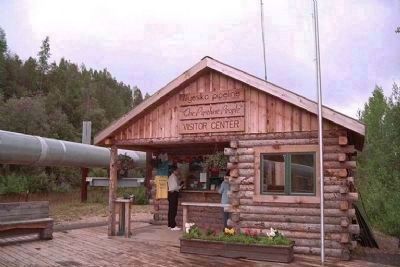
4. Fox, Pipeline Visitor Center, 8 miles North of Fairbanks
Photographed by Mike Stroud, 1995
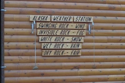
5. Alaska weather station
Photographed by Mike Stroud, 1995
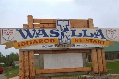
6. Wasilla
Credits. This page was last revised on January 7, 2025. It was originally submitted on June 24, 2009, by Mike Stroud of Bluffton, South Carolina. This page has been viewed 2,744 times since then and 34 times this year. Photos: 1, 2, 3, 4, 5, 6. submitted on June 24, 2009, by Mike Stroud of Bluffton, South Carolina. • Syd Whittle was the editor who published this page.
