Long Sault in Stormont, Dundas and Glengarry United Counties, Ontario — Central Canada (North America)
Corn Crib
Inscription.
Corn Crib
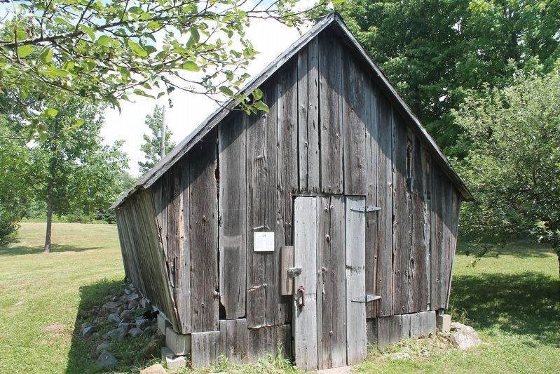
The sides of the corn crib were covered in slats to allow ventilation for the corn to dry. The slanted sides allowed the water to fall from the roof and not bounce up on the sides of the building. If the corn became wet, rot could set in. The corn crib would have originally been placed on stilts, covered in tin or tin plate and attached at the top, preventing mice from entering and feasting on the corn. This building came from north of Moulinette, and was donated to the Historical Society in 1997 by Al and MaryAnn Nessith.
Les côtés du crib à maïs étaient recouverts de lattes pour permettre une ventilation permettant au maïs de sécher. Les côtés inclinés permettaient à l'eau de tomber du toit et de ne pas rebondir sur les côtés du bâtiment. Si le maïs devenait humide, la pourriture pourrait s'installer. Le berceau de maïs aurait été à l'origine placé sur des pilotis, recouvert d'étain ou de tôle et fixé au sommet, empêchant les souris d'entrer et de se régaler du maïs. Ce bâtiment est venu du nord de Moulinette et a été donné à la Société historique en 1997 par Al et MaryAnn Nessith.
Erected by The Lost Villages Historical Society.
Topics. This historical marker is listed in these topic lists: Agriculture • Settlements & Settlers.
Location. 45° 1.961′ N, 74° 51.132′ W. Marker is in Long Sault, Ontario, in Stormont, Dundas and Glengarry United Counties. Marker is on Fran LaFlamme Drive (Ault Park Road), on the left when traveling east. Touch for map. Marker is at or near this postal address: 13655 Fran LaFlamme Drive (Ault Park Rd), Long Sault ON K0C 1P0, Canada. Touch for directions.
Other nearby markers. At least 8 other markers are within walking distance of this marker. Zina Hill Barber Shop / Le Salon de Barbier de Zina Hill (a few steps from this marker); Manson / LaPierre General Store (a few steps from this marker); Ernest (Ernie) McDonald Blacksmith Shop / Forgeron (a few steps from this marker); Moulinette Station (within shouting distance of this marker); Lost Villages of the St Lawrence (within shouting distance of this marker); MacLeod Log House / Maison en Bois MacLeod (within shouting distance of this marker); S.S. #17 - Roxborough Township School / S.S. #17 - L'Ecole du Canton de Roxborough (within shouting distance of this marker); Sandtown Advent Christian Church (within shouting distance of this marker). Touch for a list and map of all markers in Long Sault.

