Near Lucerne in Fraser-Fort George, British Columbia — Canada’s West Coast (North America)
The Yellowhead Pass / Le col Tête-Jaune
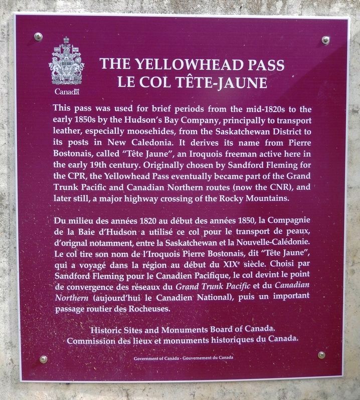
This pass was used for brief periods from the mid-1820s to the early 1850s by the Hudson's Bay Company, principally to transport leather, especially moosehides, from the Saskatchewan District to its posts in New Caledonia. It derives its name from Pierre Bostonais, called "Tête Jaune", an Iroquois freeman active here in the early 19th century. Originally chosen by Sandford Fleming for the CPR, the Yellowhead Pass eventually became part of the Grand Trunk Pacific and Canadian Northern routes (now the CNR), and later still, a major highway crossing of the Rocky Mountains.
Du milieu des années 1820 au début des années 1850, la Compagnie de la Baie d'Hudson a utilisé ce col pour le transport de peaux, d'orignal notamment, entre la Saskatchewan et la Nouvelle-Calédonie. Le col tire son nom de l’Iroquois Pierre Bostonais, dit "Tête Jaune", qui a voyagé dans la région au début du XIXe siècle. Choisi par Sandford Fleming pour le Canadian Pacifique, le col devint le point de convergence des réseaux du Grand Trunk Pacific et du Canadian Northern (aujourd’hui le Canadien National), puis un important passage routier des Rocheuses.
Erected by Historic Sites and Monuments Board of Canada/Commission des lieux et monuments historiques du Canada.
Topics and series. This historical marker is listed in these topic lists: Industry & Commerce • Railroads & Streetcars • Roads & Vehicles. In addition, it is included in the Canada, Historic Sites and Monuments Board series list.
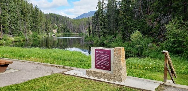
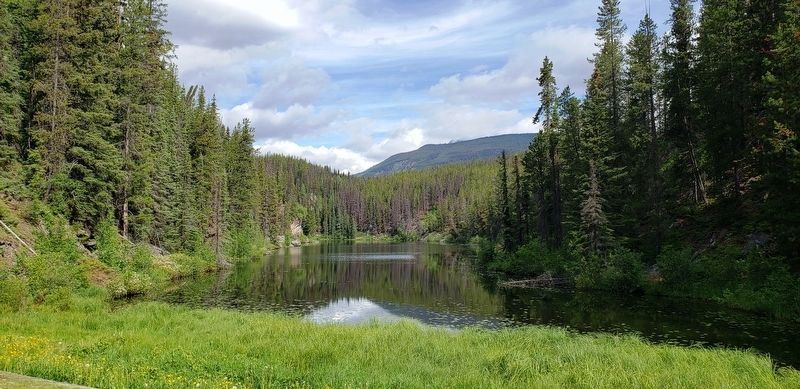
Location. 52° 52.931′ N, 118° 27.07′ W. Marker is near Lucerne, British Columbia, in Fraser-Fort George. Marker is on Yellowhead Highway (Provincial Highway 16) 24.8 kilometers west of Icefields Parkway (Provincial Highway 93), on the right when traveling west. Marker is located at the Portal Lake Rest Area, just west of the British Columbia-Alberta boundary line. Touch for map. Marker is in this post office area: Lucerne BC V0E 2Z0, Canada. Touch for directions.
Other nearby markers. At least 1 other marker is within walking distance of this marker. Yellowhead Pass (here, next to this marker).
Also see . . .
1. Yellowhead Pass.
The Yellowhead Pass is a mountain pass across the Continental Divide of the Americas in the Canadian Rockies. It is located on the provincial boundary between the Canadian provinces of Alberta and British Columbia. Due to its modest elevation and its gradual approaches, the pass was recommended by Sir Sandford Fleming as a route across the Rocky Mountains for the planned Canadian Pacific Railway. The proposal was rejected in favour of a more direct and southerly route, through the more difficult Kicking Horse Pass, which was opened in 1886. However, both the Grand Trunk Pacific and Canadian Northern Railways used the Yellowhead Pass for their main lines, built c. 1910–1913, and the main line of their successor, the Canadian National Railway, still follows the route.(Submitted on July 22, 2022, by Cosmos Mariner of Cape Canaveral, Florida.)
2. Yellowhead Pass National Historic Site.
Today the Yellowhead Pass is a valley corridor containing a highway and railway beside crystal clear rivers, through dense forests under rugged peaks links Jasper town site and the provincial border of British Columbia. In the past the low elevation made for easy movement for Indigenous peoples, fur trappers, railways and explorers. The name Yellowhead is the nickname of a fair-haired Metis-Iroquois-freeman named Bostonais, active here in the early 1800s.(Submitted on July 22, 2022, by Cosmos Mariner of Cape Canaveral, Florida.)
Credits. This page was last revised on July 22, 2022. It was originally submitted on July 21, 2022, by Cosmos Mariner of Cape Canaveral, Florida. This page has been viewed 163 times since then and 10 times this year. Photos: 1, 2. submitted on July 21, 2022, by Cosmos Mariner of Cape Canaveral, Florida. 3, 4. submitted on July 22, 2022, by Cosmos Mariner of Cape Canaveral, Florida.


