
New Buffalo in Berrien County, Michigan — The American Midwest (Great Lakes)
Avoiding Removal - The Pokagon Band of Potawatomi

Photographed by Lou Donkle, July 18, 2022
1. Avoiding Removal - The Pokagon Band of Potawatomi Marker
Logo text:
"Pokégnek Bodéwadmik" (Pokagon Band of Potawatomi)
New Buffalo was founded during an era of Indian removal from the region. Historically, the Potawatomi lands included millions of acres in Southern Michigan, Northern Illinois and Indiana, Southeastern Wisconsin and Northwestern Ohio. As the French, British, and later, the Americans fought each other for space and resources on the American continent, the many different tribes allied with different European groups to protect their lands. Despite playing an important role in the history of the United States, Potawatomi communities were forcibly removed from Michigan with President Andrew Jackson's Indian Removal Act of 1830.
On September 4, 1838, over 800 Potawatomi who originally resisted removal to Oklahoma were relocated to Kansas, in what is known as the "Potawatomi Trail of Death." However, just one year before Captain Wessel Whittaker ran aground near what would become New Buffalo, the 1833 Treaty of Chicago was signed. While both the 1821 and 1833 Treaties of Chicago ceded Potawatomi lands throughout the Great Lakes to the Federal Government, Leopold
this page online
Map of Removals Legend:
Potawatomi Removals
Direction of removal
Direction of return
Direction of migration
Ceded territories
Interim reservation
Present-day community
Community shared with other tribe
Interim community
Captions:
Between 1795 and 1842 the United States negotiated with several tribes of Michigan Indians to acquire most of the 58,216 square miles (151 326 sq km) of which the state is comprised. After this series of land cessions, the Indians held only 32 square miles (83.2 sq km) of reserved land.
Modern Michigan reservations include Bay Mills near Brimley in Chippewa County.
Photographed by Lou Donkle, July 18, 2022
2. Marker in Front of Amtrak Crossing
Map of Treaties Legend
Reservations
Greenville Treaty 1795
Detroit Treaty 1807
Maumee Treaty 1817
Saginaw Treaty 1819
Sault Saint Marie Treaty 1820
Chicago Treaty 1821
Carey Mission Treaty 1828
Chicago Treaty 1833
Washington Treaty 1836
Cedar Point Treaty 1836
La Pointe Treaty 1842
Potawatomi "Trail of Death" march: Sept. - Nov. 1838
(---) Designates 1838 Potawatomi Trail of Death route starting in Indiana, crossing Illinois and Missouri, and ending at present day Osawatomie, Kansas.
In September 1838 over 850 Potawatomi Indian people were rounded-up and marched at gunpoint from their Indiana homeland. Many walked the 660-mile distance, which took two months. More than 40 died, mostly children, of typhoid fever and the stress of the forced removal.
(o) Dots on the trail are some of the 48 places where the Potawatomi people camped one night or more on the forced removal and certain other locations mentioned in the official journal kept by a government agent.
Erected by Pokagon

Photographed by Lou Donkle, July 18, 2022
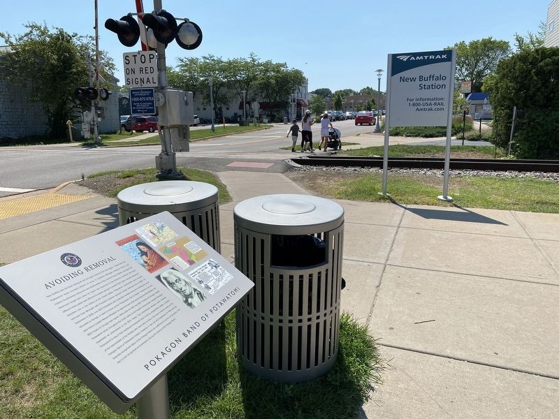
3. Marker in Front of Amtrak Station
Topics. This historical marker is listed in this topic list: Indigenous Peoples and Communities. A significant historical year for this entry is 1833.
Location. 41° 47.802′ N, 86° 44.751′ W. Marker is in New Buffalo, Michigan, in Berrien County. It is at the intersection of Oselka Road and North Whittaker Street, on the right when traveling east on Oselka Road. The marker is on the southwest corner of Whittiker and Oselka and faces west. Touch for map. Marker is in this post office area: New Buffalo MI 49117, United States of America. Touch for directions.

Regionally, this marker is in Southwest Michigan and specifically in one of the Lake Michigan Shore counties. It is also in the American Midwest. Globally, it is in North America, on the Great Lakes, in the Western Hemisphere, in the Western World, and in the Anglosphere. Historically, it finds itself in what was once the Viceroyalty of New France and also the Northwest Territory.
Other nearby markers. At least 8 other markers are within 3 miles of this marker, measured as the crow flies: The Importance of Water for Neshnabék (approx. ¼ mile away); 9:03 a.m. September 11th 2001 (approx. 1½ miles away); 8:46 a.m. September 11th 2001 (approx. 1½ miles away); The 9-11 attacks resulted in the death of 2,996 people (approx. 1½ miles away); Michigan Lighthouses (approx. 2.2 miles away); Eisenhower Interstate System (approx. 2.2 miles away); The Iron Brigade / The Twenty-Fourth Michigan Volunteer Infantry Regiment (approx. 2.2 miles away); Bicentennial Veterans Memorial (approx. 2.2 miles away). Touch for a list and map of all markers in New Buffalo.
Another marker is no longer nearby. West Michigan Pike (was approx. 0.2 miles away but has been confirmed missing).
Also see . . . A Brief History of the Pokagon Band. The Pokagon Fund website entry (Submitted on May 14, 2023, by Larry Gertner of New York, New York.)
Credits. This page was last revised on May 14, 2023. It was originally submitted on July 22, 2022, by Lou Donkle of Valparaiso, Indiana. This page has been viewed 1,212 times since then and 67 times this year. Photos: 1, 2, 3. submitted on July 22, 2022, by Lou Donkle of Valparaiso, Indiana. • J. Makali Bruton was the editor who published this page.
