Shockoe Bottom in Richmond, Virginia — The American South (Mid-Atlantic)
Winfree Cottage
— Richmond Slave Trail —
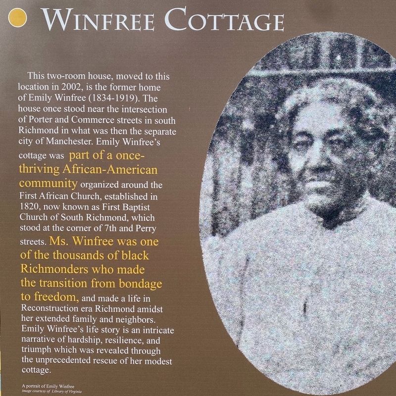
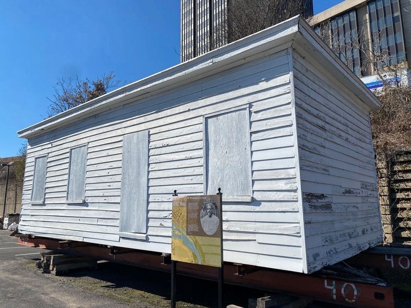
This two-room house, moved to this location in 2002, is the former home of Emily Winfree (1834-1919). The house once stood near the intersection of Porter and Commerce Streets in south Richmond in what was then the separate city of Manchester. Emily Winfree's cottage was part of a once-thriving African-American community organized around the First African Church, established in 1820, now known as First Baptist Church of South Richmond, which stood at the corner of 7th and Perry streets. Ms. Winfree was one of the thousands of black Richmonders who made the transition from bondage to freedom, and made a life in Reconstruction era Richmond amidst her extended family and neighbors. Emily Winfree's life story is an intricate narrative of hardship, resilience, and triumph which was revealed through the unprecedented rescue of her modest cottage.
About the Trail
Designed as a walking path, the Richmond Slave Trail chronicles the history of the trade in enslaved Africans from their homeland to Virginia until 1778, and away from Virginia, especially Richmond, to other locations in the Americas until 1865. The trail begins at the Manchester Docks, which, alongside Rocketts Landing on the north side of the river, operated as a major port in the massive downriver slave trade, making Richmond the largest source of enslaved blacks on the east coast of America from 1830 to 1860. While many of the slaves were shipped on to New Orleans and to other Deep South ports, the trail follows the footsteps of those who remained here and crossed the James River, often chained together in a coffle. Once reaching the northern riverbank, the trail then follows a route through the slave markets and auction houses of Richmond, beside the Reconciliation Statue commemorating the international triangular slave trade and on to the site of the notorious Lumpkin’s Slave Jail and leading on to Richmond’s African Burial Ground, once called the Burial Ground for Negroes, and the First African Baptist Church, a center of African American life in pre-Civil War Richmond. - Richmond Slave Trail Commission – 2011 –
Erected 2011 by Richmond Slave Trail Commission. (Marker Number 15.5.)
Topics. This historical marker is listed in these topic lists: Abolition & Underground RR • African Americans. A significant historical year for this entry is 1834.
Location. 37° 32.182′ N, 77° 25.733′ W. Marker is in Richmond, Virginia. It is in Shockoe Bottom. Marker can be reached from East Franklin Street east of North 15th Street, on the left when traveling east. Cottage and marker are east of, and backed-up against, the I-95 overpass in a parking lot south of Lumpkin's Slave Jail. It is between Broad Street and Franklin Street. Touch for map. Marker is at or near this postal address: 1500 E Franklin St, Richmond VA 23219, United States of America. Touch for directions.
Other nearby markers. At least 8 other markers are within walking distance of this marker. Lumpkin's Jail (within shouting distance of this marker); Slave Rebellion leader Gabriel Prasser… (about 400 feet away, measured in a direct line); Execution of Gabriel (about 400 feet away); Kahal Kadosh Beth Shalome (about 700 feet away); Richmond's African Burial Ground (about 700 feet away); The Triangle (about 700 feet away); Odd Fellows Hall (about 700 feet away); Reconciliation Statue (about 700 feet away). Touch for a list and map of all markers in Richmond.
Credits. This page was last revised on February 1, 2023. It was originally submitted on July 26, 2022, by Lou Donkle of Valparaiso, Indiana. This page has been viewed 410 times since then and 92 times this year. Last updated on July 29, 2022, by Lou Donkle of Valparaiso, Indiana. Photos: 1, 2. submitted on July 26, 2022, by Lou Donkle of Valparaiso, Indiana. • Devry Becker Jones was the editor who published this page.

