Near Haymarket in Prince William County, Virginia — The American South (Mid-Atlantic)
Ambush at Ewell’s Chapel
His Men Quickly Scattered
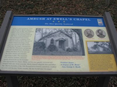
Sidebar Dunblane, the home of Dr. Jesse Ewell, served as a convalescent facility for his cousin, Confederate Gen. Richard S. Ewell, who was severely wounded in the left knee during an engagement at Groveton on August 28, 1862. After the general’s leg was amputated at the Arris Buckner house, Auburn, five miles north of the battlefield, Ewell was brought to Dunblane to recuperate under the care of relatives. Although his condition improved rapidly, reports of Union cavalry in the area on September 17 aroused concern for Ewell’s safety. He was evacuated south the next day.
“Prettiest chance... to dispose of Mr. Mosby” —Gen. George G. Meade
Erected by Civil War Trails.
Topics and series. This historical marker is listed in these topic lists: Churches & Religion • War, US Civil. In addition, it is included in the Virginia Civil War Trails series list. A significant historical date for this entry is June 22, 1863.
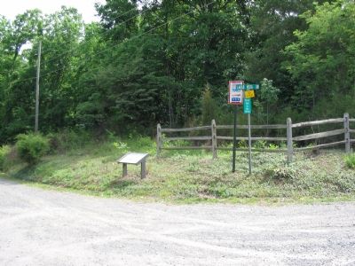
Location. 38° 54.738′ N, 77° 37.771′ W. Marker is near Haymarket, Virginia, in Prince William County. Marker is at the intersection of Loudoun Drive (County Route 615) and Largo Vista Drive, on the right when traveling west on Loudoun Drive. Located approximately 200 yards East of U.S. 15. Touch for map. Marker is at or near this postal address: 2400 Loudoun Dr, Haymarket VA 20169, United States of America. Touch for directions.
Other nearby markers. At least 8 other markers are within 4 miles of this marker, measured as the crow flies. Loudoun County / Prince William County (approx. 1.4 miles away); Simon Kenton’s Birthplace (approx. 2.9 miles away); Fair Oaks (approx. 3˝ miles away); The Carolina Road (approx. 3˝ miles away); The Mosby-Forbes Engagement July 6, 1864 (approx. 3.7 miles away); The Fog of War (approx. 3.7 miles away); Mt. Zion Cemetery (approx. 3.7 miles away); Plain Path…Shenandoah Hunting Path…Carolina Road…Rogue’s Road… (approx. 3.7 miles away). Touch for a list and map of all markers in Haymarket.
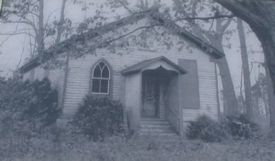
More about this marker. The main picture on the marker is a picture of Ewell’s Chapel with the caption, “Ewell’s Chapel, constructed for members of the Methodist Episcopal Church about 1847 on land donated by Dr. Jesse Ewell, was abandoned in the 20th century and stood until the 1980s. First called Rescol, by the time of the war, it was known as Ewell’s Chapel and afterward as Grace Episcopal Chapel. —Courtesy Virginia Department of Historic Resources.
In addition the marker displays portraits of Gen. George G. Meade and Maj. John S. Mosby as well as a small painting of Dunblane in the sidebar.
Also see . . . Biography of John S. Mosby. (Submitted on July 5, 2007, by Craig Swain of Leesburg, Virginia.)
Credits. This page was last revised on August 1, 2022. It was originally submitted on July 5, 2007, by Craig Swain of Leesburg, Virginia. This page has been viewed 3,916 times since then and 51 times this year. Last updated on July 30, 2022, by Carl Gordon Moore Jr. of North East, Maryland. Photos: 1, 2, 3. submitted on July 5, 2007, by Craig Swain of Leesburg, Virginia. • J. Makali Bruton was the editor who published this page.


