Meyersdale in Somerset County, Pennsylvania — The American Northeast (Mid-Atlantic)
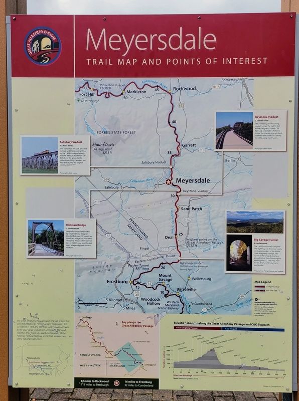
Meyersdale
Trail Map and Points of Interest
Salisbury Viaduct
1.5 miles north
Trail users cross Rte. 219, an active railroad, and the Casselman River on the 1,908-foot long Salisbury Viaduct, which is more than 100 feet above the ground at its highest point. Eight workers lost their lives during the original construction in 1911.
Photograph by Kevin Scanlon
Bollman Bridge
1.6 miles south
Originally constructed in 1871 by notable bridge designer Wendell Bollman, this historically significant bridge has been twice relocated. Rescued from demolition in 2006, it now provides trail users safe passage over Scratch Hill Road.
Photograph by Brett Hallern
Keystone Viaduct
2.1 miles south
The sweeping, 910-foot long viaduct carries the trail 90 feet above Flaugherty Creek, CSX Railroad, and Glade City Road. Notice the orange concrete deck, tinted to match the rust coming from the aging iron trusses.
Photograph by Brett Hollern
Big Savage Tunnel
9.6 miles south
The 3,300 foot tunnel, complete with lighting, was the most costly renovation project of the entire Great Allegheny Passage. The tunnel is the longest structure along the trail from Pittsburgh to Washington DC. The vista from the south end of the tunnel is spectacular.
Photographs by Paul g. Wiegman and TrailBook
(Sidebar):
The Great Allegheny Passage is part of a trail system that connects Pittsburgh, Pennsylvania to Washington, DC. Conceived in 1975, the 150-mile-long Passage connects to the C&O Canal Towpath in Cumberland, Maryland. Together, they make up a significant segment of the Potomac Heritage National Scenic Trail, a component of the National Trail System.
Erected by Great Allegheny Passage.
Topics. This historical marker is listed in these topic lists: Bridges & Viaducts • Parks & Recreational Areas. A significant historical year for this entry is 1911.
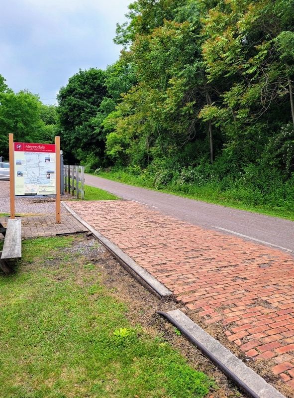
Location. 39° 49.001′ N, 79° 1.281′ W. Marker is in Meyersdale, Pennsylvania, in Somerset County. Marker can be reached from Main Street north of 8th Street, on the left when traveling east. Marker is located on the west side of the Meyersdale Area Historical Society along the Great Allegheny Passage trail. Touch for map. Marker is at or near this postal address: 527 Main Street, Meyersdale PA 15552, United States of America. Touch for directions.
Other nearby markers. At least 8 other markers are within walking distance of this marker. A different marker also named Meyersdale (here, next to this marker); What's the Use of a Caboose (a few steps from this marker); Western Maryland Railway (within shouting distance of this marker); Sweetest Place on Earth
(about 400 feet away, measured in a direct line); Early Meyersdale (approx. 0.2 miles away); Meyersdale Centennial (approx. 0.3 miles away); Lest We Forget (approx. 0.3 miles away); Korean War/Vietnam Memorial (approx. 0.4 miles away). Touch for a list and map of all markers in Meyersdale.
Regarding Meyersdale. Marker includes a diagram showing the Elevation changes along the Great Allegheny Passage and C&O Towpath.
Credits. This page was last revised on August 2, 2022. It was originally submitted on July 31, 2022, by Bradley Owen of Morgantown, West Virginia. This page has been viewed 86 times since then and 10 times this year. Photos: 1, 2. submitted on July 31, 2022, by Bradley Owen of Morgantown, West Virginia. • Bill Pfingsten was the editor who published this page.

