Near Manassas in Prince William County, Virginia — The American South (Mid-Atlantic)
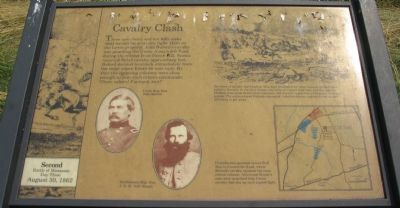
Cavalry Clash
| — | Second Battle of Manassas - Day Three - August 30, 1862 | — |
Photographed by Craig Swain, July 12, 2008
1. Cavalry Clash Marker
The lines of cavalry met head-on. Men were knocked from their mounts; dying horses rolled in the dirt. In the first charge, the Federals routed their foes, but through the blinding dust came Rebel reinforcements: Jeb Stuart's regiments, yelling and shooting pistols. The outnumbered Federals retreated - riderless horses, wounded men on foot all trying to get away.
Confederates pursued across Bull Run to Centreville Road, where Buford's cavalry rejoined the main retreat column. Afterward Stuart's men were surprised that Union cavalry had put up such a good fight.
Topics. This historical marker is listed in this topic list: War, US Civil.
Location. This marker has been replaced by another marker nearby.
this page online

Regionally, this marker was in the Washington Metropolitan Area, in Northern Virginia, and in the Piedmont. It was also in the American South, specifically in the Upper South, in the Mid-Atlantic, and on the Eastern Seaboard. Globally, it was in the North Atlantic Region, North America, the Western Hemisphere, the Western World, and the Anglosphere. Historically, it found itself in what was once the territory of the Mississippian Culture, one of the original Thirteen Colonies, one of the Confederate States of America, and the Antebellum South.
Other nearby markers. At least 8 other markers are within walking
Photographed by Bill Coughlin, November 8, 2007
2. Markers on the Manassas Battlefield
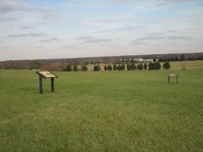
Two markers are found at this location. The Cavalry Clash marker is seen here on the right.
Another marker is no longer nearby. Confederate Headquarters (was a few steps from this marker but has been replaced with another marker now near it).
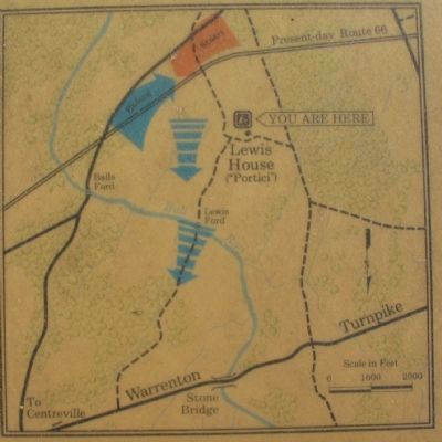
More about this marker. In the upper right is a sketch depicting the cavalry fight. On the lower right is a map illustrating the action. In the lower center are portraits of Gens. John Buford and J.E.B. Stuart.
This marker was replaced by a new one, with the same title - "Cavalry Clash". See nearby markers.
Photographed by Craig Swain, July 12, 2008
3. Cavalry Clash Map
Note the north seeking arrow pointed to the bottom of the map.
Photographed by Craig Swain, July 12, 2008
4. Location of the Cavalry Fight
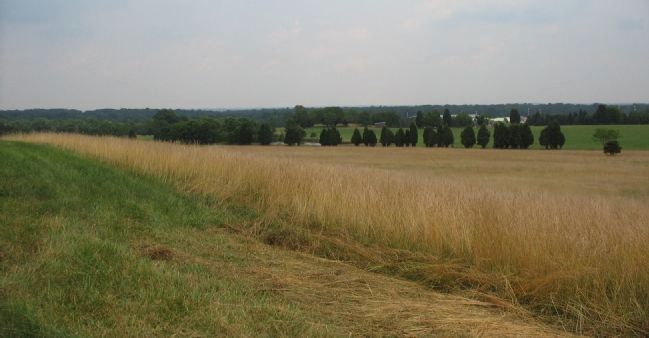
Looking southeast from the marker location. The site of the cavalry clash today is roughly in the distant center, where the roofs of the large buildings peak above the tree line. Interstate 66 runs from left to right across this photograph, but is hidden from view by rather strategically placed tree lines.
Credits. This page was last revised on August 3, 2022. It was originally submitted on July 31, 2008, by Craig Swain of Leesburg, Virginia. This page has been viewed 1,335 times since then and 30 times this year. Last updated on August 1, 2022, by Carl Gordon Moore Jr. of North East, Maryland. Photos: 1. submitted on July 31, 2008, by Craig Swain of Leesburg, Virginia. 2. submitted on November 25, 2010, by Bill Coughlin of Woodland Park, New Jersey. 3, 4. submitted on July 31, 2008, by Craig Swain of Leesburg, Virginia. • Bernard Fisher was the editor who published this page.
