Cumberland Township near Gettysburg in Adams County, Pennsylvania — The American Northeast (Mid-Atlantic)
Manor of Maske
Photographed by Craig Swain, November 11, 2008
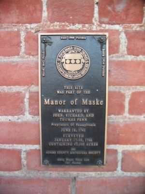
1. Manor of Maske Marker
was part of the
Manor of Maske
warranted by
John, Richard, and
Thomas Penn
Proprietors of Pennsylvania
June 18, 1741
Surveyed
January 17-30, 1766
Containing 43,500 acres
(Around the edges are the survey annotations):
North 3842 Perches
East 1900 Perches
South 3954 Purches
Along Mason Dixon Line 1887 Perches
Erected 1991 by Adams County Historical Society.
Topics. This historical marker is listed in these topic lists: Colonial Era • Settlements & Settlers. A significant historical date for this entry is January 17, 1766.
Location. 39° 46.094′ N, 77° 16.228′ W. Marker is near Gettysburg, Pennsylvania, in Adams County. It is in Cumberland Township. It is on Emmitsburg Road (Business U.S. 15), on the right when traveling south. Touch for map. Marker is in this post office area: Gettysburg PA 17325, United States of America. Touch for directions.

Regionally, this marker is in South-Central Pennsylvania. It is also in the American Northeast, in the Mid-Atlantic, in Appalachia, and specifically in Northern Appalachia. Globally, it is in North America, the Western Hemisphere, the Western World, and the Anglosphere. Historically,
this page online
Other nearby markers. At least 8 other markers are within walking distance of this marker: First U.S. Cavalry (approx. half a mile away); Second U.S. Cavalry (approx. 0.6 miles away); Reserve Brigade (approx. 0.6 miles away); Sixth U.S. Cavalry (approx. 0.6 miles away); Position of the Reserve Brigade (approx. 0.6 miles away); Battery K, First U.S. Artillery (approx. 0.6 miles away); 1st & 2d Regiments United States Cavalry (approx. 0.7 miles away); Houghtelin Farmhouse (approx. 0.7 miles away). Touch for a list and map of all markers in Gettysburg.
Photographed by Craig Swain, November 11, 2008
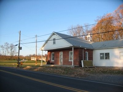
2. Manor of Maske Marker
The McCurdy Schoolhouse site. The plaque stands to the left of the door on the building.
Photographed by William Fischer, Jr., February 5, 2025
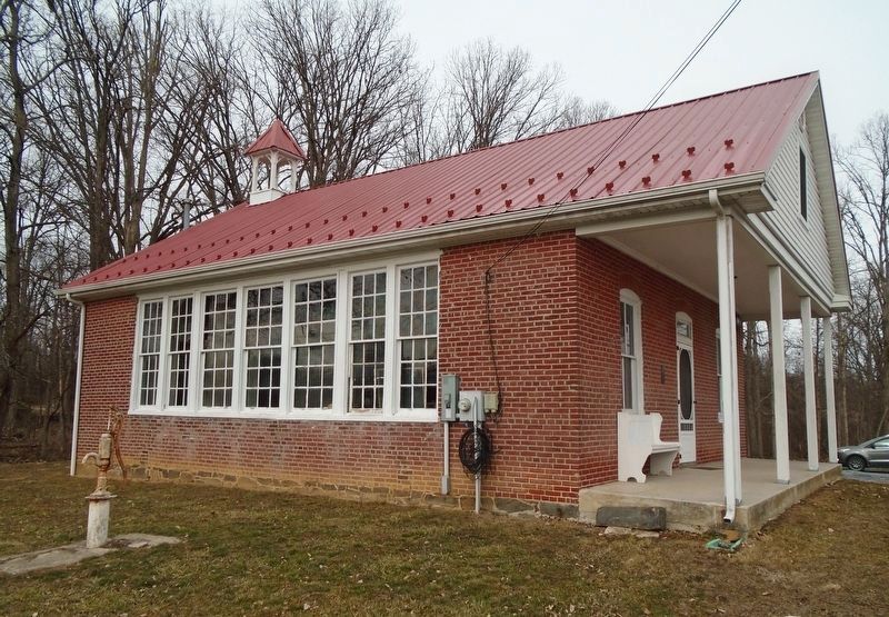
3. McCurdy Schoolhouse
Credits. This page was last revised on March 4, 2025. It was originally submitted on January 20, 2009, by Craig Swain of Leesburg, Virginia. This page has been viewed 1,894 times since then and 38 times this year. Last updated on August 3, 2022, by Carl Gordon Moore Jr. of North East, Maryland. Photos: 1, 2. submitted on January 20, 2009, by Craig Swain of Leesburg, Virginia. 3. submitted on March 4, 2025, by William Fischer, Jr. of Reynoldsburg, Ohio. • Bill Pfingsten was the editor who published this page.
