
Piney Point in St. Mary's County, Maryland — The American Northeast (Mid-Atlantic)
Potomac River Dory Boat
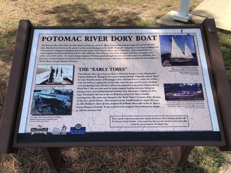
The Potomac River dory boat was built almost exclusively within St. Mary's County, Maryland, and appeared around the 1880s when Maryland was known as the greatest oyster-producing region in the world. Originally designed as a two-masted sailing craft, it was used for tonging and dredging oysters in the waters of the Potomac River and its tributaries. A descendant from an earlier popular flat-bottomed Potomac River craft called the "Black Nancy," this newly-designed work boat was larger, more stable, and a better sailor. Its unique design features a V-bottom, planked lengthwise instead of the usual cross-planking. The dory boat was discontinued around the 1930s. Only seven remain in existence today, three of which ware under the stewardship of the St. Mary's County Museum Division.
The "Early Times"
This Potomac River dory boat was built in 1916 at St. Patrick's Creek, Maryland by Captain William H. Thompson for Captain Garnett Arnold. Originally named "Elsie" by Capt. Arnold in honor of his youngest sister who had died as a child, this 34-foot craft was built as a sailing dory. In the early years, she was used for
this page online
Erected by Maryland Heritage Area Authority, St. Mary's County Museum Division.
Topics. This historical marker is listed in these topic lists: Animals • Industry & Commerce • War, World I • Waterways & Vessels. A significant historical year for this entry is 1916.
Location. This marker has been replaced by another marker nearby. It was located near 38° 8.205′ N, 76° 31.725′ W. Marker was in Piney Point, Maryland, in St. Mary's County.

Regionally, this marker was in Southern Maryland. It was also in the American South, specifically in the Upper South, in the Mid-Atlantic, in the Tidewater, in the Chesapeake Bay Region, and on the Eastern Seaboard. Globally, it was in the North Atlantic Region, North America, the Western Hemisphere, the Western World, and the Anglosphere. Historically, it found itself in what was once one of the original Thirteen Colonies and also the Antebellum South.
Other nearby markers. At least 8 other markers are within walking distance of this location: The Dory Boat (a few steps from this marker); Fueling Progress (within shouting distance of this marker); Military Influence (within shouting distance of this marker); Potomac River Military Testing (about 300 feet away, measured in a direct line); Bay Lights (about 300 feet away); Osprey (about 300 feet away); Map of Lower Potomac River and Chesapeake Bay (about 300 feet away); a different marker also named Piney Point Lighthouse (about 300 feet away). Touch for a list and map of all markers in Piney Point.
Other markers no longer nearby. Piney Point Petroleum Terminal (was within shouting distance of this marker but has been replaced with another marker now near it); a different marker also named Military Influence (was within shouting distance of this marker but has been replaced with another marker now near it); The Lighthouse Keeper's Quarters (was about 300 feet away but has been replaced with another marker now near it); Natural Highways (was about 300 feet away but has been permanently removed); Piney Point Lighthouse (was about 300 feet away but has been reported to have been replaced with another marker now near it).
Related marker. Click here for another marker that is related to this marker. This marker has been replaced by the linked marker.
Credits. This page was last revised on August 5, 2022. It was originally submitted on September 4, 2019, by Devry Becker Jones of Washington, District of Columbia. This page has been viewed 323 times since then and 14 times this year. Last updated on August 3, 2022, by Sean C Bath of Silver Spring, Maryland. Photos: 1, 2. submitted on September 4, 2019, by Devry Becker Jones of Washington, District of Columbia.
