Grand Marais in Cook County, Minnesota — The American Midwest (Upper Plains)
Geology of Minnesota
Grand Marais
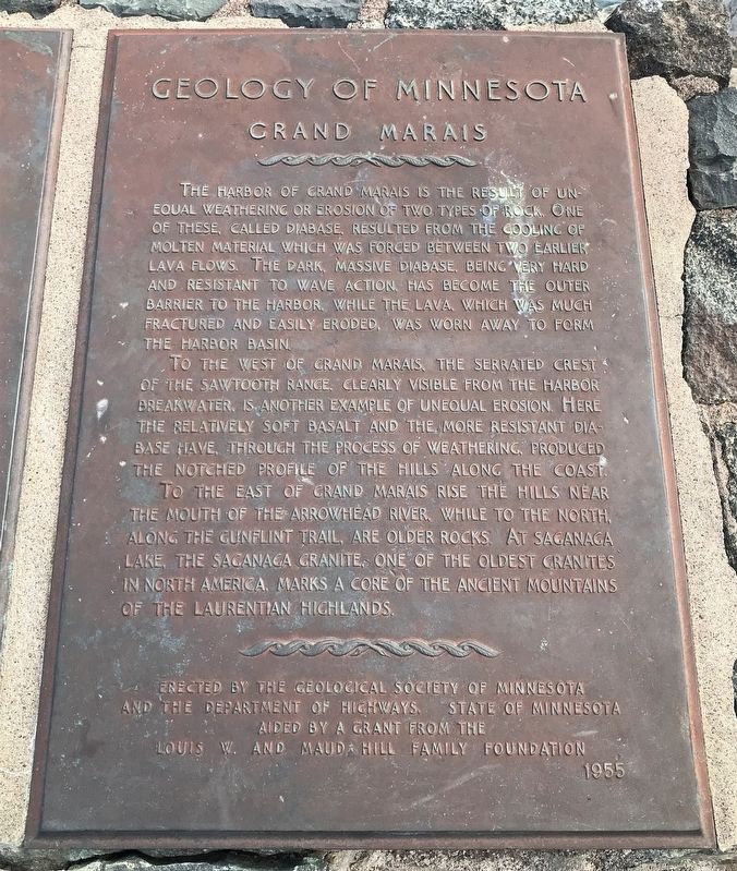
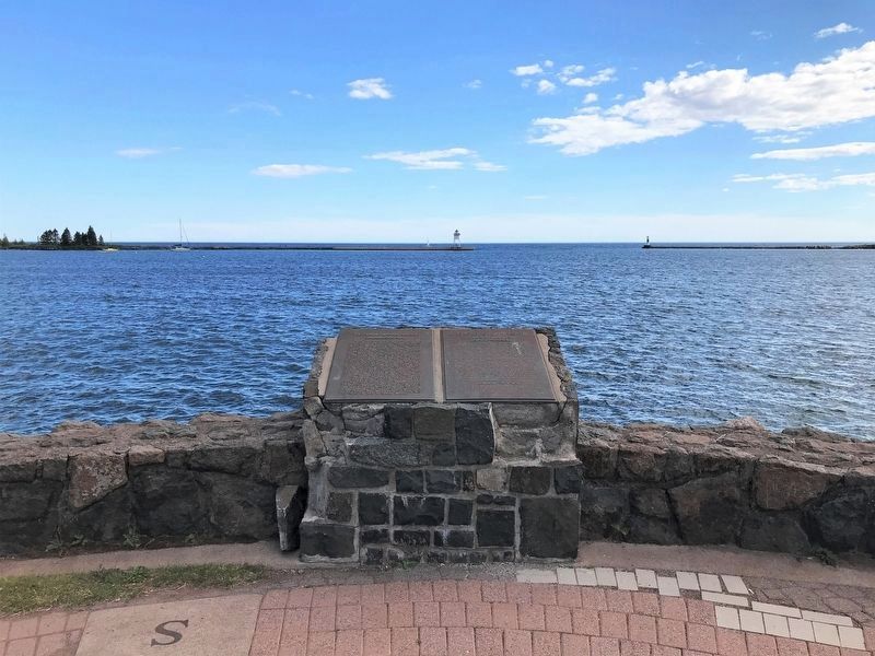
To the west of Grand Marais, the serrated crest of the Sawtooth Range, clearly visible from the harbor breakwater, is another example of unequal erosion. Here the relatively soft basalt and the more resistant diabase have, through the process of weathering, produced the notched profile of the hills along the coast.
To the east of Grand Marais rise the hills near the mouth of the Arrowhead River, while to the north, along the Gunflint Trail, are older rocks. At Saganaga Lake, the Saganaga granite, one of the oldest granites in North America, marks a core of the ancient mountains of the Laurentian Highlands.
Erected 1955 by the Geological Society of Minnesota and the Department of Highways, State of Minnesota aided by a grant from the Louis W. and Maud Hill Family Foundation.
Topics and series. This historical marker is listed in this topic list: Natural Features. In addition, it is included in the Minnesota: Geological Society of Minnesota series list.
Location. 47° 44.955′ N, 90° 20.261′ W. Marker is in Grand Marais, Minnesota, in Cook County. Marker is at the intersection of North Shore Scenic Drive (State Highway 61) and Wisconsin Street, on the right when traveling east on North Shore Scenic Drive. Touch for map. Marker is in this post office area: Grand Marais MN 55604, United States of America. Touch for directions.
Other nearby markers. At least 8 other markers are within 2 miles of this marker, measured as the crow flies. The Grand Marais Harbor (here, next to this marker); Pulpwood Rafting (approx. ¼ mile away); Bally Blacksmith Shop (approx. ¼ mile away); a different marker also named Grand Marais Harbor (approx. ¼ mile away); The Point Interpretive Site (approx. 0.3 miles away); Natural History of the Point (approx. 0.3 miles away); St. Francis Xavier Church (approx. 1.4 miles away); Chippewa City (approx. 1.4 miles away). Touch for a list and map of all markers in Grand Marais.
Credits. This page was last revised on August 4, 2022. It was originally submitted on August 3, 2022. This page has been viewed 131 times since then and 21 times this year. Photos: 1, 2, 3, 4. submitted on August 3, 2022.


