
Cuernavaca, Morelos, Mexico — The Central Highlands (North America)
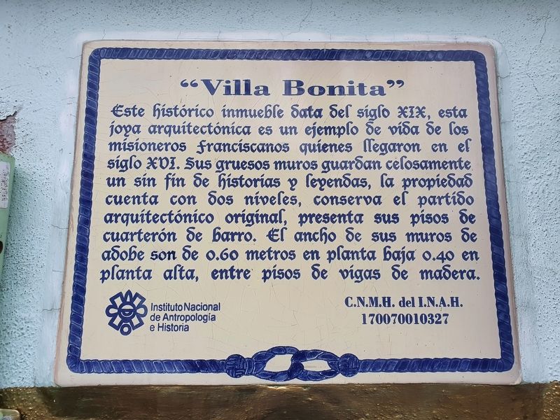
"Villa Bonita"
Photographed by J. Makali Bruton, August 4, 2022
1. "Villa Bonita" Marker

"Villa Bonita"
Este histórico inmueble data del siglo XIX, esta joya arquitectónica es un ejemplo de vida de los misioneros franciscanos quienes llegaron en ef siglo XVI. Sus gruesos muros guardan celosamente un sin fin de historias y leyendas, la propiedad cuenta con dos niveles, conserva el partido arquitectónico original, presenta sus pisos de cuarterón de barro. El ancho de sus muros de adobe son de 0.60 metros en planta baja 0.40 en planta alta, entre pisos de vigas de madera.
Instituto Nacional de Antropología e Historia
C.N.M.H. del I.N.A.H. 170070010327
"Villa Bonita"
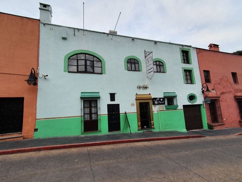
This historic building dates from the nineteenth century. This architectural jewel is an example of the life of the Franciscan missionaries who arrived in the 16th century. Its thick walls guard jealously an endless number of stories and legends. The property has two levels and retains the original architectural style, including still presenting its floors of clay tile. The width of its walls of adobe are 0.60 meters on the ground floor and 0.40 meters on the upper floor, with wooden beam floors.
Erected by Instituto
this page online
Topics. This historical marker is listed in these topic lists: Architecture • Colonial Era.
Location. 18° 55.164′ N, 99° 14.158′ W. Marker is in Cuernavaca, Morelos. It is on Netzahualcoyotl 0.7 kilometers north of Abasolo, on the right when traveling north. Touch for map. Marker is at or near this postal address: Netzahualcoyotl 33, Cuernavaca MOR 62000, Mexico. Touch for directions.

Regionally, this marker is in Central Mexico. Globally, it is in North America, specifically in Mesoamerica, on the Ring of Fire, and in the Western Hemisphere. Historically, it finds itself in what was once New Spain, a Spanish colony, and the Aztec Empire.
Other nearby markers. At least 8 other markers are within walking distance of this marker: "Las Cumbres de Galeana" (about 90 meters away, measured in a direct line); Cathedral of Cuernavaca (about 150 meters away); First Franciscans in Cuernavaca (about 150 meters away); Alexander von Humboldt (about 210 meters away); "La Casona" (about 210 meters away); Antigua Calle del Arco (approx.
Photographed by J. Makali Bruton, August 4, 2022
2. "Villa Bonita" and Marker
Credits. This page was last revised on August 6, 2022. It was originally submitted on August 6, 2022, by J. Makali Bruton of Washington, District of Columbia. This page has been viewed 156 times since then and 8 times this year. Photos: 1, 2. submitted on August 6, 2022, by J. Makali Bruton of Washington, District of Columbia.
