Canaan in Grafton County, New Hampshire — The American Northeast (New England)
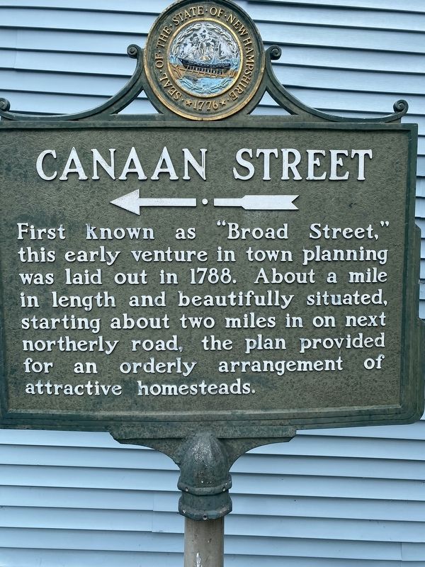
Canaan Street
First known as "Broad Street," this early venture in town planning was laid out in 1788. About a mile in length and beautifully situated, starting about two miles in on next northerly road, the plan provided for an orderly arrangement of attractive homesteads.
Topics. This historical marker is listed in these topic lists: Colonial Era • Roads & Vehicles. A significant historical year for this entry is 1788.
Location. 43° 38.793′ N, 72° 0.703′ W. Marker is in Canaan, New Hampshire, in Grafton County. Marker is at the intersection of Church Street (Route 4) and Canaan Street (U.S. 4), on the left when traveling east on Church Street. Touch for map. Marker is in this post office area: Canaan NH 03741, United States of America. Touch for directions.
Other nearby markers. At least 8 other markers are within 7 miles of this marker, measured as the crow flies. Canaan Veterans Monument (about 500 feet away, measured in a direct line); Snow Roller (approx. 2 miles away); Noyes Academy (approx. 2 miles away); Old North Church (approx. 2˝ miles away); This Mill Stone (approx. 6.4 miles away); Office of the Enfield Advocate (approx. 6.7 miles away); Downtown Enfield Village (approx. 6.7 miles away); The Copeland Block (approx. 6.7 miles away). Touch for a list and map of all markers in Canaan.
Credits. This page was last revised on August 15, 2022. It was originally submitted on August 8, 2022, by Col. James F. Jamison, USMC (Ret) of Coronado, California. This page has been viewed 101 times since then and 18 times this year. Photos: 1, 2. submitted on August 8, 2022, by Col. James F. Jamison, USMC (Ret) of Coronado, California. • Michael Herrick was the editor who published this page.

