Denton in Denton County, Texas — The American South (West South Central)
Texas Agricultural Experiment Station No. 6
Photographed by Joe Lotz, August 9, 2022
1. Texas Agricultural Experiment Station No. 6 Marker
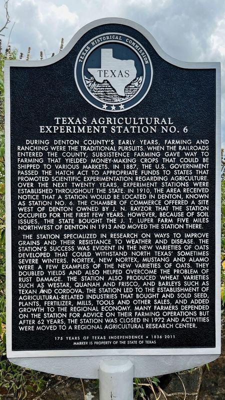
During Denton County’s early years, farming and ranching were the traditional pursuits. When the railroads entered the county, subsistence farming gave way to farming that yielded money-making crops that could be shipped to various markets. In 1887, the U.S. government passed the Hatch Act to appropriate funds to states that promoted scientific experimentation regarding agriculture. Over the next twenty years, experiment stations were established throughout the state. In 1910, the area received notice that a station would be located in Denton, known as Station No. 6. The Chamber of Commerce offered a site west of Denton owned by J. N. Rayzor that the station occupied for the first few years. However, because of soil issues, the state bought the J. T. Luper farm five miles northwest of Denton in 1913 and moved the station there.
The station specialized in research on ways to improve grains and their resistance to weather and disease. The station’s success was evident in the new varieties of oats developed that could withstand north Texas’ sometimes severe winters. Nortex, New Nortex, Mustang and Alamo were a few examples of the new varieties of oats. They doubled yields and also helped overcome the problem of rust damage. The station also produced wheat varieties such as Westar, Quanah and Frisco, and barleys such as Texan and Cordova. The station led to the establishment of agricultural-related industries that bought and sold seed, plants, fertilizer, mills, tools and other sales, and added growth to the regional economy. Many farmers depended on the station for advice on their farming operations but after 62 years, the station was closed in 1972 and activities were moved to a regional agricultural research center.
Erected 2011 by Texas Historical Commission. (Marker Number 16743.)
Topics. This
this page online
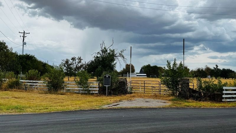
Location. 33° 14.341′ N, 97° 11.813′ W. Marker is in Denton, Texas, in Denton County. It is at the intersection of Masch Branch Road and Hampton Road, on the right when traveling north on Masch Branch Road. Touch for map. Marker is in this post office area: Denton TX 76207, United States of America. Touch for directions.

Regionally, this marker is in the Prairies & Lakes Region and in the Dallas-Fort Worth Metropolitan Area. Globally, it is in North America, a Gulf of Mexico state, the Western Hemisphere, the Western World, and the Anglosphere. Historically, it finds itself in what was once New Spain, the Republic of Texas, and one of the Confederate States of America.
Other nearby markers. At least 8 other markers are within 4 miles of this marker, measured as the crow flies: Immaculate Conception Catholic Church (approx. 2 miles away); City of Krum (approx. 2.4 miles away); First Baptist Church of Denton (approx. 2.9 miles away); First Christian Church of Denton (approx. 3.2 miles away); Terrill Hall (approx. 3.3
Photographed by Joe Lotz, August 9, 2022
2. Texas Agricultural Experiment Station No. 6 Marker
Another marker is no longer nearby. County Line Road Bridge at Denton Creek (was approx. 2.2 miles away but has been confirmed missing).
Credits. This page was last revised on August 28, 2022. It was originally submitted on August 9, 2022, by Joe Lotz of Flower Mound, Texas. This page has been viewed 436 times since then and 37 times this year. Photos: 1, 2. submitted on August 9, 2022, by Joe Lotz of Flower Mound, Texas. • J. Makali Bruton was the editor who published this page.
