Rabun Gap in Rabun County, Georgia — The American South (South Atlantic)
Memorial Lands and Cottages
Georgia Division UDC
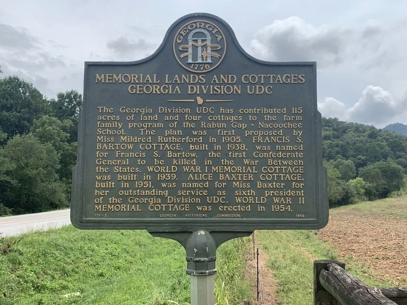
Photographed by Tim Fillmon, August 19, 2022
1. Memorial Lands and Cottages Marker
Erected 1956 by Georgia Historical Commission. (Marker Number 119-2.)
Topics and series. This historical marker is listed in these topic lists: Education • Notable Buildings • War, US Civil. In addition, it is included in the Georgia Historical Society series list. A significant historical year for this entry is 1905.
Location. 34° 57.188′ N, 83° 23.188′ W. Marker is in Rabun Gap, Georgia, in Rabun County. It can be reached from the intersection of U.S. 441 at milepost 17 and Kelly's Creek Road. Touch for map. Marker is at or
this page online

Regionally, this marker is in Georgia’s and he Mountains in the Golden Corner. It is also in the American South, specifically in the Deep South, in Appalachia, and specifically in Southern Appalachia. Globally, it is in North America, the Western Hemisphere, the Western World, and the Anglosphere. Historically, it finds itself in what was once the original Cherokee Nation, the territory of the Mississippian Culture, one of the original Thirteen Colonies, one of the Confederate States of America, and the Antebellum South.
Other nearby markers. At least 8 other markers are within 6 miles of this marker, measured as the crow flies: Brig·Gen·Francis·S·Bartow·C·S·A· (approx. 0.4 miles away); Rabun Gap – Nacoochee School (approx. 0.7 miles away); York House Inn (approx. 1.1 miles away); Cherokee Defeat (approx. 4½ miles away in North Carolina); The Rabun County Courthouse (approx. 5.2 miles away); Rabun County Service Memorial (approx. 5.2 miles away); Rabun County War Memorial (approx. 5.2 miles away); Rabun County Confederate Monument
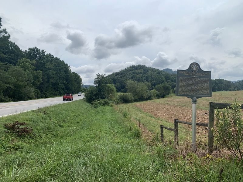
Photographed by Tim Fillmon, August 19, 2022
2. Memorial Lands and Cottages Marker
Looking south on US 441
More about this marker. According to the nearby school, the marker was removed sometime in the last (few) years. It was at an old entrance to the Rabun Gap-Nacoochee School that is now closed. The houses that it refers to are located on part of the campus that is now closed by security gates. Supposedly they were going to make a new post for the marker, but it has not been put up again. The school is trying to locate the marker. Marker text is from the Online Georgia Almanac - GeorgiaInfo
Also see . . . Web site showing old photo of installed marker. (Submitted on October 21, 2016, by Mark Hilton of Montgomery, Alabama.)
Additional commentary.
1. More info about marker.
This marker has been missing for well over ten years. When photographed, it was at the corner of US 441 and School Farm Rd. at coordinates N 34° 57.188 W 083° 23.188
— Submitted October 21, 2016, by Tim Fillmon of Webster, Florida.
2. Former location of marker.
Coordinates provided put it at OC Skinner Road and that area appears to match the photo
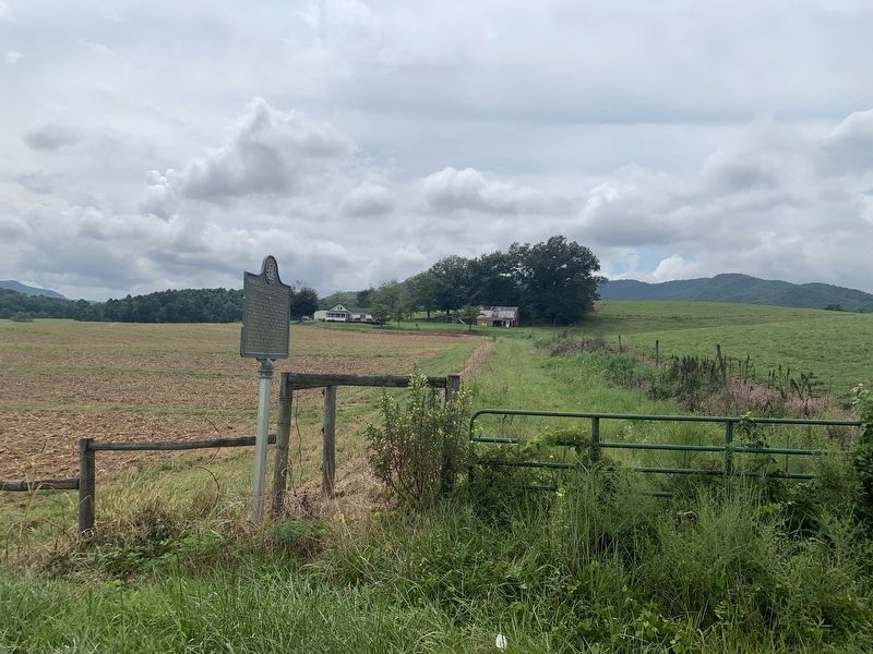
Photographed by Tim Fillmon, August 19, 2022
3. Memorial Lands and Cottages Marker
Looking west
— Submitted October 22, 2016, by Mark Hilton of Montgomery, Alabama.
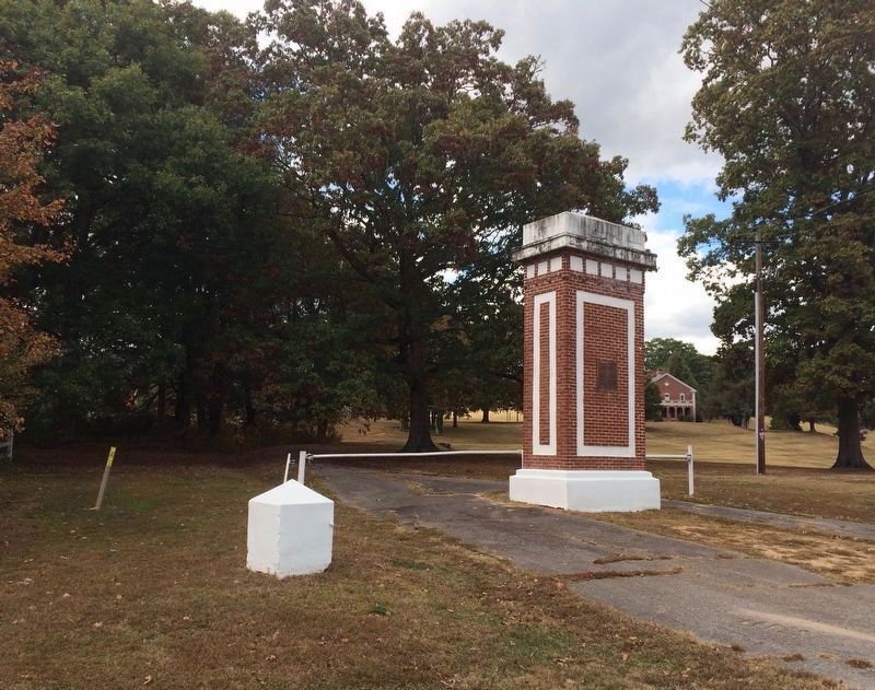
Photographed by Mark Hilton, October 18, 2016
4. The marker mentions the Rabun Gap-Nacoochee School Campus in the far background.
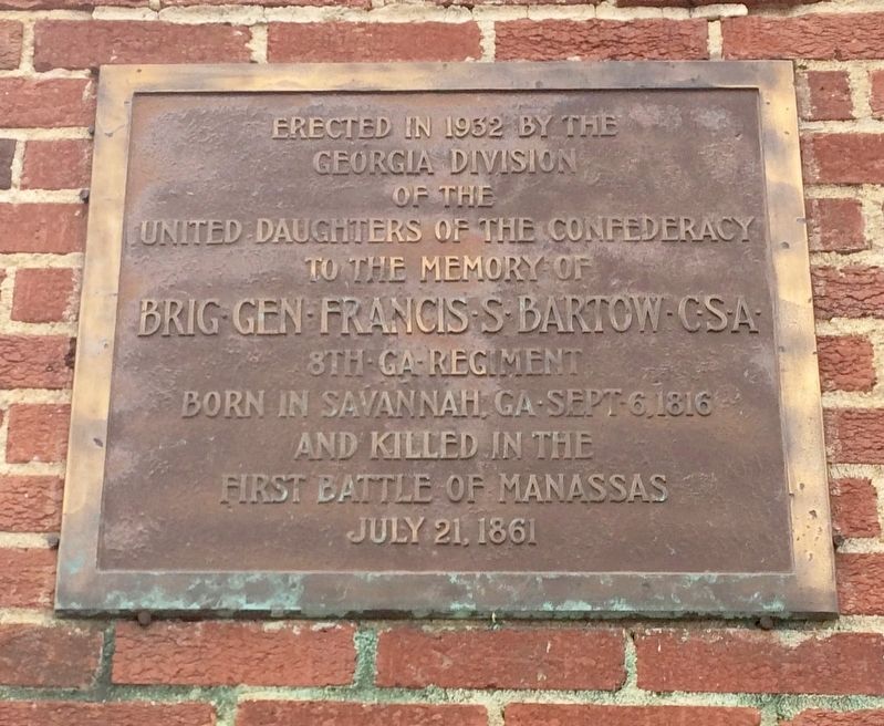
Photographed by Mark Hilton, October 18, 2016
5. Plaque at old entrance about General Francis Bartow - named on the marker.
Credits. This page was last revised on August 19, 2022. It was originally submitted on October 21, 2016, by Mark Hilton of Montgomery, Alabama. This page has been viewed 684 times since then and 32 times this year. Last updated on August 11, 2022, by Dave W of Co, Colorado. Photos: 1, 2, 3. submitted on August 19, 2022, by Tim Fillmon of Webster, Florida. 4, 5. submitted on October 21, 2016, by Mark Hilton of Montgomery, Alabama. • Bernard Fisher was the editor who published this page.
