Split Rock Lighthouse State Park near Beaver Bay in Lake County, Minnesota — The American Midwest (Upper Plains)
Fog Signal
| — | Split Rock Lighthouse | — |
July 27, 2022
1. Fog Signal Marker
Sound When Sight Fails
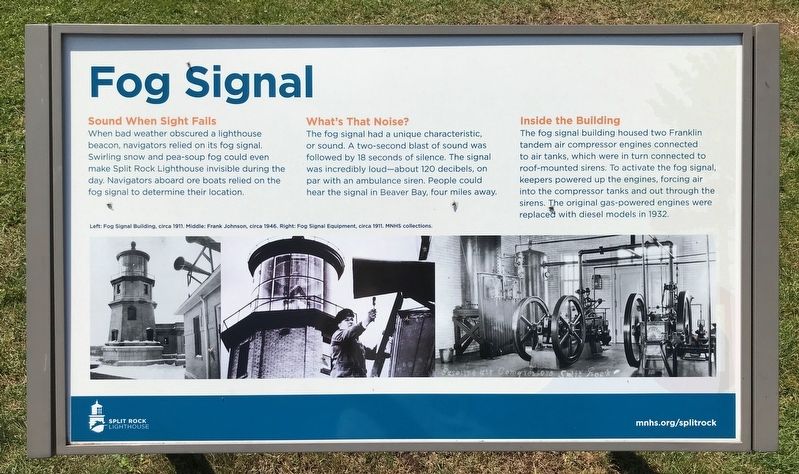
When bad weather obscured a lighthouse beacon, navigators relied on its fog signal. Swirling snow and pea-soup fog could even make Split Rock Lighthouse invisible during the day. Navigators aboard ore boats relied on the fog signal to determine their location.
What's That Noise?
The fog signal had a unique characteristic, or sound. A two-second blast of sound was followed by 18 seconds of silence. The signal was incredibly loud—about 120 decibels, on par with an ambulance siren. People could hear the signal in Beaver Bay, four miles away.
Inside the Building
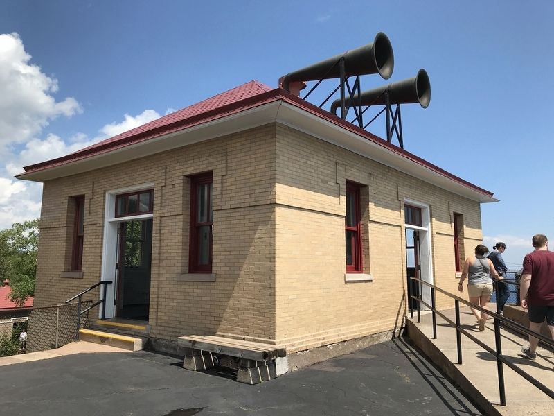
The fog signal building housed two Franklin tandem air compressor engines connected to air tanks, which were in turn connected to roof-mounted sirens. To activate the fog signal, keepers powered up the engines, forcing air into the compressor tanks and out through the sirens. The original gas-powered engines were replaced with diesel models in 1932.
Left: Fog Signal Building, circa 1911. Middle: Frank Johnson, circa 1946. Right: Fog Signal Equipment, circa 1911. MNHS collections.
Erected by Minnesota Historical Society.
Topics and series.
this page online
Location. 47° 12.019′ N, 91° 22.026′ W. Marker is near Beaver Bay, Minnesota, in Lake County. It is in Split Rock Lighthouse State Park. It can be reached from Split Rock Lighthouse Road half a mile south of North Shore Scenic Drive (State Highway 61). Located at the Split Rock Lighthouse Historic Site. Touch for map. Marker is at or near this postal address: 3713 Split Rock Lighthouse Rd, Two Harbors MN 55616, United States of America. Touch for directions.

Regionally, this marker is in the Arrowhead Region, in the Iron Range, and in the North Shore. It is also in the American Midwest and in the Corn Belt. Globally, it is in North America, in the Great North Woods, on the Great Lakes, on Lake Superior’s North Shore, in the Western Hemisphere, in the Western World, and in the Anglosphere. Historically, it finds itself in what was once the Viceroyalty of New France, Rupert’s Land, the territory of the Mississippian
July 27, 2022
2. Fog Signal Marker & Building
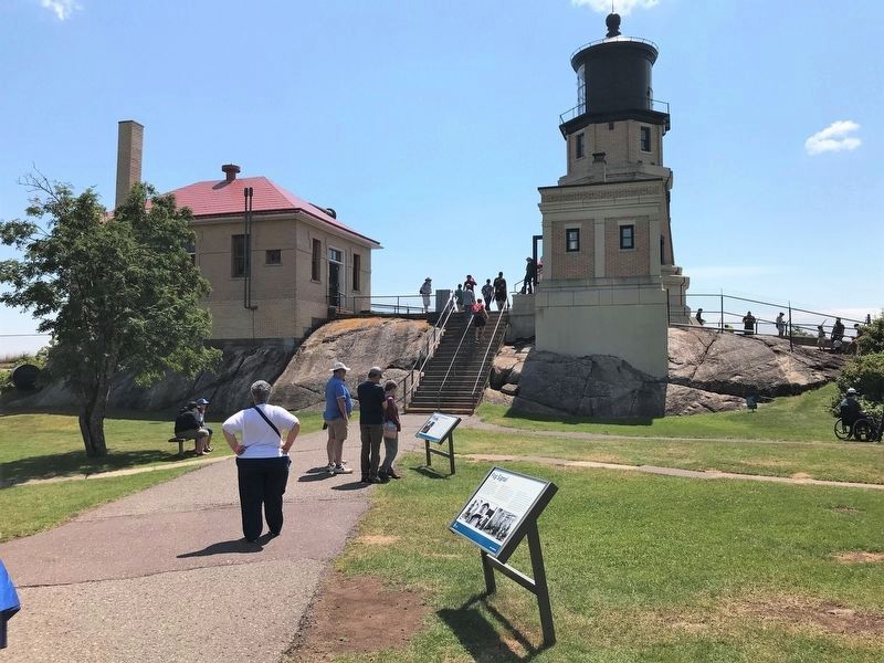
The fog signal building is located to the left of the lighthouse.
Other nearby markers. At least 8 other markers are within walking distance of this marker: Lighthouse (a few steps from this marker); Home Away From Home (a few steps from this marker); Oil House (a few steps from this marker); Storage Barn (a few steps from this marker); Little Two Harbors (within shouting distance of this marker); Gold Rock Point (within shouting distance of this marker); Steam Engine Hoist (within shouting distance of this marker); a different marker also named The Gales of November (within shouting distance of this marker). Touch for a list and map of all markers in Beaver Bay.
Other markers no longer nearby. Steam Hoist Engine (was within shouting distance of this marker but has been replaced with another marker now near it); The Gales of November (was within shouting distance of this marker but has been replaced with another marker now near it).
Also see . . . Split Rock Lighthouse. (Submitted on August 13, 2022.)
July 27, 2022
3. Fog Signal Building
Credits. This page was last revised on August 12, 2026. It was originally submitted on August 13, 2022. This page has been viewed 539 times since then and 31 times this year. Photos: 1, 2, 3. submitted on August 13, 2022.
