Near Tiburon in Marin County, California — The American West (Pacific Coastal)
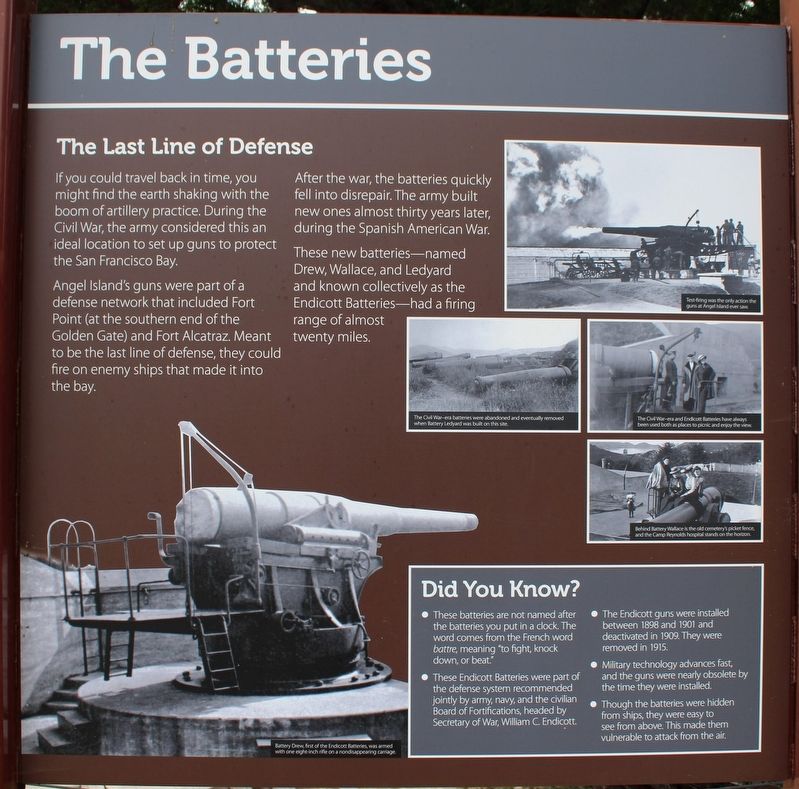
The Batteries
The Last Line of Defense
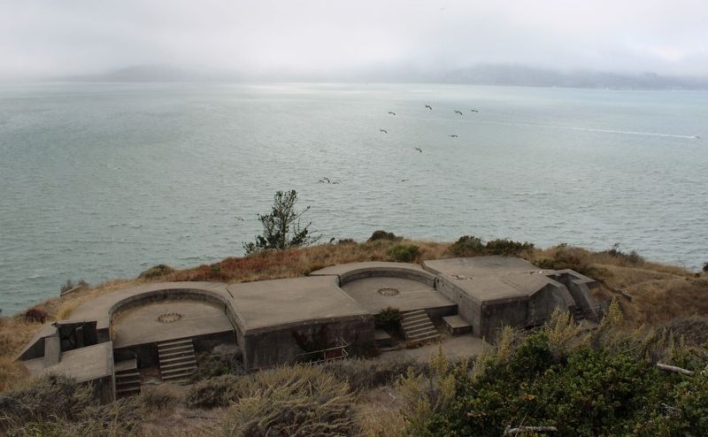
If you could travel back in time, you might find the earth shaking with the boom of artillery practice. During the Civil War, the army considered this an ideal location to set up guns to protect the San Francisco Bay.
Angel Island’s guns were part of a defense network that included Fort Point (at the southern end of the Golden Gate) and Fort Alcatraz. Meant to be the last line of defense, they could fire on enemy ships that made it into the bay.
After the war, the batteries quickly fell into disrepair. The army built new ones almost thirty years later, during the Spanish American War.
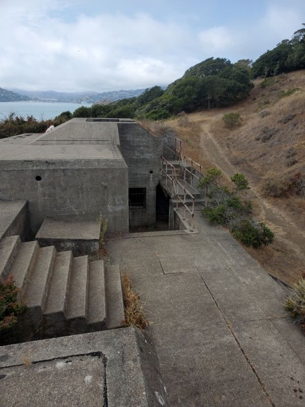
These new batteries—named Drew, Wallace, and Ledyard and known collectively as the Endicott Batteries—had a firing range of almost twenty miles.
Did You Know?
• These batteries are not named after the batteries you put in a clock. The word comes from the French word battre, meaning “to fight, knock down, or beat.”
• These Endicott Batteries were part of the defense system recommended jointly by army, navy, and the civilian Board of Fortifications, headed by Secretary of War, William C. Endicott.
• The Endicott guns were installed between 1898 and 1901 and deactivated in 1909. They were removed in 1915.
• Military technology advances fast, and the guns were nearly obsolete by the time they were installed.
• Though the batteries were hidden from ships, they were easy to see from above. This made them vulnerable to attack from the air.
(captions)
Battery Drew, first of the Endicott Batteries, was armed with one eight-inch rifle on a nondisappearing carriage.
Test-firing was the only action the guns at Angel Island ever saw.
The Civil War-era batteries were abandoned and eventually removed when Battery Ledyard was built on this site.
The Civil War-era and Endicott Batteries have always been used both as places to picnic and enjoy the view.
Behind Battery Wallace is the old cemetery’s picket fence, and the Camp Reynolds hospital stands on the horizon.
(Right Panel)
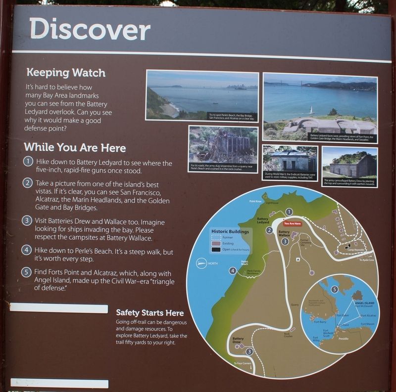
Discover
Keeping Watch
It’s hard to believe how many Bay Area landmarks you can see from Battery Ledyard overlook. Can you see why it would make a good defense point?
While You Are Here
1. Hike down to Battery Ledyard to see where the five-inch, rapid-fire guns once stood.
2. Take a picture from one of the island’s best vistas. If it’s clear, you can see San Francisco, Alcatraz, the Marin Headlands, and the Golden Gate and Bay Bridges.
3. Visit Batteries Drew and Wallace too. Imagine looking for ships invading the bay. Please respect the campsites at Battery Wallace.
4. Hike down to Perle’s Beach. It’s a steep walk, but it’s worth every step.
5. Find Forts Point and Alcatraz, which, along with Angel Island, made up the Civil War-era “triangle of defense.”
Safety Starts Here
Going off-trail can be dangerous and damage resources. To explore Battery Ledyard, take the trail fifty yards to your right.
(captions)
Try to spot Perle's Beach, the Bay Bridge, San Francisco, and Alcatraz on a clear day.
For its roads, the army dug serpentine from a quarry near Perle's Beach and crushed it in the rock crusher.
Battery Ledyard faces west, providing views of Fort Point, the Golden Gate Bridge, the Main Headlands, and Sausalito.
During World War II, the Endicott Battereies were used to store military supplies, including TNT.
The army campouflaged Battery Drew by planting the top and surrounding it with earthen mounds.
(Left Panel)
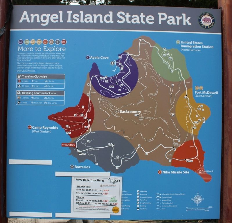
Angel Island State Park
(map)
Erected by California Department of Parks & Recreation.
Topics. This historical marker is listed in these topic lists: Forts and Castles • Parks & Recreational Areas • War, Spanish-American • War, US Civil • War, World II. A significant historical year for this entry is 1898.
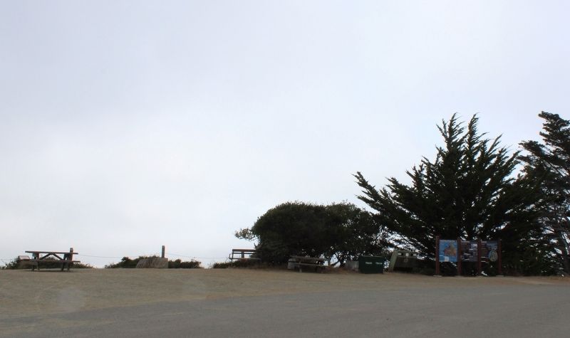
Location. 37° 51.4′ N, 122° 26.474′ W. Marker is near Tiburon, California, in Marin County. Marker is located above Battery Ledyard in Angel Island State Park. Angel Island in San Francisco Bay can be accessed by ferry, private boat, watercraft, or kayak. Touch for map. Marker is in this post office area: Belvedere Tiburon CA 94920, United States of America. Touch for directions.
Other nearby markers. At least 8 other markers are within walking distance of this marker. Defending the Bay (here, next to this marker); Camp Reynolds Chapel (about 700 feet away, measured in a direct line); Mule Power (approx. 0.2 miles away); High Rank, Great View (approx. ¼ mile away); Housing the Troops (approx. ¼ mile away); Caring for Soldiers (approx. 0.3 miles away); Crushing Rock for the Roads (approx. 0.3 miles away); Camp Reynolds (approx. 0.3 miles away). Touch for a list and map of all markers in Tiburon.
Also see . . .
1. US Army on the Island. "With concern mounting over threats to the Bay Area from Confederate sympathizers and naval forces, the federal government established Camp Reynolds (West Garrison) on Angel Island in 1863. Artillery batteries were built near the camp and at Points Stuart, Knox, and Blunt."
...
"U.S. Army presence on the island increased significantly in 1899, when a quarantine station was built at Fort McDowell on the eastern end of the island. This new facility made it possible to isolate troops who had been exposed to contagious diseases while serving overseas in the Spanish-American War and the Philippine Insurrection." (Submitted on August 12, 2022, by Joseph Alvarado of Livermore, California.)
2. Angel Island State Park. California Department of Parks and Recreation (Submitted on August 14, 2022.)
Credits. This page was last revised on August 16, 2022. It was originally submitted on August 12, 2022, by Joseph Alvarado of Livermore, California. This page has been viewed 199 times since then and 46 times this year. Last updated on August 14, 2022, by Joseph Alvarado of Livermore, California. Photos: 1, 2, 3, 4, 5, 6. submitted on August 12, 2022, by Joseph Alvarado of Livermore, California. • Bernard Fisher was the editor who published this page.
