Logan Square in Philadelphia in Philadelphia County, Pennsylvania — The American Northeast (Mid-Atlantic)
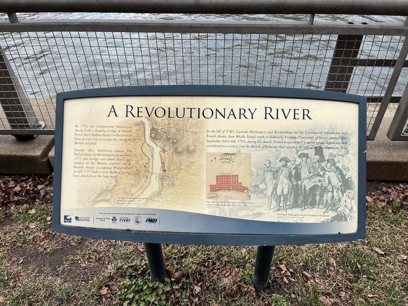
A Revolutionary River
In 1776, the Continental (American) Army built a floating bridge at Middle Ferry (later Market Street) so they would have an easy way to escape the city if the British invaded.
Shortly after American troops left Philadelphia for Wilmington in summer 1777, the bridge was taken down and hidden so the British couldn't use it. British troops occupying Philadelphia in fall 1777 built a new floating bridge here, labeled on the large map.
In the fall of 1781, Generals Washington and Rochambeau led the Continental (American) and French Armies from Rhode Island south to Yorktown, Virginia. Thousands of troops camped here September 3rd to 6th, 1781, during this march. French troops helped to revive weary Americans and contributed to a victory over the British at Yorktown that signaled the end of the Revolutionary War.
Erected by Fairmount Park Conservancy; Schuylkill Banks.
Topics and series. This historical marker is listed in these topic lists: Bridges & Viaducts • War, US Revolutionary • Waterways & Vessels. In addition, it is included in the Former U.S. Presidents: #01 George Washington series list. A significant historical date for this entry is September 3, 1781.
Location. 39° 57.292′ N, 75° 10.772′ W. Marker is in Philadelphia, Pennsylvania, in Philadelphia County. It is in Logan Square. Marker is on Schuylkill River Trail north of Market Street (Pennsylvania Route 3), on the right when traveling south. Touch for map. Marker is at or near this postal address: 2451 Market St, Philadelphia PA 19103, United States of America. Touch for directions.
Other nearby markers. At least 8 other markers are within walking distance of this marker. Linking Philadelphia to the West (a few steps from this marker); You Are Here, In the Year… (within shouting distance of this marker); Schuylkill Permanent Bridge (about 300 feet away, measured in a direct line); First Troop Philadelphia City Cavalry (about 700 feet away); Rolling Along (approx. 0.2 miles away); June 5th Memorial (approx. 0.2 miles away); Industry Transforms the Hidden River (approx. 0.2 miles away); The College of Physicians of Philadelphia Building (approx. 0.2 miles away). Touch for a list and map of all markers in Philadelphia.
Credits. This page was last revised on February 2, 2024. It was originally submitted on February 27, 2022, by Devry Becker Jones of Washington, District of Columbia. This page has been viewed 217 times since then and 19 times this year. Last updated on August 15, 2022, by Carl Gordon Moore Jr. of North East, Maryland. Photos: 1, 2. submitted on February 27, 2022, by Devry Becker Jones of Washington, District of Columbia.

