Near Tiburon in Marin County, California — The American West (Pacific Coastal)
Camp Reynolds
Protecting the West
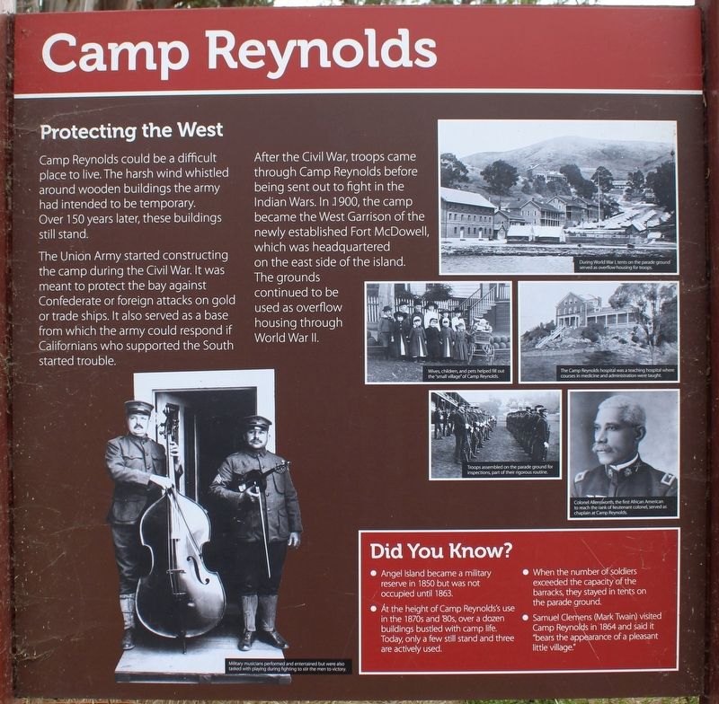
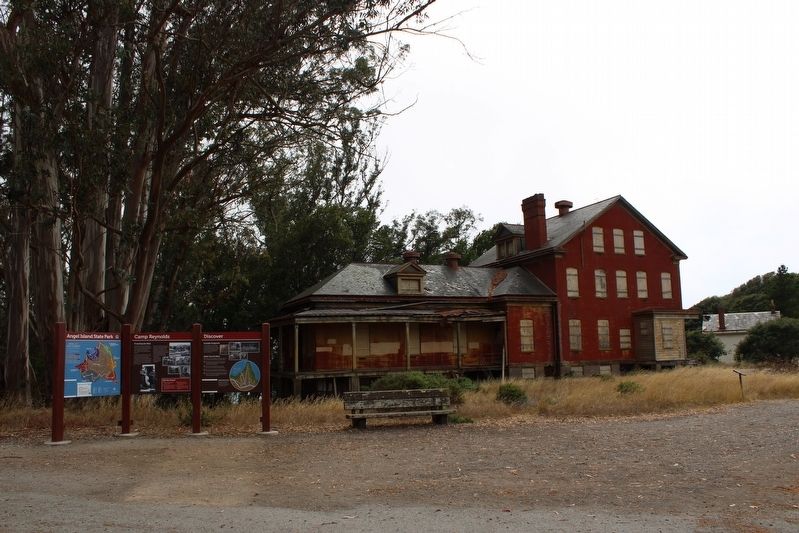
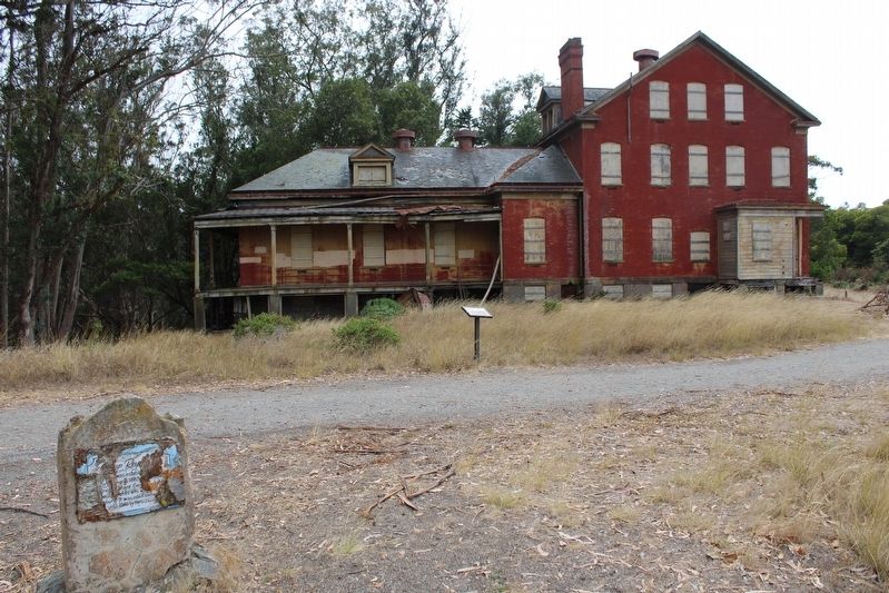
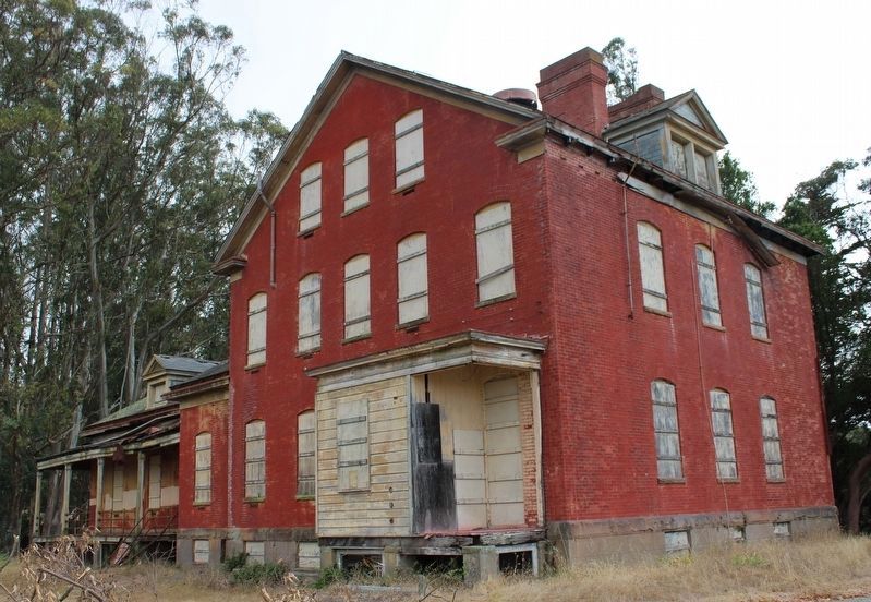
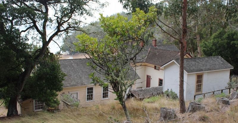
Camp Reynolds could be a difficult place to live. The harsh wind whistled around wooden buildings the army had intended to be temporary. Over 150 years later, these buildings still stand.
The Union Army started constructing the camp during the Civil War. It was meant to protect the bay against Confederate or foreign attacks on gold or trade ships. It also served as a base from which the army could respond if Californians who supported the South started trouble.
After the Civil War, troops came through Camp Reynolds before being sent out to fight in the Indian Wars. In 1900, the camp became the West Garrison of the newly established Fort McDowell, which was headquartered on the east side of the island. The grounds continued to be used as overflow housing through World War II.
Did You Know?
• Angel Island became a military reserve in 1850 but was not occupied until 1863.
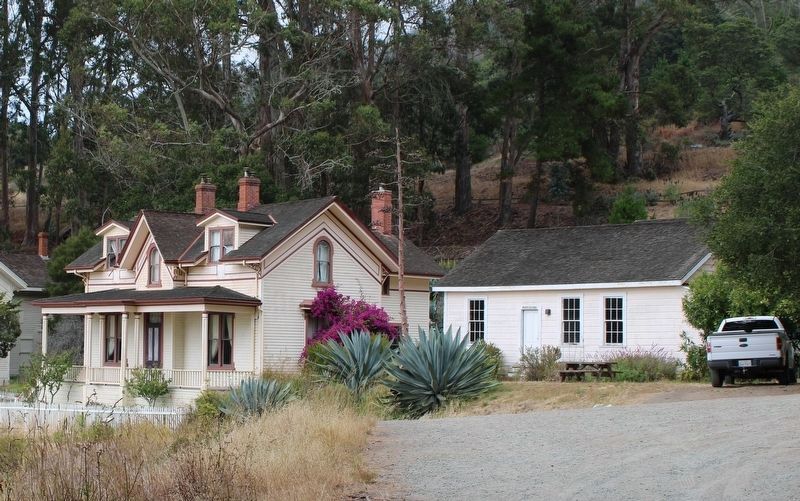
• At the height of Camp Reynold’s use in the 1870s and 80s, over a dozen buildings bustled with camp life. Today, only a few still stand and three are actively used.
• When the number of soldiers exceeded the capacity of the barracks, they stayed in tents on the parade ground.
• Samuel Clemens (Mark Twain) visited Camp Reynolds in 1864 and said it “bears the appearance of a pleasant little village.”
(captions)
Military musicians performed and entertained but were also tasked with playing during fighting to stir the men to victory.
During World War I, tents on the parade ground served as overflow housing for troops.
Wives, children, and pets helped fill out the “small village” of Camp Reynolds.
The Camp Reynolds hospital was a teaching hospital where courses in medicine and administration were taught.
Troops assembled on the parade ground for inspections, part of their rigorous routine.
Colonel Allensworth, the first African American to reach the rank of lieutenant colonel, served as Chaplain at Camp Reynolds.
(Right Panel)
Discover
Invisible Footprints
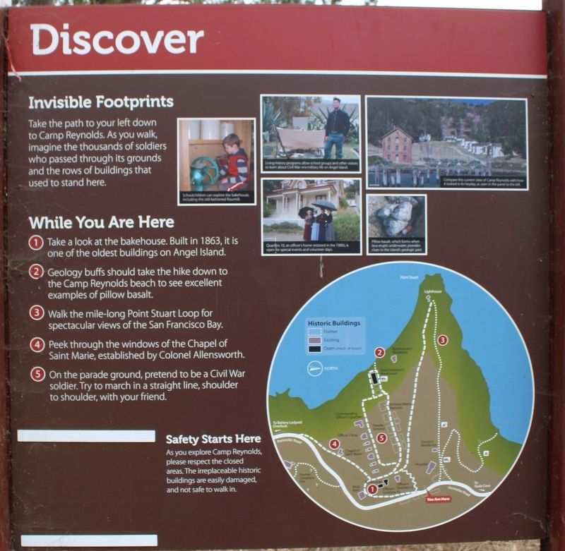
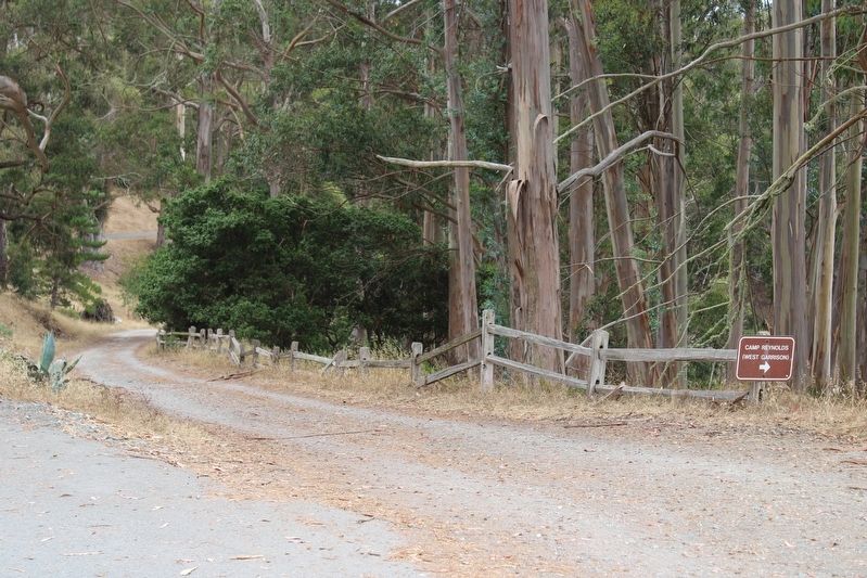
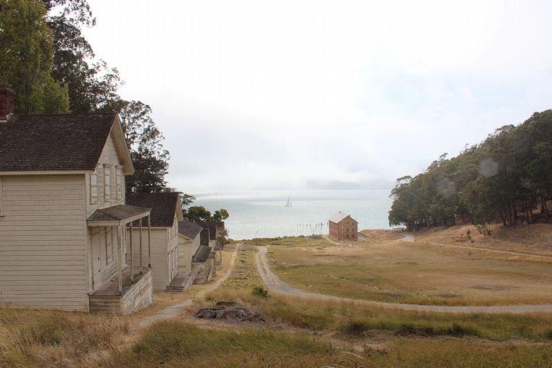
Take the path to your left down to Camp Reynolds. As you walk, imagine the thousands of soldiers who passed through its grounds and the rows of buildings that used to stand here.
While You Are Here
1. Take a look at the bakehouse. Built in 1863, it is one of the oldest buildings on Angel Island.
2. Geology buffs should take the hike down to Camp Reynolds beach to see excellent examples of pillow basalt.
3. Walk the mile-long Point Stuart Loop for spectacular views of the San Francisco Bay.
4. Peek through the windows of the Chapel of Saint Marie, established by Colonel Allensworth.
5. On the parade ground, pretend to be a Civil War soldier. Try to march in a straight line, shoulder to shoulder, with your friend.
Safety Starts Here
As you explore Camp Reynolds, please respect the closed areas. The irreplaceable historic buildings are easily damaged, and not safe to walk in.
(captions)
Schoolchildren can explore the bakehouse, including the old-fashioned flourmill.
Living history programs allow school groups and other visitors to learn about Civil War-era military life on Angel Island.
Quarters 10, an officer’s home restored in the 1980s, is open for special events and volunteer days.
Compare the current view of Camp Reynolds with how it looked in its heyday, as seen in the panel to the left.
(Left Panel)
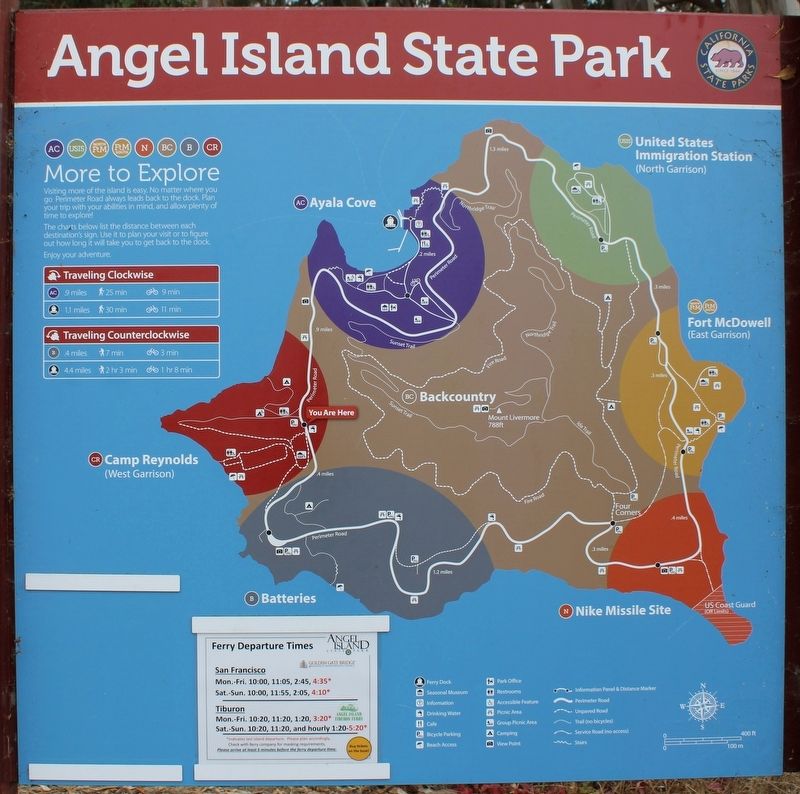
Angel Island State Park
(map)
Erected by California Department of Parks & Recreation.
Topics. This historical marker is listed in these topic lists: African Americans • War, US Civil • War, World I • Wars, US Indian. A significant historical year for this entry is 1850.
Location. 37° 51.664′ N, 122° 26.395′ W. Marker is near Tiburon, California, in Marin County. Marker is located at Camp Reynolds in Angel Island State Park. Angel Island in San Francisco Bay can be accessed by ferry, private boat, watercraft, or kayak. Touch for map. Marker is in this post office area: Belvedere Tiburon CA 94920, United States of America. Touch for directions.
Other nearby markers. At least 8 other markers are within walking distance of this marker. Caring for Soldiers (within shouting distance of this marker); Housing the Troops (about 400 feet away, measured in a direct line); High Rank, Great View (about 500 feet away); Mule Power (about 600 feet away); Camp Reynolds Chapel (approx. 0.2 miles away); Defending the Bay (approx. 0.3 miles away); The Batteries (approx. 0.3 miles away); Melting Glaciers + Rising Seas = (approx. 0.3 miles away). Touch for a list and map of all markers in Tiburon.
Also see . . .
1. Angel Island State Park. California Department of Parks and Recreation (Submitted on August 15, 2022.)
2. US Army on the Island. "After the Civil War, Camp Reynolds became an infantry camp, serving as a depot for recruits, and as a staging area for troops serving in campaigns against the Apache, Sioux, Modoc, and other Indian tribes." (Submitted on August 15, 2022, by Joseph Alvarado of Livermore, California.)
Credits. This page was last revised on September 4, 2022. It was originally submitted on August 14, 2022, by Joseph Alvarado of Livermore, California. This page has been viewed 457 times since then and 100 times this year. Last updated on August 15, 2022, by Joseph Alvarado of Livermore, California. Photos: 1, 2, 3, 4, 5, 6. submitted on August 14, 2022, by Joseph Alvarado of Livermore, California. 7, 8, 9. submitted on August 15, 2022, by Joseph Alvarado of Livermore, California. 10, 11, 12. submitted on September 4, 2022, by Joseph Alvarado of Livermore, California. • Bernard Fisher was the editor who published this page.
