Near Hanging Rock in Hampshire County, West Virginia — The American South (Appalachia)
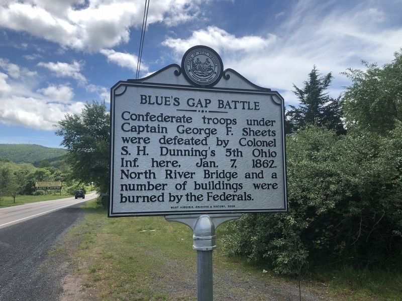
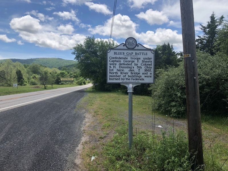
Blue's Gap Battle
Erected 2009 by West Virginia Archives & History.
Topics and series. This historical marker is listed in this topic list: War, US Civil. In addition, it is included in the West Virginia Archives and History series list. A significant historical date for this entry is January 7, 1862.
Location. Marker is missing. It was located near 39° 16.413′ N, 78° 33.569′ W. Marker was near Hanging Rock, West Virginia, in Hampshire County. Marker was on Northwestern Turnpike (U.S. 50) 0.2 miles west of Moler Drive, on the right when traveling east. Touch for map. Marker was at or near this postal address: 11532 Northwestern Turnpike, Augusta WV 26704, United States of America. Touch for directions.
Other nearby markers. At least 8 other markers are within 7 miles of this location, measured as the crow flies. Oriskany Sand (approx. 0.9 miles away); Ice Mountain (approx. 3 miles away); Fort Edwards (approx. 6.8 miles away); Northwestern Turnpike (approx. 7 miles away); The Ken Edmonds Memorial Heritage Trail (approx. 7 miles away); Forts in Col. George Washington's Chain of Forts Guarding the Eighteenth Century Virginia Froniter (approx. 7 miles away); Gen. Braddock is Defeated (approx. 7 miles away); Some French and Indian War Incidents in Hampshire County (approx. 7 miles away).
Credits. This page was last revised on August 17, 2022. It was originally submitted on November 11, 2018, by Mike Wintermantel of Pittsburgh, Pennsylvania. This page has been viewed 772 times since then and 99 times this year. Last updated on August 16, 2022, by Craig Doda of Napoleon, Ohio. Photos: 1, 2. submitted on May 28, 2020, by Devry Becker Jones of Washington, District of Columbia. • Bernard Fisher was the editor who published this page.

