Winchester in Frederick County, Virginia — The American South (Mid-Atlantic)
Molineux's Stand
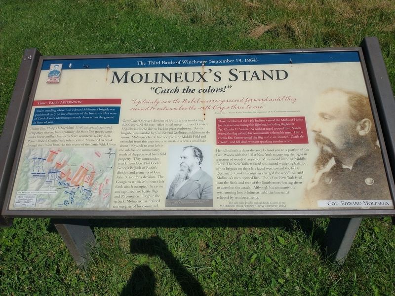
"Catch the colors!"
— The Third Battle of Winchester (September 19, 1864) —
You're standing where Col. Edward Molineux's brigade was positioned early on the afternoon of the battle — with a wave of Confederates advancing towards them across the ground in front of you.
"I plainly saw the Rebel massses pressed forward until they seemed to outnumber the 19th Corps three to one." - Union Col. J. Warren Keifer, describing the apperarance of the Confederate counter attack
Union Gen. Philip H. Sheridan's 11:40 am assault achieved temporary success, but eventually the front line troops came under heavy artillery fire and a fierce counterattack by Gen. Robert Rodes's Confederate infantry that threatened to break through the Union lines. In this sector of the battlefield, Union Gen. Cuvier Grover's division of four brigades numbering 8,000 men led the way. After initial success, three of Grover's brigades had been driven back in great confusion. But the brigade commanded by Col. Edward Molineux held firm in the storm. Molineux's battle line occupied the Middle Field and extended from this area into a ravine that is now a small lake about 500 yards to your left in the subdivision immediately south of the preserved battlefield property. They came under attack from Gen. Phil Cook's Georgia Brigade of Rodes's division and elements of Gen. John B. Gordon's division. The Georgians struck Molineux's left flank which occupied the ravine and captured two battle flags and 95 prisoners. Despite the setback, Molineux maintained the integrity of his command.
He pulled back a short distance behind you to a portion of the First Woods with the 131st New York occupying the right in a section of woods that projected westward into the Middle Field. The New Yorkers faced southward while the balance of the brigade on their left faced west toward the field. (See map.) Cook's Georgians charged the woodline, and Molineux's men opened fire. The 131st New York fired into the flank and rear of the Southerners forcing them of abandon the attack. Although his ammunition was running low, Molineux held the line until relieved by reinforcements.
Three members of the 11th Indiana earned the Medal of Honor for their actions during this fighting, including flagbearer Sgt. Charles H. Seston. As combat raged around him, Seston waved the flag to help his commander reform his men. Hit by enemy fire, Seston tossed the flag in the air, shouted "Catch the colors!", and fell dead without speaking another word.
(captions)
Postwar image of Confederate Gen. Phillip Cook, which served as a U.S. Congressman from 1873-1883. Library of Congress
Col. Edward Molineux Courtesy Nicholas P. Picerno Collection
Erected by Millbrook High School Cross Country Team.
Topics. This historical marker is listed in this topic list: War, US Civil. A significant historical date for this entry is September 19, 1864.
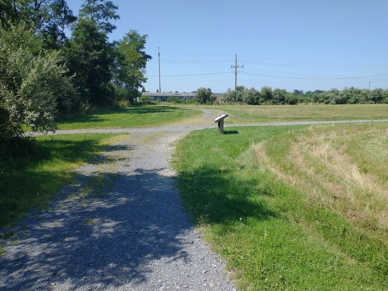
Location. 39° 11.85′ N, 78° 7.565′ W. Marker is in Winchester, Virginia, in Frederick County. Marker can be reached from the intersection of Averrell Avenue and Artifact Avenue, on the left when traveling north. Located 0.1 mile north of the parking area along the Third Battle of Winchester Trail. Touch for map. Marker is at or near this postal address: 253 Averrell Ave, Winchester VA 22603, United States of America. Touch for directions.
Other nearby markers. At least 8 other markers are within walking distance of this marker. Maine (within shouting distance of this marker); A Perfect Sheet Of Lead (about 400 feet away, measured in a direct line); The Cost of Battle (about 600 feet away); Alabama (about 700 feet away); Ash Hollow (about 700 feet away); The Middle Field (approx. 0.2 miles away); The Third Battle of Winchester (approx. 0.2 miles away); Grover's Attack (approx. 0.2 miles away). Touch for a list and map of all markers in Winchester.
Also see . . . The Third Battle of Winchester. Shenandoah Valley Battlefields Foundation (Submitted on August 18, 2022.)
Credits. This page was last revised on August 18, 2022. It was originally submitted on August 18, 2022, by Craig Doda of Napoleon, Ohio. This page has been viewed 152 times since then and 43 times this year. Photos: 1, 2. submitted on August 18, 2022, by Craig Doda of Napoleon, Ohio. • Bernard Fisher was the editor who published this page.

