Winchester in Frederick County, Virginia — The American South (Mid-Atlantic)
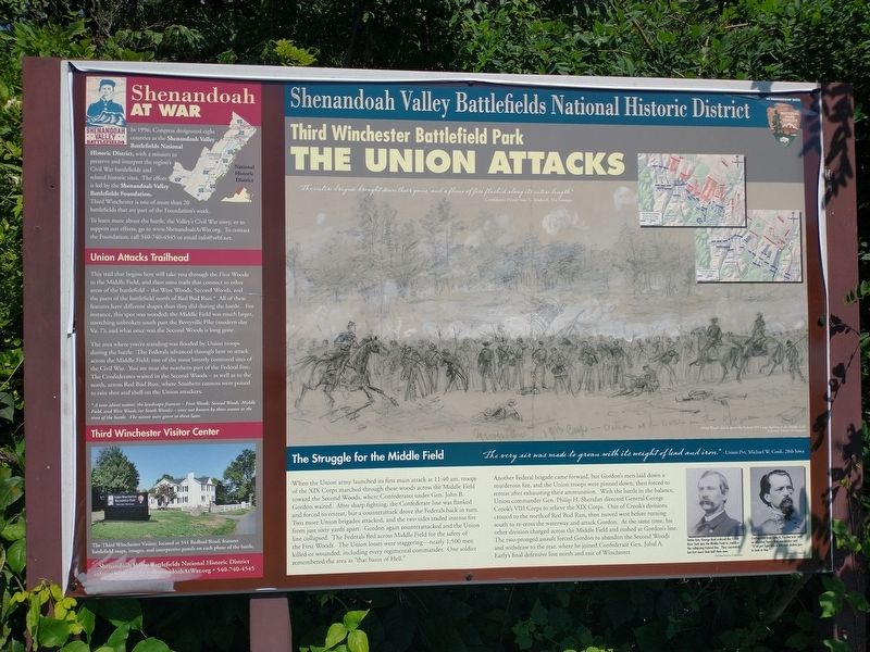
The Union Attacks
Third Winchester Battlefield Park
— Shenandoah Valley Battlefields National Historic District —
In 1996, Congress designated eight counties as the Shenandoah Valley Battlefields National Historic District, with a mission topreserve and interpret the region's Civil War battlefields and related historic sites. The effort is led by the Shenandoah Valley Battlefields Foundation. Third Winchester is one of more than 20 battlefields that are part of the Foundation's work.
To learn more about the battle, the Valley's Civil War story, or to support our efforts, go to www.ShenandoahArWar.org. To contact the Foundation, call 540-740-4545 or email [email protected].
Union Attacks Trailhead
This trail that begins here will take you through the First Woods to the Middle Field, and then onto trails that connect to other areas of the battlefield — the West Woods, Second Woods, and the parts of the battlefield north of Red Bud Run.* All of these features have different shapes than they did during the battle. For instance, this spot was wooded; the Middle Field was much larger, stretching unbroken south past the Berryville Pike (modern-day Va. 7); and what once was the Second Woods is long gone.
The area where you're standing was flooded by Union troops during the battle. The Federals advanced through here to attack across the Middle Field, one of the most bitterly contested sites of the Civil War. You are near the northern part of the Federal line. The Confederates waited in the Second Woods — as well as to the north, across Red Bud Run, where Southern cannon were poised to rain shot and shell on the Union attackers.
*A note about names: the landscape features — First Woods, Second Woods, Middle Field, and West Woods (or South Woods) — were not known by those names at the time of the battle. The names were given to them later.
Third Winchester Visitor Center
The Third Winchester Visitor, located at 541 Redbud Road, features battlefield maps, images, and interpretive panels on each phase of the battle.
The Struggle for the Middle Field
"The very air was made to groan with its weight of lead and iron." - Union Pvt. Michael W. Cook, 28th Iowa
When the Union army launched its first main attack at 11:40 am, troops of the XIX Corps marched through these woods across the Middle Field toward the Second Woods, where Confederates under Gen. John B. Gordon waited. After sharp fighting, the Confederate line was flanked and forced to retreat, but a counterattack drove the Federals back in turn. Two more Union brigades attacked, and the two sides traded intense fire from just sixty yards apart. Gordon again counterattacked and the Union line collapsed. The Federals fled across Middle Field for the safety of the First Woods. The Union losses were staggering—nearly 1,500 men killed or wounded, including every regimental commander. One soldier remembered the area as "that basin of Hell."
Another Federal brigade came forward, but Gordon's men laid down a murderous fire, and the Union troops were pinned down, then forced to retreat after exhausting their ammunition. With the battle in the balance, Union commander Gen. Philip H. Sheridan directed General George Crook's VIII Corps to relieve the XIX Corps. One of Crook's divisions crossed to the north of Red Bud Run, then moved west before turning south to re-cross the waterway and attack Gordon. At the same time, his other division charged across the Middle Field and rushed at Gordon's line. The two-pronged assault forced Gordon to abandon the Second Woods and withdraw to the rear, where he joined Confederate Gen. Jubal A. Early's final defensive line north and east of Winchester.
(captions)
"The entire brigade brought down their guns, and a flame of fire flashed along its entire length." - Confederate Private Isaac G. Bradwell, 31st Georgia
Alfred Waud's sketch shows the Fderal XIX Corps fighting in the Middle Field. Courtesy Library of Congress
Union Gen. George Beal ordered the 114th New York into the Middle Field to stabilize the collapsing Federal line. They succeeded, but lost more than half their men. (Nicolas Picerno Collection)
Confederated Gen. John B. Gordon was such an inspiring figure that one soldier said "It' ud put fight into a whipped chicken just to look at him." (Library of Congress)
Erected by Shenandoah Valley Battlefields Foundation.
Topics. This historical marker is listed in this topic list: War, US Civil. A significant historical date for this entry is September 19, 1864.
Location. 39° 11.621′ N, 78° 6.934′ W. Marker is in Winchester, Virginia, in Frederick County. Marker can be reached from First Woods Drive north of Millbrook Drive, on the left when traveling north. Located behind Millbrook High School at the entrance to the Third Battle of Winchester Trail. Touch for map. Marker is at or near this postal address: 251 First Woods Dr, Winchester VA 22603, United States of America. Touch for directions.
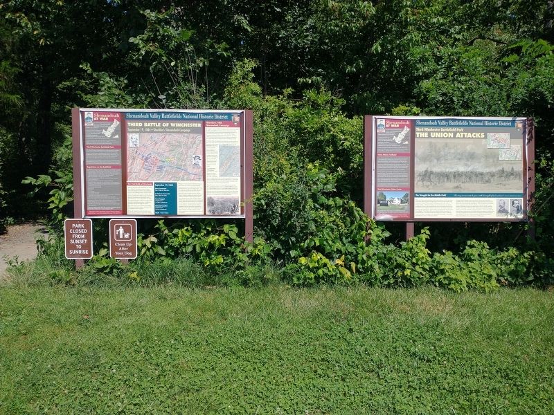
Other nearby markers. At least 8 other markers are within walking distance of this marker. Third Battle of Winchester (here, next to this marker); Sheridan Moves To Battle (about 300 feet away, measured in a direct line); a different marker also named The Third Battle of Winchester (approx. 0.4 miles away); Jost Hite and Winchester (approx. 0.4 miles away); a different marker also named Third Battle of Winchester (approx. 0.4 miles away); Grover's Attack (approx. 0.4 miles away); The Middle Field (approx. half a mile away); Ash Hollow (approx. half a mile away). Touch for a list and map of all markers in Winchester.
Also see . . . The Third Battle of Winchester. Shenandoah Valley Battlefields Foundation (Submitted on August 18, 2022.)
Credits. This page was last revised on August 18, 2022. It was originally submitted on August 18, 2022, by Craig Doda of Napoleon, Ohio. This page has been viewed 99 times since then and 24 times this year. Photos: 1, 2. submitted on August 18, 2022, by Craig Doda of Napoleon, Ohio. • Bernard Fisher was the editor who published this page.

