Winchester in Frederick County, Virginia — The American South (Mid-Atlantic)
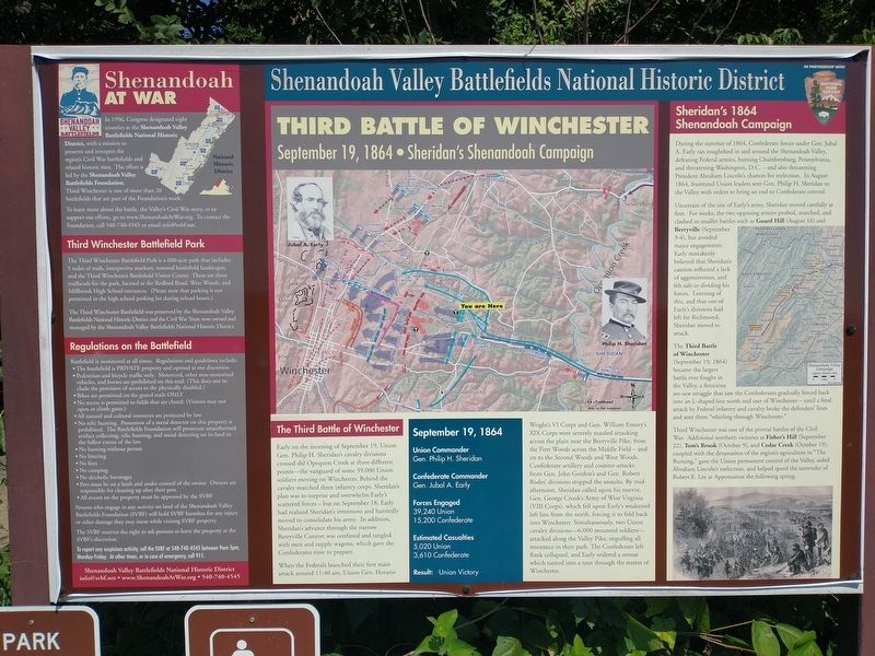
Third Battle of Winchester
September 19, 1864 • Sheridan's Shenandoah Champaign
— Shenandoah Valley Battlefields National Historic District —
In 1996, Congress designated eight counties as the Shenandoah Valley Battlefields National Historic District, with a mission topreserve and interpret the region's Civil War battlefields and related historic sites. The effort is led by the Shenandoah Valley Battlefields Foundation. Third Winchester is one of more than 20 battlefields that are part of the Foundation's work.
To learn more about the battle, the Valley's Civil War story, or to support our efforts, go to www.ShenandoahArWar.org. To contact the Foundation, call 540-740-4545 or email [email protected].
Third Winchester Battlefield Park
The Third Winchester Battlefield Park is a 600-acre park that includes 5 miles of trails, interpretive markers, restored battlefield landscapes, and the Third Winchester Battlefield Visitor Center. There are three trailheads for the park, located at the Redbud Road, West Woods, and Millbrook High School entrances. (Please note that parking is not permitted in the high school parking lot during school hours.)
The Third Winchester Battlefield was preserved by the Shenandoah Valley Battlefields National Historic District and the Civil War Trust: now owned and managed by the Shenandoah Valley Battlefields National Historic District.
Regulations on the Battlefield
Battlefield is monitored at all times. Regulations and guidelines include:
• The battlefield is PRIVATE property and opened at our discretion
• Pedestrian and bicycle traffic only. Motorized, other non-motorized vehicles, and horses are prohibited on this trail. (This does not include the provision of access to the physically disabled.)
• Bikes are permitted on the gravel trails ONLY
• No access is permitted to fields that are closed. (Visitors may not open or climb gates.)
• All natural and cultural resources are protected by law. • No relic hunting. Possession of a metal detector on this property is prohibited. The Battlefields Foundation will prosecute unauthorized artifact collecting, relic hunting, and metal detecting on its land to the fullest extent of the law.
• No hunting without permit
• No littering
• No fires
• No camping
• No alcoholic beverages
• Pets must be on a leash and under control of the owner. Owners are responsible for cleaning up after their pets.
• All events on the property must be approved by the SVBF
Persons who engage in any activity on land of the Shenandoah Valley Battlefields Foundation (SVBF) will hold SVBF harmless for any injury or other damage they may incur while visiting SVBF property.
The SVBF reserves the right to ask persons to leave the property at the SVBF's discretion.
To report any suspicious activity, call the SVBF at 540-740-4545 between 9am-5pm, Monday-Friday. At other times, or in case of emergency, call 911.
Shenandoah Valley Battlefields National Historic District
[email protected] • www.ShenandoahAtWar.org • 540-740-4545
The Third Battle of Winchester
Early on the morning of September 19, Union Gen. Philip H. Sheridan's cavalry divisions crossed the Opequon Creek at three different points—the vanguard of some 39,000 Union soldiers moving on Winchester. Behind the cavalry marched three infantry corps. Sheridan's plan was to surprise and overwhelm Early's scattered forces — but on September 18, Early had realized Sheridan's intentions and hurriedly moved to consolidate his army. In addition, Sheridan's advance through the narrow Berryville Canyon was confused and tangled with men and supply wagons, which gave the Confederates time to prepare.
When the Federals launched their first main attack around 11:40 am, Union Gen. Horatio Wright's VI Corps and Gen. William Emory's XIX Corps were severely mauled attacking across the plain near the Berryville Pike, from the First Woods across the Middle Field — and on to the Second Woods and West Woods. Confederate artillery and counter-attacks from Gen. John Gordon's and Gen. Robert Rodes' divisions stopped the assaults. By mid-afternoon, Sheridan called upon his reserve, Gen. George Crook's Army of West Virginia (VIII Corps), which fell upon Early's weakened left line from the north, forcing it to fold back into Winchester. Simultaneously, two Union cavalry divisions—6,000 mounted soldiers—attacked along the Valley Pike, engulfing all resistance in their path. The Confederate left flank collapsed, and Early ordered a retreat which turned into a rout through the streets of Winchester.
September 19, 1864
Union Commander
Gen. Philip H. Sheridan
Confederate Commander
Gen. Jubal A. Early
Forces Engaged
39,240 Union
15,200 Confederate
Estimated Casualties
5,020 Union
3,610 Confederate
Result: Union Victory
Sheridan's 1864 Shenandoah Campaign
During the summer of 1864, Confederate forces under Gen. Jubal A. Early ran roughshod in and around the Shenandoah Valley, defeating Federal armies, burning Chambersburg, Pennsylvania, and threatening Washington, D.C. — and also threatening President Abraham Lincoln's chances for reelection. In August 1864, frustrated Union leaders sent Gen. Philip H. Sheridan to the Valley with orders to bring an end to Confederate control.
Uncertain of the size of Early's army, Sheridan moved carefully at first. For weeks, the two opposing armies probed, marched, and clashed in smaller battles such as Guard Hill (August 16) and Berryville (September 3-4), but avoided major engagements. Early mistakenly believed that Sheridan's caution reflected a lack of aggressiveness, and felt safe in dividing his forces. Learning of this, and that one of Early's divisions had left for Richmond, Sheridan moved to attack.
The Third Battle of Winchester (September 19, 1864) became the largest battle ever fought in the Valley, a ferocious see-saw struggle that saw the Confederates gradually forced back into an L-shaped line north and east of Winchester — until a final attack by Federal infantry and cavalry broke the defenders' lines and sent them "whirling through Winchester."
Third Winchester was one of the pivotal battles of the Civil War. Additional northern victories at Fisher's Hill (September 22), Tom's Brook (October 9), and Cedar Creek (October 19), coupled with the devastation of the region's agriculture in "The Burning,” gave the Union permanent control of the Valley, aided Abraham Lincoln's reelection, and helped speed the surrender of Robert E. Lee at Appomattox the following spring.
Erected by Shenandoah Valley Battlefields Foundation.
Topics. This historical marker is listed in this topic list: War, US Civil. A significant historical date for this entry is September 19, 1864.
Location. 39° 11.62′ N, 78° 6.936′ W. Marker is in Winchester, Virginia, in Frederick County. Marker can be reached from First Woods Drive north of Millbrook Drive, on the left when traveling north. Located behind Millbrook High School at the entrance to the Third Battle of Winchester Trail. Please note that parking is not permitted in the high school parking lot during school hours. Touch for map. Marker is at or near this postal address: 251 First Woods Dr, Winchester VA 22603, United States of America. Touch for directions.
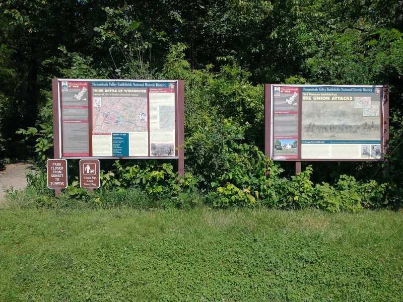
Other nearby markers. At least 8 other markers are within walking distance of this marker. The Union Attacks (here, next to this marker); Sheridan Moves To Battle (about 300 feet away, measured in a direct line); a different marker also named The Third Battle of Winchester (approx. 0.4 miles away); Jost Hite and Winchester (approx. 0.4 miles away); a different marker also named Third Battle of Winchester (approx. 0.4 miles away); Grover's Attack (approx. 0.4 miles away); The Middle Field (approx. half a mile away); Ash Hollow (approx. half a mile away). Touch for a list and map of all markers in Winchester.
Also see . . .
1. Third Winchester Battlefield Park. Shenandoah Valley Battlefields Foundation (Submitted on August 18, 2022.)
2. The Third Battle of Winchester. Shenandoah Valley Battlefields Foundation (Submitted on August 18, 2022.)
Credits. This page was last revised on August 18, 2022. It was originally submitted on August 18, 2022, by Craig Doda of Napoleon, Ohio. This page has been viewed 100 times since then and 31 times this year. Photos: 1, 2. submitted on August 18, 2022, by Craig Doda of Napoleon, Ohio. • Bernard Fisher was the editor who published this page.

