Near Winchester in Frederick County, Virginia — The American South (Mid-Atlantic)
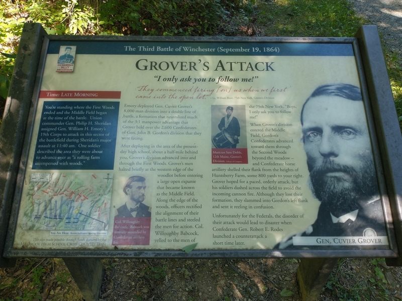
Grover's Attack
"I only ask you to follow me!"
— The Third Battle of Winchester (September 19, 1864) —
Time: Late Morning
You're standing where the First Woods ended and the Middle Field began at the time of the battle. Union commander Gen. Philip H. Sheridan assigned Gen. William H. Emory's 19th Corps to attack in this sector of the battlefield during Sheridan's major assault at 11:40 am. One soldier described the area they were about to advance over as "a rolling farm interspersed with woods."
"They commenced firing [on] us when we first came into the open lot." - Lt. William Root, 75th New York, Grover's Division
Emory deployed Gen. Cuvier Grover's 8,000 man division into a double line of battle, a formation that neutralized much of the 3:1 manpower advantage that Grover held over the 2,600 Confederates of Gen. John B. Gordon's division that they were facing.
After deploying in the area of the present-day high school, about a half-mile behind you, Grover's division advanced into and through the First Woods. Grover's men halted briefly at the western edge of the woodlot before entering a large open expanse that became known as the Middle Field. Along the edge of the woods, officers rectified the alignment of their battle lines and steeled the men for action. Col. Willoughby Babcock, yelled to the men of the 75th New York. "Boys, 1 only ask you to follow me!"
When Grover's division entered the Middle Field, Gordon's Confederates advanced toward them through the Second Woods beyond the meadow — and Confederate horse artillery shelled their flank from the heights of Huntsberry Farm, some 800 yards to your right. Grover hoped for a paced, orderly attack, but his soldiers dashed across the field to avoid the incoming cannon fire. Although they lost their formation, they slammed into Gordon's left flank and sent it reeling in confusion.
Unfortunately for the Federals, the disorder of their attack would lead to disaster when Confederate Gen. Robert E. Rodes launched a counterattack a short time later.
[Caption:]
Col. Willoughby Babcock. Babcock was mortally wounded by Confederate artillery fire.
Erected by Shenandoah Valley Battlefields Foundation.
Topics. This historical marker is listed in this topic list: War, US Civil. A significant historical date for this entry is September 19, 1864.
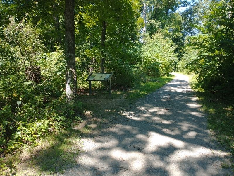
Location. 39° 11.866′ N, 78° 7.325′ W. Marker is near Winchester, Virginia, in Frederick County. Marker can be reached from Averrell Avenue north of Artifact Avenue, on the right when traveling north. Located 0.4 miles northeast of the parking area on the Third Battle of Winchester Trail. Touch for map. Marker is at or near this postal address: 150 Third Battle of Winchester Trail, Winchester VA 22601, United States of America. Touch for directions.
Other nearby markers. At least 8 other markers are within walking distance of this marker. The Middle Field (a few steps from this marker); The Third Battle of Winchester (about 500 feet away, measured in a direct line); Ash Hollow (about 600 feet away); A Perfect Sheet Of Lead (approx. 0.2 miles away); Maine (approx. 0.2 miles away); Ten Thousand Devils (approx. 0.2 miles away); “Shrapnel Rained On Us” (approx. 0.2 miles away); Molineux's Stand (approx. 0.2 miles away). Touch for a list and map of all markers in Winchester.
Also see . . . The Third Battle of Winchester. Shenandoah Valley Battlefields Foundation (Submitted on August 19, 2022.)
Credits. This page was last revised on September 30, 2022. It was originally submitted on August 18, 2022, by Craig Doda of Napoleon, Ohio. This page has been viewed 135 times since then and 30 times this year. Photos: 1, 2. submitted on August 18, 2022, by Craig Doda of Napoleon, Ohio. • Bernard Fisher was the editor who published this page.

