
Roissy-en-France in Val-d'Oise, Île-de-France, France — Western Europe
Route de Maubeuge à Paris
⎯⎯⎯
Route from Maubeuge to Paris
| — | Roissy: Étonnant Village / Unexpected Village | — |
Photographed by Andrew Ruppenstein, July 26, 2022
1. Route de Maubeuge a Paris / Route from Maubeuge to Paris Marker

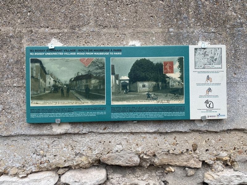
Route nationale, entrée sud du village. Un oeil averti trouve encore des marques d'un passe agricole. Ce porche, le dernier de cette importance, an el un belle example. «Tous ceux qui visitèrent Roissy dans le passé, ou même ceux qui ne tirent que le traverser en diligence, le trouvèrent attachant» - Eugènd Soitel - in Roissy dans le passé. Cette route est la plus chargée d'histoire du village. Elle a été empruntée par toutes les invasions et les années liberatrices de la France.
The southern entry into the village. A trained eye will still find remnants of its agricultural past. This porch, the last remaining one of this size, is a fine example. «All who visited Roissy in the past, even those who merely passed through on the stagecoach, found it appealing» Eugène Soitel - in «Roissy dans le passé» . This road is the most historical of the village. It has been used by all the invasions and the liberating armies of France.
Erected 2022.
this page online
Topics and series. This historical marker is listed in this topic list: Roads & Vehicles. In addition, it is included in the Roissy: Étonnant Village / Unexpected Village series list.
Location. 49° 0.043′ N, 2° 30.867′ E. Marker is in Roissy-en-France, Île-de-France, in Val-d'Oise. It is at the intersection of Avenue Charles de Gaulle and Rond-Point St. Eloi, on the left when traveling north on Avenue Charles de Gaulle. Touch for map. Marker is in this post office area: Roissy-en-France, Île-de-France 95700, France. Touch for directions.

Regionally, it is in the North Atlantic Region, Europe, the European Union, Atlantic Europe, the Schengen Area, Western Europe, a coastal Mediterranean country, and the Western World. Historically, it finds itself in what was once a French colony and also the Roman Empire.
Other nearby markers. At least 8 other markers are within walking distance of this marker: Église Saint-Éloi / The Church of Saint-Éloi (within shouting distance of this marker); Fontaine Compostelle / Compostela Fountain (within shouting distance

Photographed by Andrew Ruppenstein, July 26, 2022
2. Route de Maubeuge à Paris / Route from Maubeuge to Paris Marker
1905
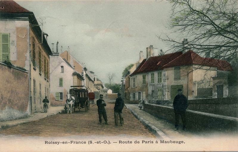
3. Roissy-en-France (S.-et.-O.) - Route de Paris à Maubeuge
This is the same image as the left postcard on the marker.
Credits. This page was last revised on August 19, 2022. It was originally submitted on August 19, 2022, by Andrew Ruppenstein of Lamorinda, California. This page has been viewed 146 times since then and 4 times this year. Photos: 1, 2, 3. submitted on August 19, 2022, by Andrew Ruppenstein of Lamorinda, California.
