Coolidge in Hamilton County, Kansas — The American Midwest (Upper Plains)
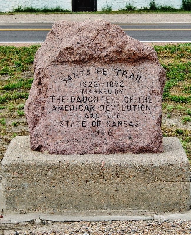
Santa Fe Trail
Photographed by Cosmos Mariner, August 16, 2022
1. Santa Fe Trail Marker
1822 - 1872
Erected 1906 by Daughters of the American Revolution and the State of Kansas. (Marker Number 83.)
Topics and series. This historical marker is listed in this topic list: Roads & Vehicles. In addition, it is included in the Daughters of the American Revolution (DAR), and the Santa Fe Trail series lists. A significant historical year for this entry is 1822.
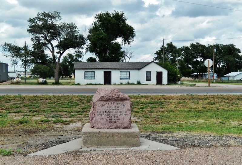
Location. 38° 2.407′ N, 102° 0.469′ W. Marker is in Coolidge, Kansas, in Hamilton County. It is on Coolidge Avenue (U.S. 50/400) just east of Main Street, on the right when traveling east. Marker is located in a pull-out on the south side of the highway. Touch for map. Marker is in this post office area: Coolidge KS 67836, United States of America. Touch for directions.

Regionally, this marker is in the American Midwest, in the Corn Belt, on the prairies, on the Great Plains, on the Southern Plains, and specifically on the High Plains. Globally, it is in North America, the Western Hemisphere, the Western World, and the Anglosphere. Historically, it finds itself in what was once the Comanchería, the Dust Bowl, and the Louisiana
this page online
Other nearby markers. At least 4 other markers are within 3 miles of this marker, measured as the crow flies: Santa Fe Trail Scenic and Historic Byway — Colorado (approx. 2½ miles away in Colorado); Trail City (approx. 2½ miles away in Colorado); Arkansas River (approx. 2½ miles away in Colorado); Explore Santa Fe Trail History (approx. 2½ miles away in Colorado).
Also see . . .
1. Santa Fe Trail Markers. Daughters of the American Revolution website entry (Submitted on April 16, 2023, by Larry Gertner of New York, New York.)
2. The story of the marking of the Santa Fe Trail by the Daughters of the American revolution in Kansas. Internet Archive/Google Book entry (Submitted on April 16, 2023, by Larry Gertner of New York, New York.)
3. The Great Prairie Highway. National Park Service website entry:
From 1821 until 1846, the Santa Fe Trail was a two-way international commercial highway used by both Mexican and American traders. Then, in 1846, the Mexican-American War began, and a few months later, America’s Army of the West followed the Santa Fe Trail westward to successfully invade Mexico.(Submitted on August 20, 2022, by Cosmos Mariner of Cape Canaveral, Florida.)After the Treaty of Guadalupe Hidalgo ended the war in 1848, the Santa Fe Trail became a national road connecting the more settled parts of the United States to the new southwest territories. Commercial freighting along the trail boomed to unheard-of levels, including considerable military freight hauling to supply the southwestern forts. The trail was also used by stagecoach lines, thousands of gold seekers heading to the California and Colorado gold fields, adventurers, missionaries, wealthy New Mexican families and emigrants.Photographed by Cosmos Mariner, August 16, 20222. Santa Fe Trail Marker(looking north • Coolidge Avenue/US Hwy 50/400 in background)
4. Santa Fe Trail Association. Website homepage:
In 1821, the Santa Fe Trail became America's first great international commercial highway, and for nearly sixty years thereafter was one of the nation's great routes of adventure and western expansion.(Submitted on August 20, 2022, by Cosmos Mariner of Cape Canaveral, Florida.)
Credits. This page was last revised on July 6, 2025. It was originally submitted on August 20, 2022, by Cosmos Mariner of Cape Canaveral, Florida. This page has been viewed 1,035 times since then and 70 times this year. Photos: 1, 2. submitted on August 20, 2022, by Cosmos Mariner of Cape Canaveral, Florida.
