Fort Myer in Arlington in Arlington County, Virginia — The American South (Mid-Atlantic)
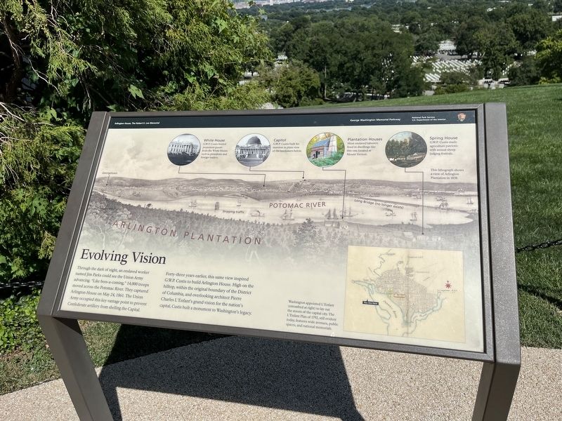
Evolving Vision
Arlington House, The Robert E. Lee Memorial
— George Washington Memorial Parkway, National Park Service, U.S. Department of the Interior —
Through the dark of night, an enslaved worker named Jim Parks could see the Union Army advancing. "Like bees-a-coming," 14,000 troops moved across the Potomac River. They captured Arlington House on May 24, 1861. The Union Army occupied this key vantage point to prevent Confederate artillery from shelling the Capital.
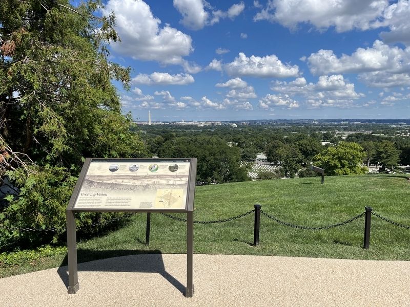
Forty-three years earlier, this same view inspired G.W.P. Custis to build Arlington House. High on the hilltop, within the original boundary of the District of Columbia, and overlooking architect Pierre Charles L'Enfant's grand vision for the nation's capital, Custis built a monument to Washington's legacy.
[Captions:]
White House
G.W.P. Custis hosted prominent guests from the White House such as presidents and foreign leaders.
Capitol
G.W.P. Custis built his mansion in plain view of the lawmakers below.
Plantation Houses
Most enslaved laborers lived in dwellings like this one located at Mount Vernon.
Spring House
G.W.P. Custis made agriculture patriotic with annual sheep judging festivals.
This lithograph shows a view of Arlington Plantation in 1838.
Washington appointed L'Enfant (entombed at right) to lay out the streets of the capital city. The L'Enfant Plan of 1792, still evident today, features wide avenues, public spaces, and national memorials.
Erected by National Park Service, U.S. Department of the Interior.
Topics. This historical marker is listed in these topic lists: African Americans • Government & Politics • Settlements & Settlers • War, US Civil • Waterways & Vessels. A significant historical date for this entry is May 24, 1861.
Location. 38° 52.874′ N, 77° 4.345′ W. Marker is in Arlington, Virginia, in Arlington County. It is in Fort Myer. Marker can be reached from Sheridan Drive, 0.1 miles east of Humphreys Drive, on the right when traveling north. Touch for map. Marker is at or near this postal address: 32 Sheridan Dr, Fort Myer VA 22211, United States of America. Touch for directions.
Other nearby markers. At least 8 other markers are within walking distance of this marker. Arlington Estate, 1860 (here, next to this marker); Paying Tribute (a few steps from this marker); Pierre Charles L’Enfant (a few steps from this marker); Platforms of Power (a few steps from this marker); Growing Season (within shouting distance of this marker); Piecing the Past Together (within shouting distance of this marker); A Garden Sustains (within shouting distance of this marker); Trophy of War (within shouting distance of this marker). Touch for a list and map of all markers in Arlington.
Credits. This page was last revised on February 1, 2023. It was originally submitted on August 20, 2022, by Devry Becker Jones of Washington, District of Columbia. This page has been viewed 126 times since then and 16 times this year. Photos: 1, 2. submitted on August 20, 2022, by Devry Becker Jones of Washington, District of Columbia.

