Fort Myer in Arlington in Arlington County, Virginia — The American South (Mid-Atlantic)
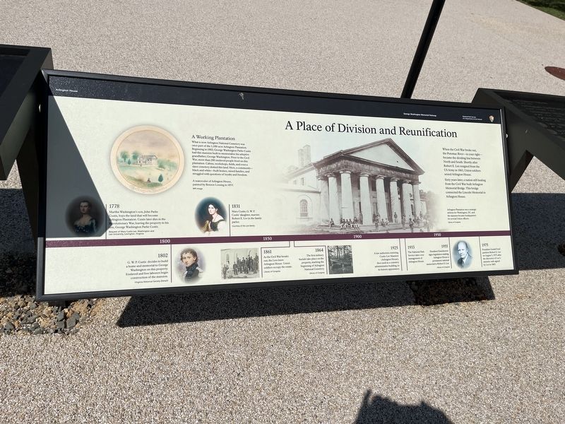
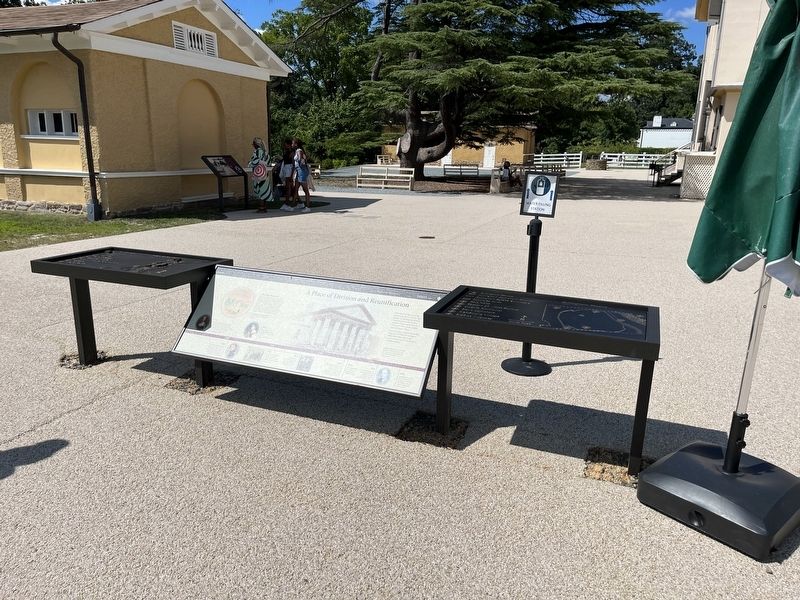
A Place of Division and Reunification
Arlington House
— George Washington Memorial Parkway, National Park Service, U.S. Department of the Interior —

Photographed By Devry Becker Jones (CC0), August 20, 2022
1. A Place of Division and Reunification Marker
When the Civil War broke out, the Potomac River—to your right—became the dividing line between North and South. Shortly after Robert E. Lee resigned from the US Army in 1861, Union soldiers seized Arlington House.
Sixty years later, a nation still healing from the Civil War between Arlington Memorial Bridge. This bridge connected the Lincoln Memorial to Arlington House.
[Sidebar:]
A Working Plantation
What is now Arlington National Cemetery was once part of the 1,100-acre Arlington Plantation. Beginning in 1802, George Washington Parke Custis had this mansion built to memorialize his adoptive grandfather, George Washington. Prior to the Civil War, more than 200 enslaved people lived on this plantation. Cabins, workshops, fields, and even a slave cemetery dotted this land. Here, a community—black and white—built homes, raised families, and struggled with questions of loyalty and freedom.
[Caption:]
Arlington Plantation was a strategic defense for Washington, DC, and the mansion became headquarters for several Union officers.
[Timeline:]
1778: Martha Washington's son, John Parke Custis, buys the land that will become Arlington Plantation. Custis later dies in the Revolutionary War, leaving the property to his son, George Washington Parke Custis.
1802: G.W.P. Custis decides to build a home and memorial to George Washington on this property. Enslaved and free laborers begin construction of the mansion.
1831: Mary Custis, G.W.P. Custis' daughter, marries Robert E. Lee in the family parlor.
1861: As the Civil War breaks out, the Lees have Arlington House. Union soldiers occupy the estate.
1864: The first military burials take place on the property, marking the beginning of Arlington National Cemetery.
1925: A law authorize restoring Custis-Lee Mansion (Arlington House), then used a cemetery administrative building, to its historic appearance.
1933: The National Park Service takes over management of Arlington House.
,br> 1955: President Eisenhower signs legislation making Arlington House a permanent national memorial to Robert E. Lee.
1975: President Gerald Ford pardons Robert E. Lee on August 5, 1975 after the discovery of Lee's amnesty oath signed by Lee in 1865.
Erected by National Park Service, U.S. Department of the Interior.
Topics. This historical marker is listed in these topic lists: African Americans • Agriculture

Photographed By Devry Becker Jones (CC0), August 20, 2022
2. A Place of Division and Reunification Marker
Location. 38° 52.852′ N, 77° 4.365′ W. Marker is in Arlington, Virginia, in Arlington County. It is in Fort Myer. Marker is on Sherman Drive north of Sheridan Drive, on the right when traveling north. Touch for map. Marker is at or near this postal address: 319 Sherman Dr, Fort Myer VA 22211, United States of America. Touch for directions.
Other nearby markers. At least 8 other markers are within walking distance of this marker. Kingdom of my childhood (a few steps from this marker); Garden to Graves (a few steps from this marker); The Gray Family (a few steps from this marker); Trophy of War (a few steps from this marker); Guardian of a Nation's Heritage (a few steps from this marker); Long Haul (within shouting distance of this marker); Platforms of Power (within shouting distance of this marker); Division and Reunification (within shouting distance of this marker). Touch for a list and map of all markers in Arlington.
Credits. This page was last revised on February 1, 2023. It was originally submitted on August 21, 2022, by Devry Becker Jones of Washington, District of Columbia. This page has been viewed 151 times since then and 13 times this year. Photos: 1, 2, 3, 4. submitted on August 21, 2022, by Devry Becker Jones of Washington, District of Columbia.

