Dublin in Alameda County, California — The American West (Pacific Coastal)
Iron Horse Regional Trail
Tassajara Creek/Ridge Trail
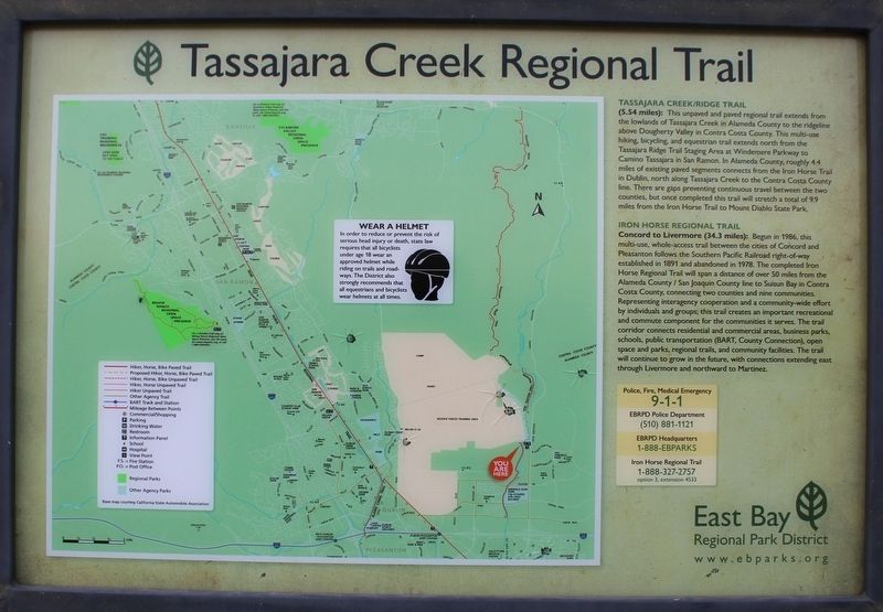
(5.54 Miles): This unpaved and paved regional trail extends from the lowlands of Tassajara Creek in Alameda County to the ridgeline above Dougherty Valley in Contra Costa County. This multi-use hiking, bicycling, and equestrian trail extends north from the Tassajara Ridge Trail Staging Area at Windemere Parkway to Camino Tassajara in San Ramon. In Alameda County, roughly 4.4 miles of existing paved segments connects from the Iron Horse Trail in Dublin, north along Tassajara Creek to the Contra Costa County line. There are gaps preventing continuous travel between the two counties, but once completed this trail will stretch a total of 9.9 miles from the Iron Horse Trail to Mount Diablo State Park.
Iron Horse Regional Trail
Concord to Livermore (34.3 miles): Begun in 1986, this multi-use, whole-access trail between the cities of Concord and Pleasanton follows the Southern Pacific Railroad right-of-way established in 1891 and abandoned in 1978. The completed Iron Horse Regional Trail will span a distance of over 50 miles from the Alameda County / San Joaquin County line to Suisun Bay in Contra Costa County, connecting two counties and nine communities. Representing interagency cooperation and a community-wide effort by individuals and groups, this trail creates an important recreational and commute component for the communities it serves. The trail corridor connects residential and commercial areas, business parks, schools, public transportation (BART, County Connection), open space and parks, regional trails, and community facilities. The trail will continue to grow in the future, with connections extending east through Livermore and northward to Martinez.
Erected by East Bay Regional Park District.
Topics and series. This historical marker is listed in these topic lists: Parks & Recreational Areas • Railroads & Streetcars. In addition, it is included in the Southern Pacific Railroad series list. A significant historical year for this entry is 1891.
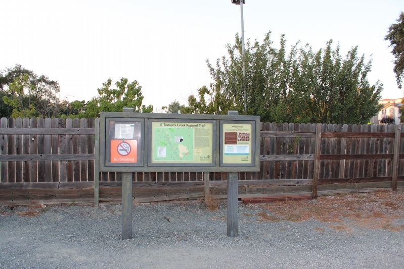
Location. 37° 43.399′ N, 121° 52.317′ W. Marker is in Dublin, California, in Alameda County. Marker is on Tassajara Road, on the left when traveling north. The marker is mounted in a metal stand at the Tassajara Creek Regional Park staging area. Touch for map. Marker is in this post office area: Dublin CA 94568, United States of America. Touch for directions.
Other nearby markers. At least 8 other markers are within 4 miles of this marker, measured as the crow flies. Antone School (approx. 0.7 miles away); San Ramon's Pioneers (approx. 2 miles away); History of Ramona Park (approx. 2 miles away); 1943 Fleet City 1946 (approx. 2.1 miles away); Fire Truck Park (approx. 2.2 miles away); Tolliver Airship (approx. 3˝ miles away); Sister City Program (approx. 3˝ miles away); 1914 Rasmussen House 1990 (approx. 3.8 miles away). Touch for a list and map of all markers in Dublin.
Also see . . . East Bay Regional Parks. Iron Horse Trail page. (Submitted on August 22, 2022, by Joseph Alvarado of Livermore, California.)
Credits. This page was last revised on September 4, 2022. It was originally submitted on August 22, 2022, by Joseph Alvarado of Livermore, California. This page has been viewed 146 times since then and 13 times this year. Photos: 1, 2, 3. submitted on August 22, 2022, by Joseph Alvarado of Livermore, California.


